
Nice Monday but multiple storm chances ahead
Heat could be building for early next week
Go Deeper.
Create an account or log in to save stories.
Like this?
Thanks for liking this story! We have added it to a list of your favorite stories.


Monday will be pleasant and dry for most except northwestern Minnesota. We’ll have multiple chances of storms ahead Tuesday into Wednesday.
Nice Monday but multiple storm chances ahead
We’ll have a pleasant Monday. Look for partly cloudy skies and highs in the upper 80s to near 90 degrees in western Minnesota. It will be cooler, of course, near Lake Superior. Dew points won’t be terribly uncomfortable, mostly in the low to mid-60s.

A slowly moving cool front will touch off a few spotty showers and thunderstorms later in the day across northwestern Minnesota.
There’s even a slight (level 2 of 5) severe risk in northwestern Minnesota.
Turn Up Your Support
MPR News helps you turn down the noise and build shared understanding. Turn up your support for this public resource and keep trusted journalism accessible to all.

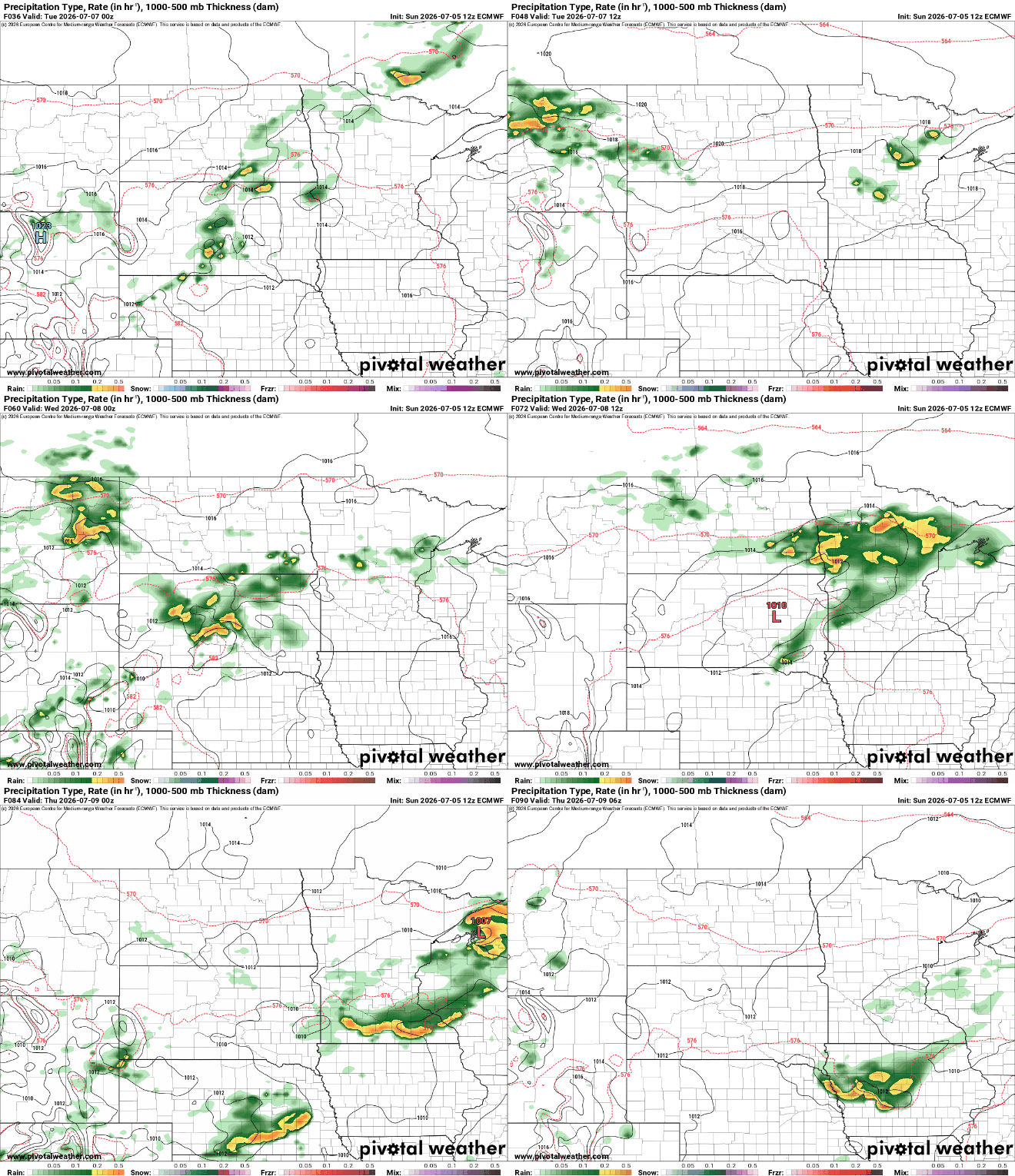
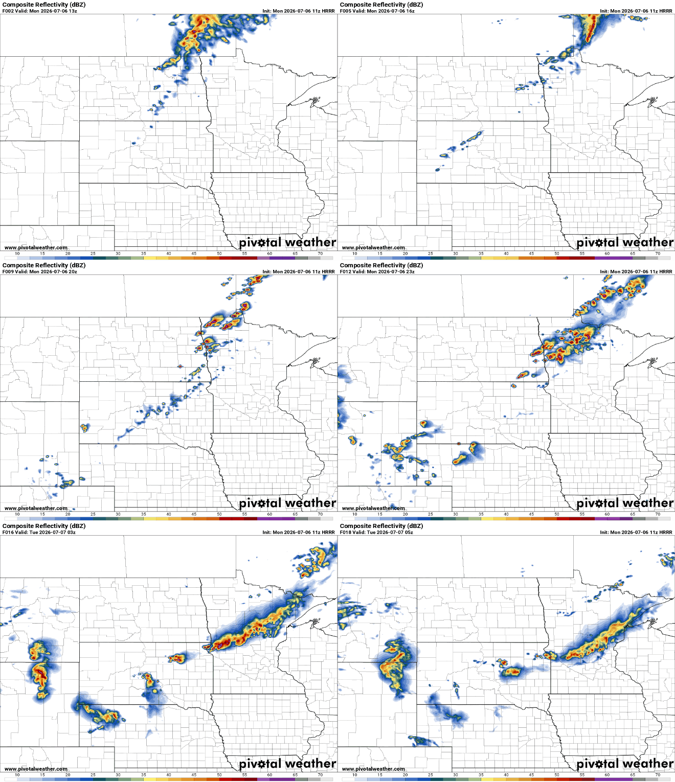
The leftover outflows from those storms and front will touch off more scattered showers and storms this time a bit more south across central Minnesota, including possibly the Twin Cities on Tuesday. More storms will develop Tuesday evening and overnight.
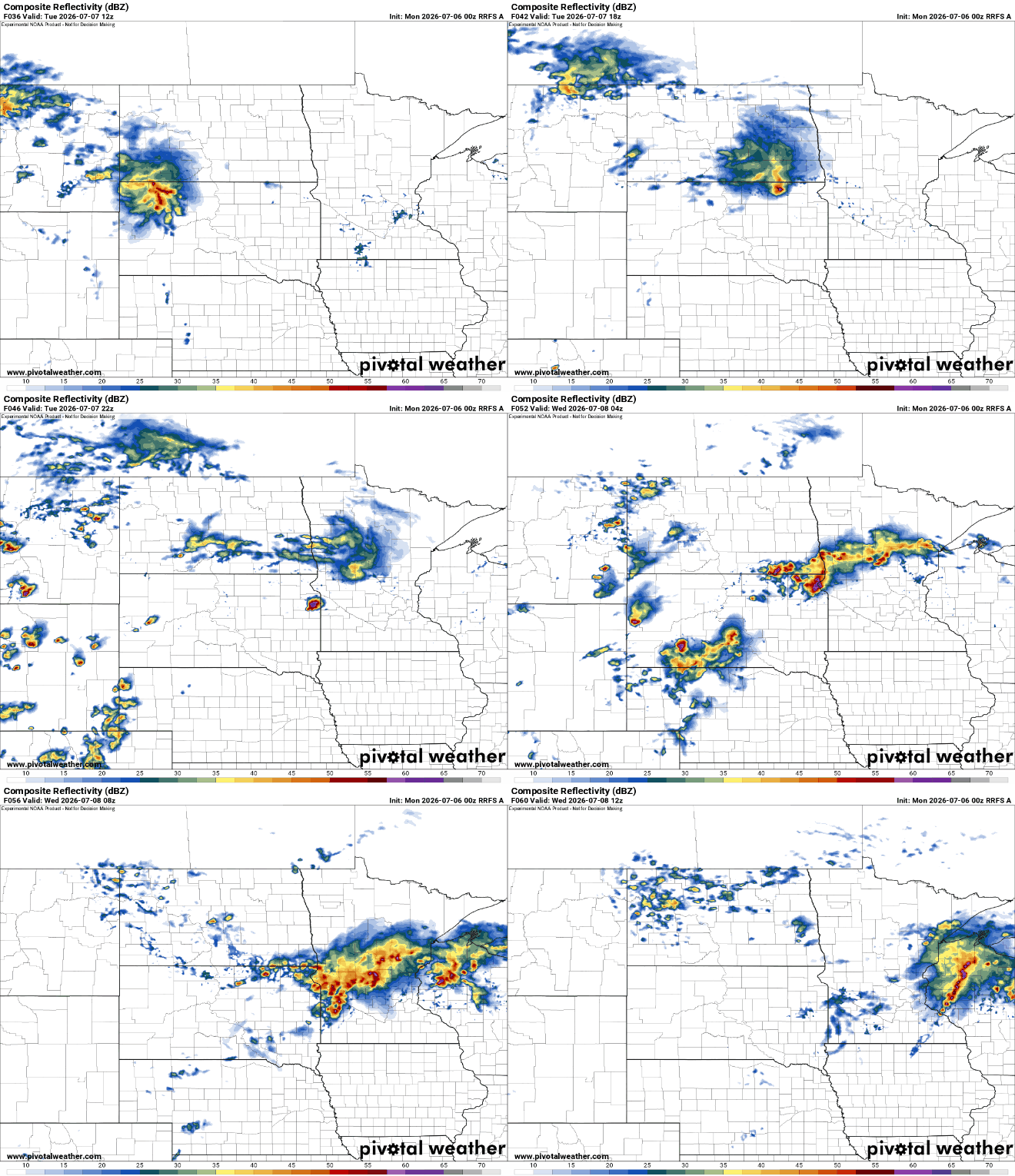
After overnight storms Tuesday night, more storms will develop later in the day Wednesday into the evening before we dry out for Thursday and Friday.
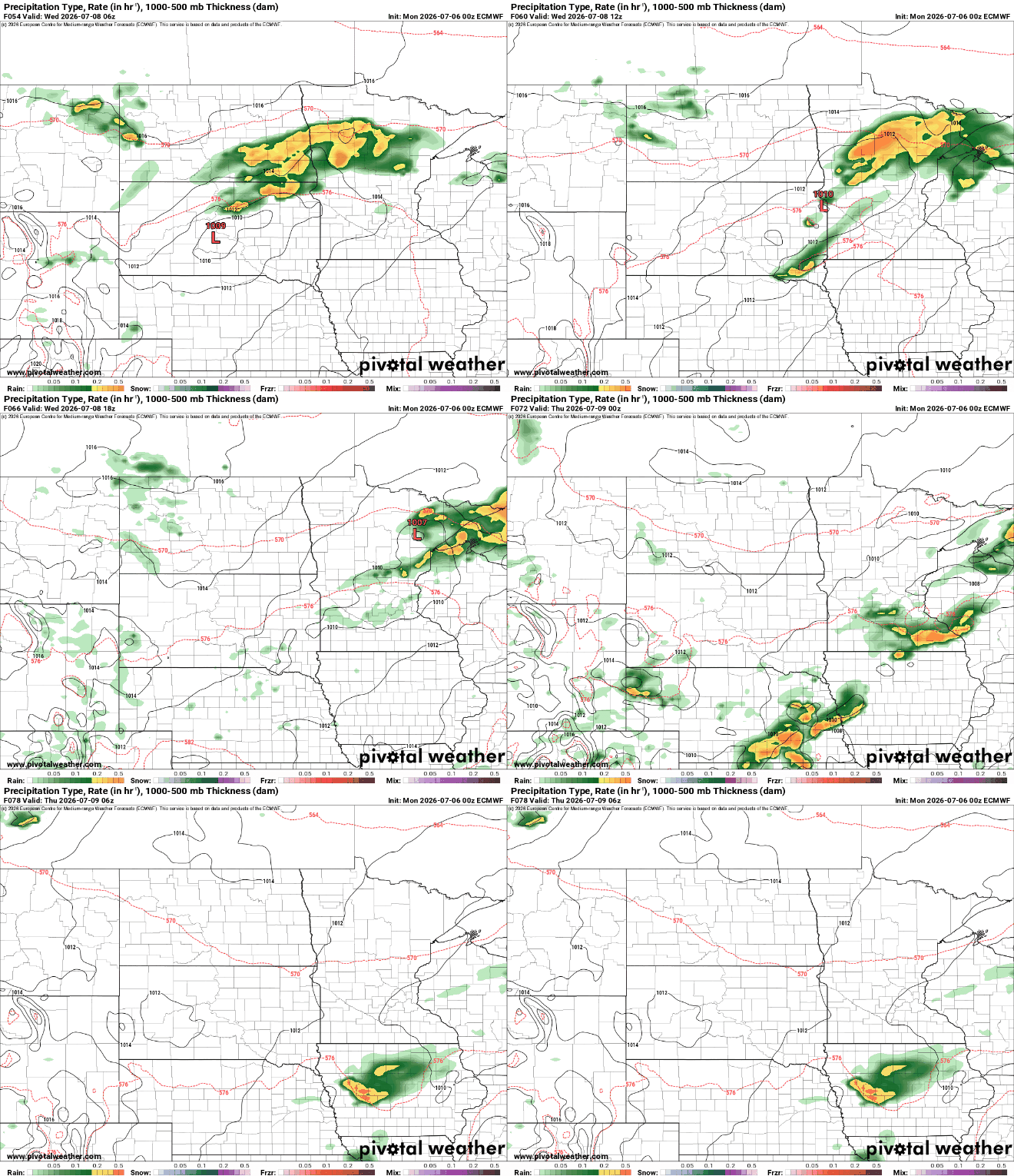
There’s a slight risk (level 2 of 5) forecast for severe storms Tuesday into Tuesday night in southwestern and south-central Minnesota. In particular, we’re concerned about damaging winds, large hail and flash flooding in this period.

In addition to the risk of severe weather, we’ll be watching for potential heavy rainfall. There’s a slight risk of excessive rainfall Tuesday into Tuesday night meaning a potential flash flood risk with multiple rounds of storms developing over the same region in central Minnesota.

We’ll then see a slight dip in temps and dew points for Thursday and Friday. Enjoy that because we’re watching a potential heat dome developing for early next week. It looks increasingly likely a ‘heat dome’ will develop in the region.
A heat dome is an upper-level area of high pressure that acts like a pressure cooker, creating heat waves.
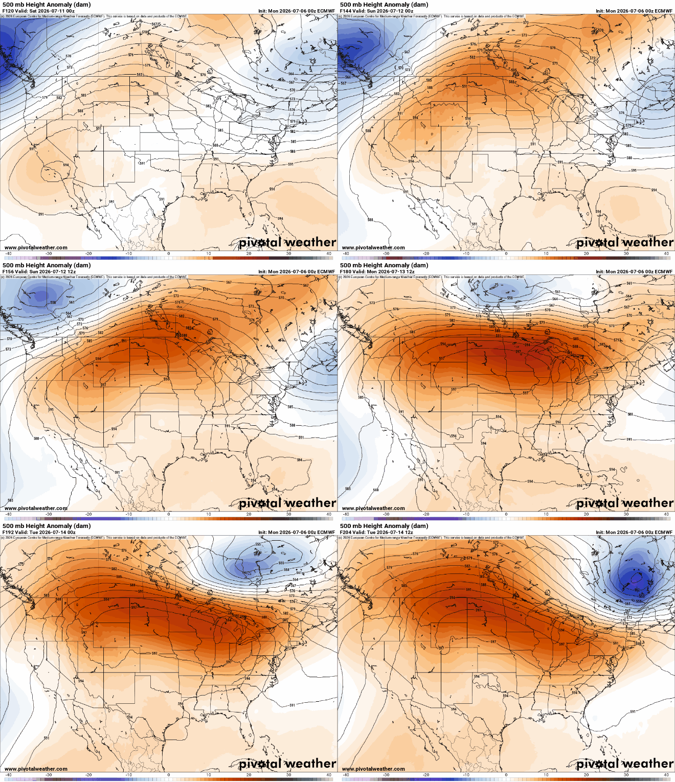
The European Centre for Medium-Range Weather Forecasts model is the most aggressive with the heat, which is concerning as it tends to be one of the more accurate models. While highs in the 90s look likely early next week, we could possibly hit 100 degrees in southern Minnesota.


