
Severe thunderstorm watch for NW Minnesota as active weather pattern begins
Heavy rains expected on Tuesday
Go Deeper.
Create an account or log in to save stories.
Like this?
Thanks for liking this story! We have added it to a list of your favorite stories.


A severe thunderstorm watch was issued for northwestern Minnesota Monday evening with the potential for heavy rains into Tuesday.
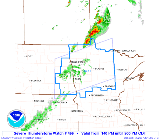
Severe thunderstorm watch until 9 p.m.
A severe thunderstorm watch has been issued for northwestern Minnesota through 9 p.m. as thunderstorms develop across eastern North Dakota and move east into the region.
The atmosphere across western Minnesota is primed for strong to severe storms Monday afternoon and evening, with damaging wind gusts and large hail posing the greatest threats.
The storms are expected to weaken as they move farther southeast after sunset. Portions of western and central Minnesota could still see strong storms before they gradually dissipate overnight.
Turn Up Your Support
MPR News helps you turn down the noise and build shared understanding. Turn up your support for this public resource and keep trusted journalism accessible to all.
This is just the beginning of what looks to be a busy stretch of weather.
Multiple rounds of thunderstorms are expected through Wednesday with Tuesday and Tuesday night currently appearing to bring the greatest potential for widespread heavy rainfall and additional severe weather.
While severe thunderstorms will be a concern, heavy rainfall and flash flooding may ultimately become the bigger story Tuesday night.
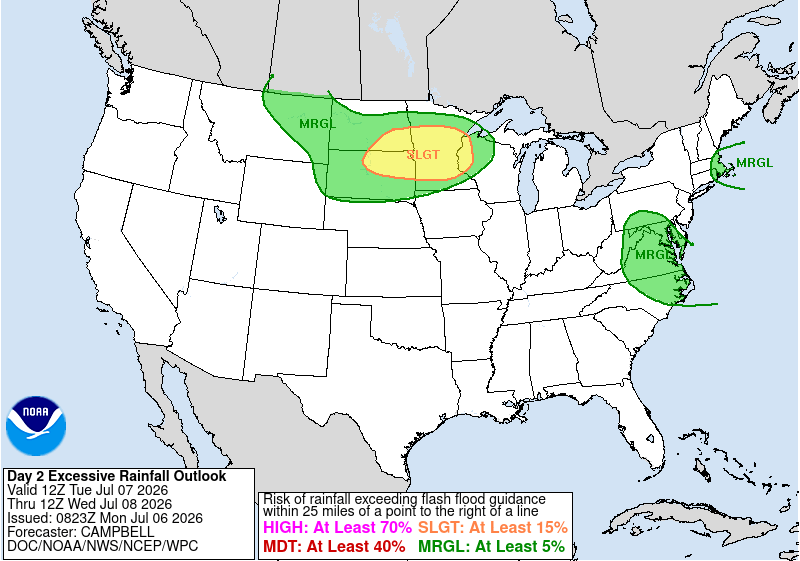
The National Oceanic and Atmospheric Administration’s Weather Prediction Center has placed much of central and northern Minnesota in a slight risk (level 2 of 4) for excessive rainfall on Tuesday.
A slowly moving cold front is expected to stall somewhere across Minnesota, becoming the focus for repeated rounds of thunderstorms. This setup raises the potential for training thunderstorms, storms that repeatedly move over the same locations like train cars on a track.
When this happens, rainfall totals can add up quickly over just a few hours.

One of the biggest forecast challenges is determining exactly where the stalled front sets up. A shift of just 50 to 100 miles north or south will determine where the heaviest rain falls.
Right now, the favored corridor appears to be somewhere near central Minnesota, but confidence in the exact location will improve over the next 24 hours as higher-resolution models come into range.


Forecast models are showing a narrow corridor of 1 to 3 inches of rain with localized amounts exceeding 3 to 4 inches where storms repeatedly track over the same area.
The heavy rainfall will certainly make a dent in our current drought conditions.

