
Unsettled and stormy 36 hours ahead
Heat dome may be building for early next week

Go Deeper.
Create an account or log in to save stories.
Like this?
Thanks for liking this story! We have added it to a list of your favorite stories.


More storms are expected to develop Tuesday evening into Wednesday and again late Wednesday. Flash flooding and severe weather are possible.
Unsettled, stormy 36 hours ahead
It was an active evening Monday in northwestern Minnesota. A potential tornado blew through Detroit Lakes. The National Weather Service office in Grand Forks, N.D., will conduct damage surveys Tuesday.

It’ll be steamy midday as clouds break up some with highs in the 80s to near 90 degrees along with dew points in the 60s to near 70 degrees. Northwestern Minnesota will be cooler behind the cool front that’s the focus for the stormy weather.

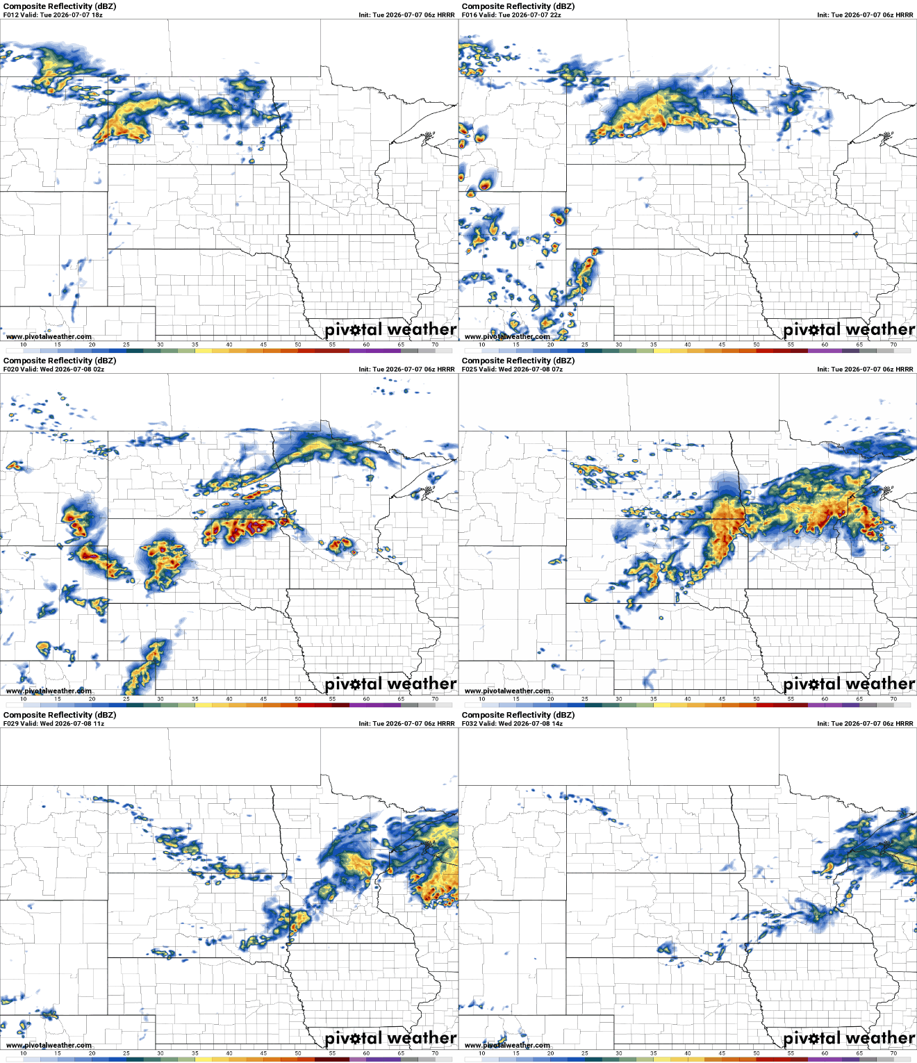
Our focus will then turn to storm redevelopment later Tuesday afternoon and evening into the overnight. Isolated storms will develop across central Minnesota with more storms developing in the Dakotas that will march east.
Turn Up Your Support
MPR News helps you turn down the noise and build shared understanding. Turn up your support for this public resource and keep trusted journalism accessible to all.
There’s the potential for damaging wind gusts, large hail and heavy downpours into early Wednesday.
There’s a slight risk (level 2 of 5) for severe storms forecast for Tuesday into Tuesday night and early Wednesday. The main threat is from damaging wind gusts.

The maps below show a breakdown of the particular severe weather threats. The area from west-central Minnesota into South Dakota has the highest risk of large hail and damaging wind gusts in addition to an isolated tornado or two.

The National Oceanic and Atmospheric Administration’s High-Resolution Rapid Refresh model shows where most of these potential severe wind gusts could occur:

In addition to the severe threat, storms moving across and developing over the same areas of central Minnesota could lead to flash flooding concerns. There’s a slight risk (level 2 of 5) for excessive rainfall in those areas.

At least a few inches with locally higher amounts of rainfall are possible in the regions that see continued storm development into early Wednesday. Forecast models vary on where this area sets up.
Here’s one such scenario from NOAA’s High-Resolution Rapid Refresh model:
We’ll likely see some more scattered storms develop later Wednesday afternoon and evening due to lingering instability ahead of the advancing cool front.
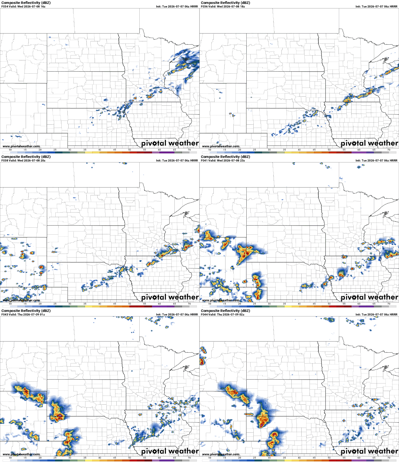
Behind the front, it will be slightly cooler and slightly less muggy for Thursday and Friday.
Highs will be mainly in the low to mid-80s with dew points closer to 60 degrees. Enjoy that break because a heat dome is building for later in the weekend and early next week. We might see our hottest high temperatures yet this summer.
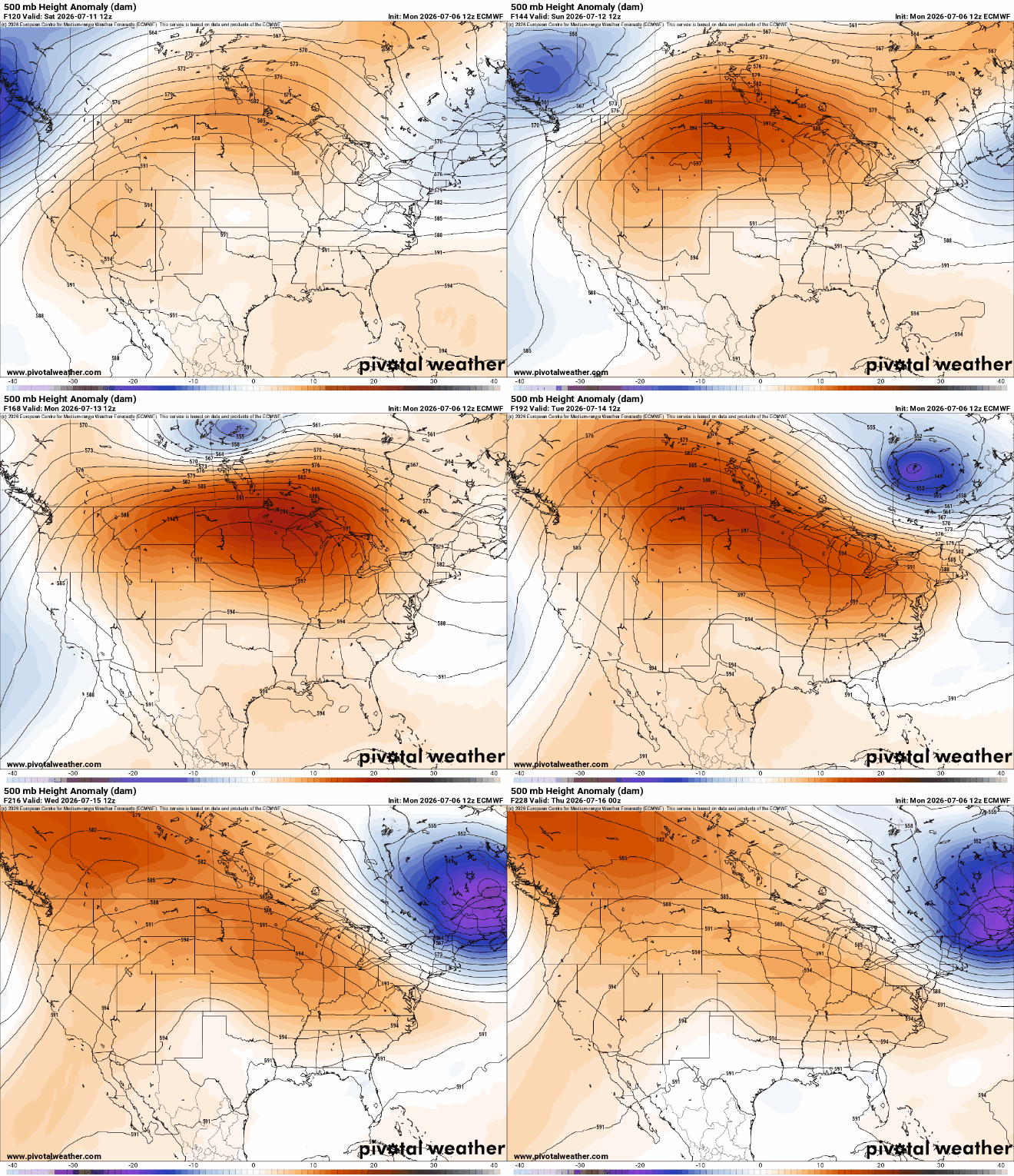
We’ll likely see a string of highs in the 90s starting as early as Saturday or Sunday for central and southern Minnesota.

The European Centre for Medium-Range Weather Forecasts continues to be the most aggressive with the heat with highs peaking in the triple digits potentially for some on Tuesday.


