Last big wave of rain before calmer days
Flood watch, severe weather threat in SE Minnesota

Go Deeper.
Create an account or log in to save stories.
Like this?
Thanks for liking this story! We have added it to a list of your favorite stories.


Much of Minnesota is seeing quieter weather Wednesday afternoon, although late evening thunderstorms are expected in southeastern Minnesota near Rochester, Austin and into La Crosse, Wis.
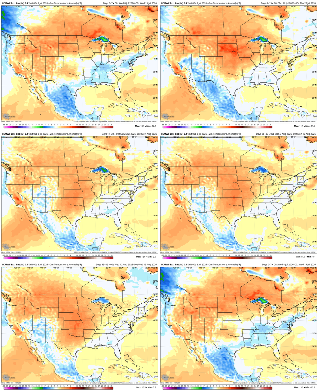
A heat wave starts Sunday and continues for much of next week.
Storm potential Wednesday
This weather pattern should be called “Groundhog Day.” Just like the movie, the weather lately keeps repeating.
While much of Minnesota is quiet Wednesday afternoon, southeastern Minnesota and parts of western Wisconsin are in for some late evening booming thunderstorms. There’s yet another severe storm risk (level 2 out of 5).
Turn Up Your Support
MPR News helps you turn down the noise and build shared understanding. Turn up your support for this public resource and keep trusted journalism accessible to all.
A flood watch has been posted in the same general area for Wednesday night.

Downpours late Tuesday night that fell in a tight band in central Minnesota wrapped up as expected around dawn on Wednesday. Apart from one brief flooded road near Mille Lacs, we fended off the flooding. Rain also fell in parts of Minnesota in need of drought relief.
The clouds stuck around, keeping us milder Wednesday. We could get a few smaller showers along with a lower air conditioning demand the rest of Wednesday.

Thunderstorms reform on the stalled boundary that seems semi-permanent at this point.
Action kicks off around Interstate 90 closer to 5 p.m. then huddles in the same place until about 8 p.m. We could see some ponding or minor flash flooding near Rochester and Austin as a result.


Calmer weather, then heat
Thursday and Friday are nearly totally dry across the big state of Minnesota. Temperatures are a little cooler Thursday morning, from the middle 50s in the Arrowhead and Iron Range to the middle 80s in the southwestern corner. The humidity is down, but the UV index is high.
Friday also looks like a lovely day. There may be a very isolated rain shower in the Boundary Waters but most spots are dry. A couple of little pop-up showers are possible in the Arrowhead but the chance is pretty low.
The dominating weather story quickly becomes the heat wave. We already have a rare high risk day a full week into the future.
Saturday is warmer but not quite 90 degrees in many spots. There could be a couple of raindrops from Brainerd to Hibbing to Duluth by Saturday night but most remain dry.
This kind of heat dome setup always gives me pause while forecasting in the Upper Midwest. Typically, the weather maps are ultra hot and very dry about a week out. When you get closer to the dates, then rain starts to appear. The signal is stronger for heat this time.
The data shows Minnesota dry from Sunday into Monday with some storms possible next Wednesday. The heat doesn’t really appear to dissolve at all in the coming weeks.