
Unsettled Wednesday then cooler before heating up next week
A string of hot days develops this weekend

Go Deeper.
Create an account or log in to save stories.
Like this?
Thanks for liking this story! We have added it to a list of your favorite stories.


We’ll see scattered showers and storms ahead of a cool front in southern Minnesota Wednesday. Cooler, less humid air moves in for a couple of days before heat builds this weekend.
Unsettled Wednesday then cooler before heating up next week
We have some lingering showers and thunderstorms moving through the region Wednesday morning.
We’ll continue to see scattered showers and thunderstorms develop along and ahead of a slowly advancing cool front into the evening hours, especially for southern and southeastern Minnesota into western Wisconsin.
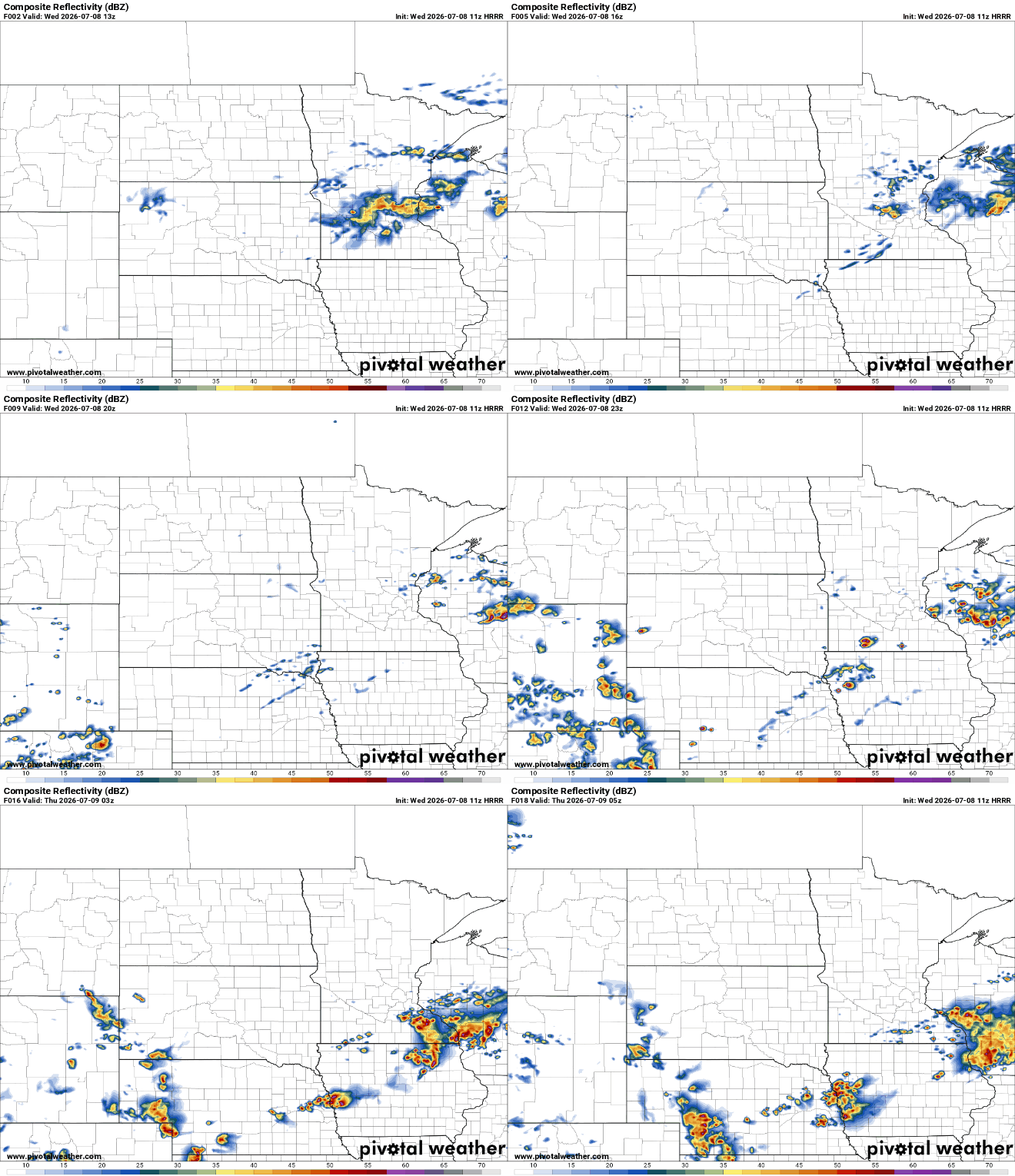
The severe risk shifts south slightly for mainly southeastern Minnesota Wednesday afternoon and evening. There’s a slight risk (level 2 of 5) forecast for southeastern Minnesota with a broad marginal risk (level 1 of 5) for southern Minnesota.
Turn Up Your Support
MPR News helps you turn down the noise and build shared understanding. Turn up your support for this public resource and keep trusted journalism accessible to all.
Behind the cool front, we’ll see dew points dip just a bit into the low 60s for Thursday and Friday after hovering near 70 degrees at times the first half of this week.
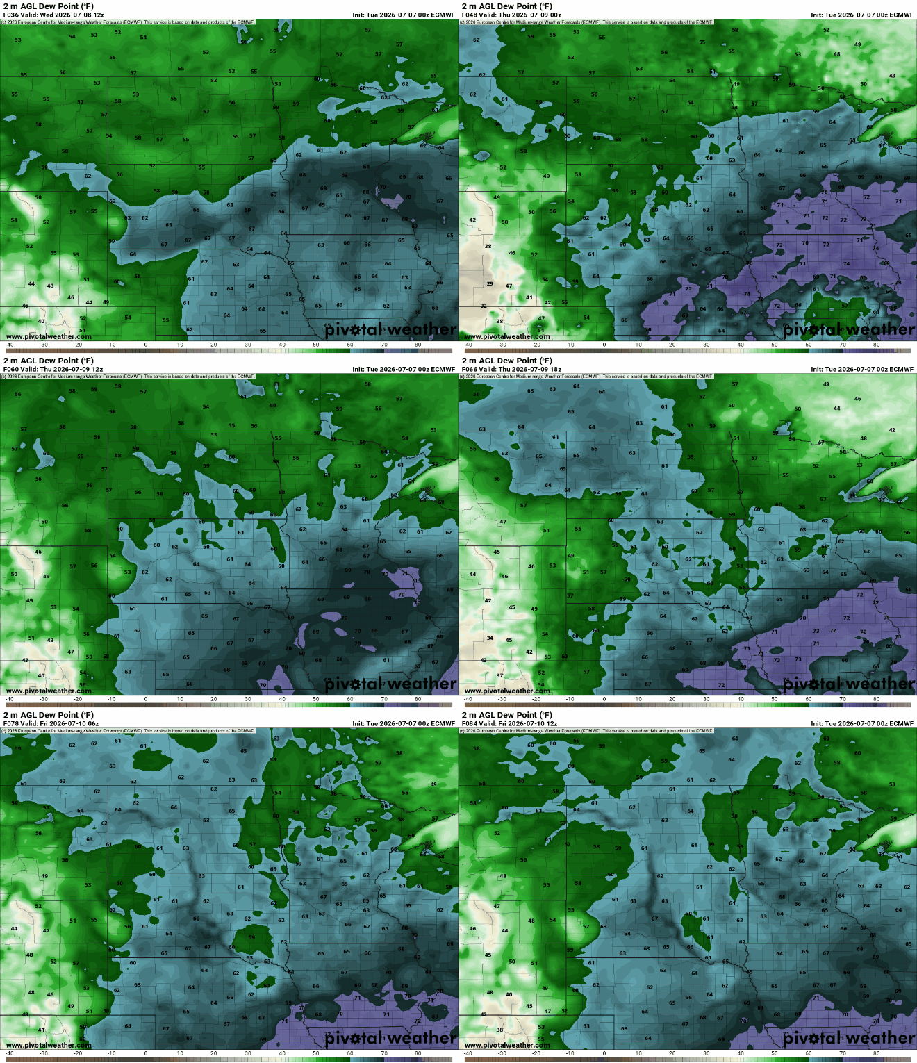
Temperatures will also be just a bit cooler with highs mostly in the low to mid-80s on Thursday and Friday. Dew points will remain decent too, mostly in the 50s to low 60s.

Our focus is on a developing heat dome this weekend into next week. It’s looking likely we’ll be in for a string of hot days. It may not be as humid as some of our recent heat, but we could see our hottest temperatures of the summer on the way.
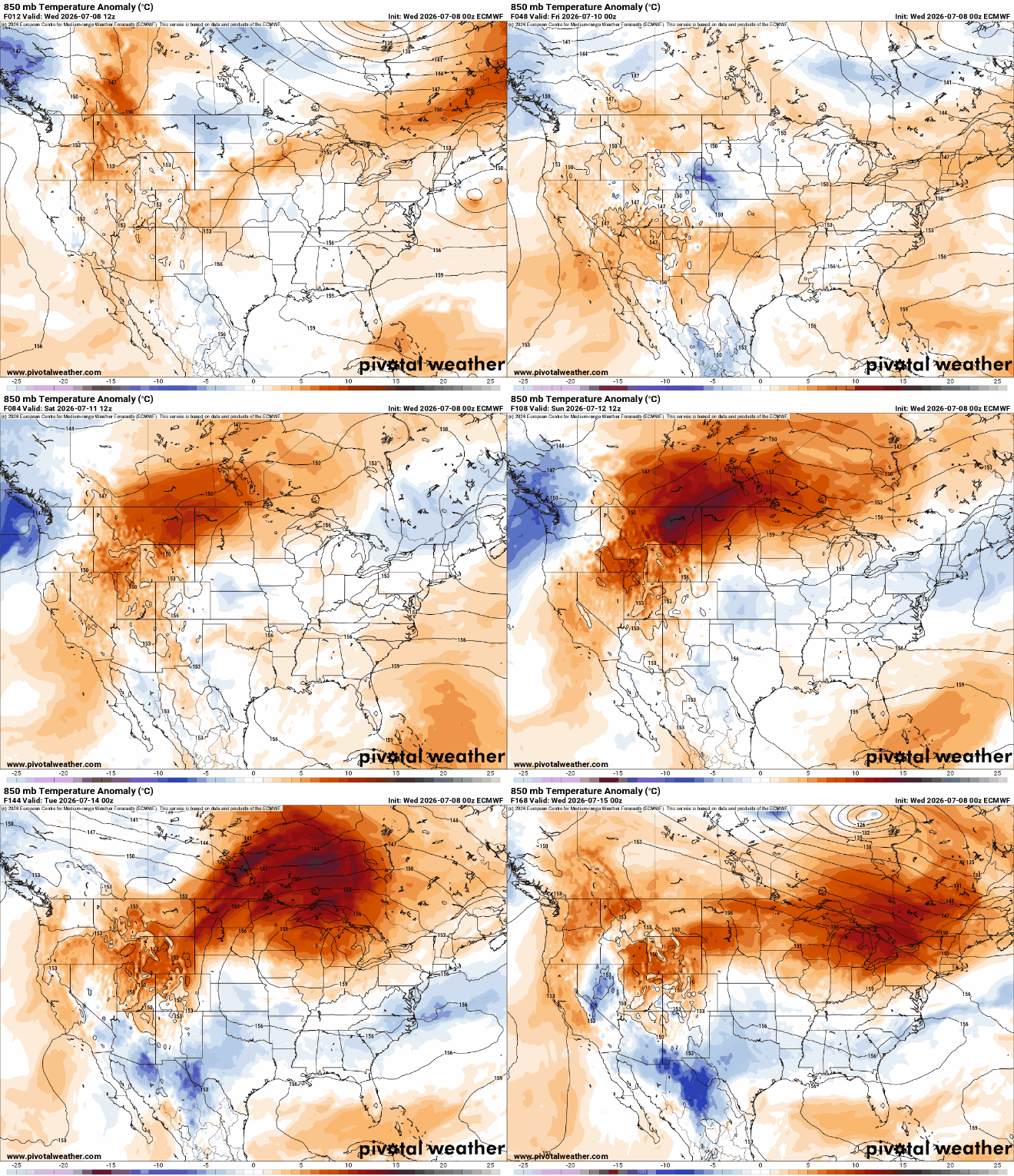
Most forecast models put us well into the 90s with some even near 100 degrees by Monday and or Tuesday next week. With dew points on the lower end — in the 60s mostly — heat index values won’t be as bad as they could be but still near 100 degrees at times.

Unlike our last bout with heat, this heat dome will be more centered in our region, keeping most storms away.
Early last week we were dealing with a “ring of fire” pattern on the edge of the heat dome allowing for frequent chances of storms. This go around looks drier due to the heat dome placement.


