
Extreme heat Sunday into next week across Minnesota
Just a few raindrops in the days ahead

Go Deeper.
Create an account or log in to save stories.
Like this?
Thanks for liking this story! We have added it to a list of your favorite stories.


There could be a couple of raindrops later Friday into early Saturday but the looming story is the heat next week across Minnesota.
Lovely weather before weekend heat
“If I could bottle this up, I’d be rich!” That’s basically the forecast for Thursday all across Minnesota. The weather is tranquil, although the UV index is remarkably high so pack the sunscreen.
Friday could bring a few tiny showers to the far north of Minnesota, but most parts of the state stay dry through dusk.
The heat is coming. Temperature trends are climbing. An extreme heat watch is posted for Sunday in northwestern Minnesota. More alerts are likely to be added as the heat rises. We often see the extreme heat start to pull back at the last moment, but not this round.
Turn Up Your Support
MPR News helps you turn down the noise and build shared understanding. Turn up your support for this public resource and keep trusted journalism accessible to all.


Weekend bake
The sunshine is back on Saturday, and we’re simply baking. Daytime hours should be dry. Most parts of Minnesota will be in the upper 80s with some in the 90s.
The National Oceanic and Atmospheric Administration’s Global Forecast System and the European Centre for Medium-Range Weather Forecasts model both show a few overnight showers bouncing around Minnesota from Saturday night late into early Sunday morning.
The National Weather Service offices responsible for Minnesota are all cautioning about the heat Sunday and beyond. (Check out the report for the Twin Cities and areas of southern and western Minnesota in the graphic at the top of the post.)
It won’t be just a southern Minnesota concern. Here’s the guidance for northwestern Minnesota …
Hot temperatures and high humidity levels prevail Saturday through Monday. Heat index values are expected to climb into the 100-110 degree range this weekend, into early next week. pic.twitter.com/nfqWRUdboz
— NWS Grand Forks (@NWSGrandForks) July 9, 2026
… and northeastern Minnesota:
Widespread MAJOR HeatRisk is expected Sunday and Monday across the region. On Sunday, north-central MN has a 50-90% chance of Major HeatRisk. Hot and muggy weather will persist through Tuesday. Have a plan to stay cool and hydrated! #MNwx #WIwx pic.twitter.com/YtsXQOWb50
— NWS Duluth (@NWSduluth) July 8, 2026
Most models show dry weather until at least Wednesday afternoon. Mid-90s are a safe bet in many areas of Minnesota next week. The question is who will see rain next and when?
There’s certainly a looming threat of flash drought in north-central Minnesota we will need to watch closely. Looking at Thursday’s drought conditions report for Minnesota, I was shocked that there was not more improvement from the prior week.
Super El Niño on the way?
We also got a new El Niño update Thursday morning.
NOAA’s Climate Prediction Center sees “an 81% chance of a very strong El Niño weather pattern during October-December that would rank among the largest El Niño events in the historical record going back to 1950.”
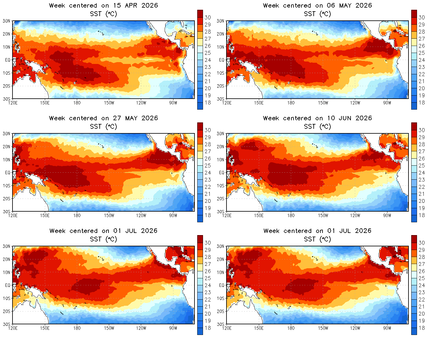
Impacts will be greatest this winter. The Climate Prediction Center sees a 97 percent chance of the El Niño–Southern Oscillation continuing into early 2027. So it’s coming!

