
More comfortable Thursday and Friday before the heat builds
Next week looks very hot and dry

Go Deeper.
Create an account or log in to save stories.
Like this?
Thanks for liking this story! We have added it to a list of your favorite stories.


Temperatures and dew points will be ever so slightly lower Thursday and Friday. Enjoy that because heat is building over the weekend into next week.
More comfortable Thursday and Friday before the heat builds
It’s been a soggy 24 hours and week across southern Minnesota. Portions of Mower County into northern Iowa saw 4 to 7 inches of rainfall Wednesday evening.

Austin specifically saw 5.68 inches of rainfall in just several hours, the bulk of which fell just in the 4:30 p.m. to 6 p.m. time frame.
This brings the seven-day total rainfall in Austin to 11.03 inches and up to 11.26 inches just to the east in Spring Valley. That’s almost a whole summer’s worth of rainfall in a week!
Turn Up Your Support
MPR News helps you turn down the noise and build shared understanding. Turn up your support for this public resource and keep trusted journalism accessible to all.

In the winter, we say it’s not the temperatures but the wind chill. In summer around here, it’s all about the humidity or, more properly, dew points.
Those dew points will be slightly lower Thursday and Friday from the tropical levels we’ve had lately, mainly in the 50s and low 60s versus occasional 70s.
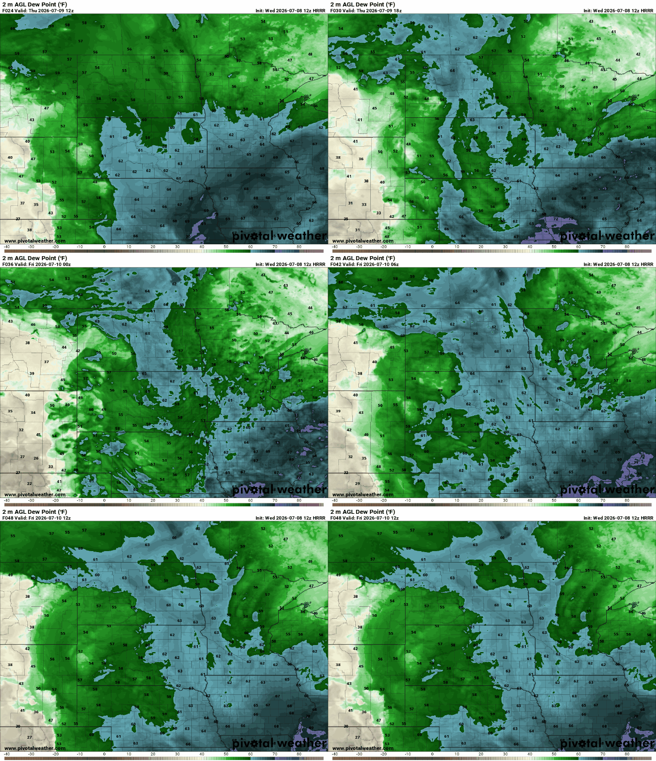
Temperatures will be slightly cooler, too — in the low to mid-80s today — but still pretty close to normal. We should see a fair amount of sun with any lingering clouds moving out of southern Minnesota.
An isolated shower or thundershower is possible in far southern Minnesota Thursday afternoon.

You can copy and paste for Friday, although temperatures will start to nudge up a few degrees. There could be a few spotty showers or thunderstorms Friday in northwestern Minnesota.
Heat dome forms
The heat builds in for the weekend into early next week as a significant heat dome develops over the Upper Midwest. A heat dome is an upper-level area of high pressure that keeps things clear and hot underneath it like a pressure cooker.
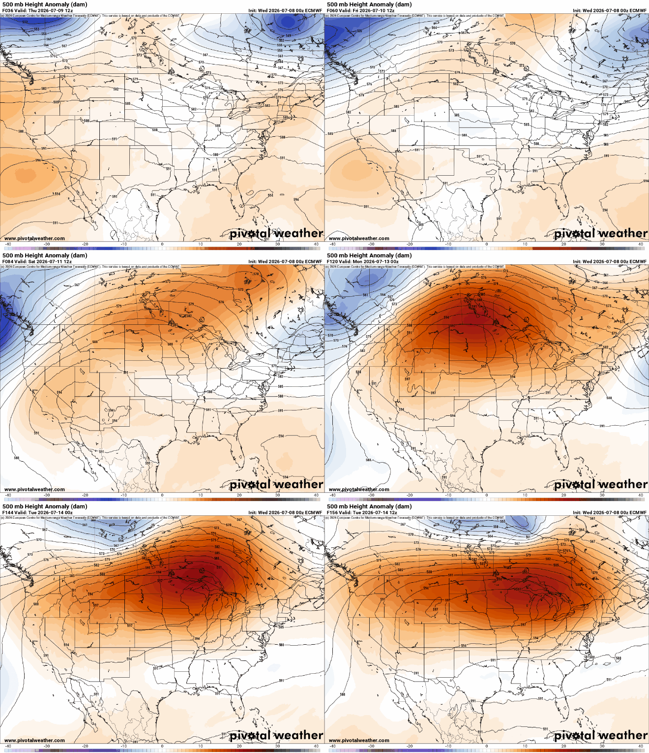
This time around we look to be more centrally located within the heat dome, which means storms and clouds that could keep temperatures occasionally cooler will be hard to come by. In fact, forecast rainfall next week is sparse in our region:

Highs Monday look to be some of the hottest, well into the 90s across much of Minnesota. The heat index will be in the mid-90s to lower 100s.

The heat could last at least until the middle of next week, if not longer.
Forecast models differ on when the demise of the heat dome may come. Regardless, plan on a prolonged period of heat coming up.


