
Worrisome smoke, high heat this week across Minnesota
Air quality alert posted for NE Minnesota Tuesday into Thursday
Go Deeper.
Create an account or log in to save stories.
Like this?
Thanks for liking this story! We have added it to a list of your favorite stories.


We’re in the low to mid-90s all across Minnesota this week. The Arrowhead on Monday is having one of its hottest days ever recorded with wildfire smoke continuing in the Boundary Waters. There is not much rain relief until at least Friday across Minnesota.
At about 3:30 p.m. Monday, the Minnesota Pollution Control Agency posted an air quality alert for wildfire smoke Tuesday into Thursday across northeastern Minnesota.
An air quality alert has been issued for wildfire smoke across northeast Minnesota, and is valid tomorrow, Tuesday July 14th through Thursday, July 16th. Find more information at https://t.co/oEvwCgEJvz #mnwx #aqi pic.twitter.com/j7GxiN2QRy
— MN Air Quality Index (@mpca_aqi) July 13, 2026
High heat bakes Minnesota
Intense heat is the big story across Minnesota. Temperatures were already nearing 90 degrees at noon Monday. While some of the heat advisories and warnings expire midweek, we don’t think there will be a drop-off until the start of the weekend.
At the tip of Minnesota’s Arrowhead region near the Canadian border, Grand Portage on Monday shattered its previous all-time hottest temperature, hitting 100 degrees. The previous hottest temperature there was 95 in June of 1995.
Turn Up Your Support
MPR News helps you turn down the noise and build shared understanding. Turn up your support for this public resource and keep trusted journalism accessible to all.
Seagull and Meander lakes in northern Minnesota also hit 100 degrees Monday afternoon, an extraordinarily rare number.
With only minor variation in cloud cover and temperatures, the thread continues to be high heat. We could see worsening ozone and perhaps a little smoke Monday but it will get worse as the week progresses.
Prior to Monday, the Twin Cities hit 90 degrees four times this year. That’s actually lower than the norm, but that all changes this week. We should at least double the number of 90s so far this year by the end of the week.


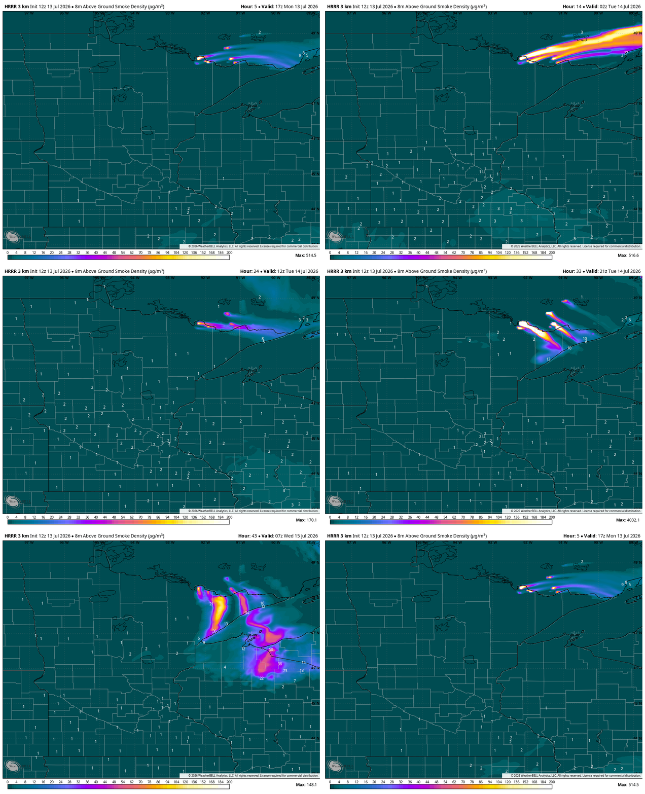
The Boundary Waters Canoe Area Wilderness is temporarily closing public access starting Tuesday. The smoke has spiked in the afternoon each of the last two days and we’ve seen an enormous jump in afternoon smoke Monday, too.

That smoke plume will grow a little weaker overnight, which is good. But the winds will shift, driving the smoke right over Duluth on Tuesday. That will then meander down closer to the Twin Cities.
Following the hottest day in more than 100 years in International Falls, we’ll stay baking hot in the coming days. There are only a couple of chances of rain ahead, all the way through Friday morning. Notice the gray color below; this is really only a few sprinkles.

Perhaps some better rain chances and amounts are here later Friday into Saturday, which would allow temperatures to cool statewide, but it won’t be too chilly, just closer to normal.

