
Cooling off north but heat continues in central, southern Minneota
Only spotty rain chances ahead

Go Deeper.
Create an account or log in to save stories.
Like this?
Thanks for liking this story! We have added it to a list of your favorite stories.


Northern Minnesota will cool off into the 80s Wednesday but temperatures in the 90s continue for central and southern Minnesota through Saturday. Rain chances will be few and far between.
Smoke creates air quality problems
Extreme heat warnings and heat advisories persist for central Minnesota, including the Twin Cities.
Air quality alerts continue for much of Minnesota Wednesday due to wildfire smoke. Officials logged a new record Wednesday morning for Minnesota’s worst wildfire smoke concentration:
Our West Duluth air quality monitor measured a preliminary hourly Minnesota state record for wildfire smoke concentration earlier this morning, July 15, 2026 (pending final QC). An air quality alert remains in effect for much of the state through 11am Friday. #mnwx #aqi pic.twitter.com/f2tsIFRLYK
— MN Air Quality Index (@mpca_aqi) July 15, 2026
Check the latest air quality conditions, alerts and forecasts here:
Turn Up Your Support
MPR News helps you turn down the noise and build shared understanding. Turn up your support for this public resource and keep trusted journalism accessible to all.
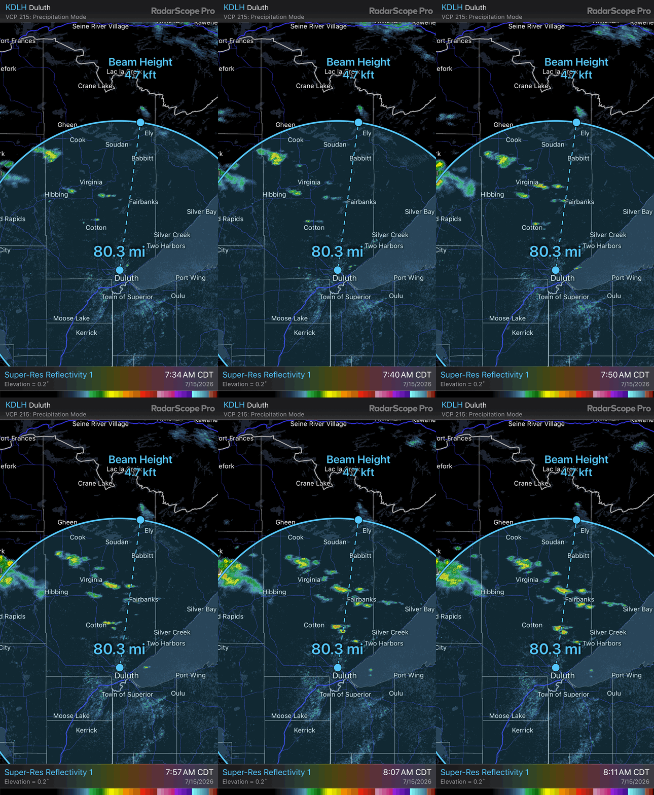
The smoke has been showing up on Duluth’s weather radar occasionally. Ely is about 80 to 85 miles north of Duluth so the radar beam is hitting the smoke at about 5,000 feet up. That means the smoke is reaching more than a mile into the atmosphere and blowing east and southeast.
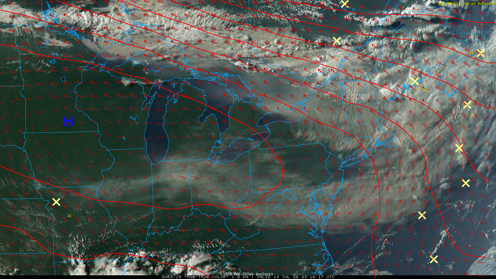
The smoke is so thick and abundant it’s now reached the northeast of the U.S. and is wrapping around, clockwise, over Washington, D.C., and back to Indiana, Illinois and Missouri.
Air flows clockwise around large high-pressure areas and heat domes such as this. There is some bright white, which is cloud cover, but the dirty gray is all smoke. This image is from Tuesday evening:
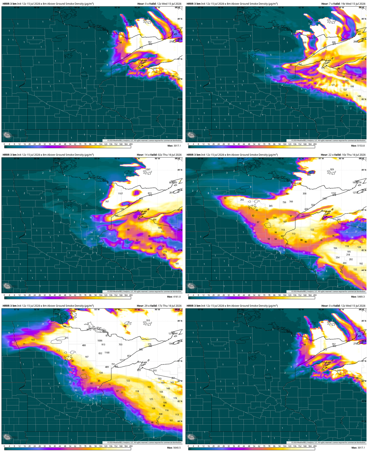
Forecasting where smoke moves can be difficult but forecast models show wildfire smoke migrating south, following a slowly moving, weak cool front Wednesday night into Thursday. The Twin Cities may stay on the edge of the worst smoke:
Hot, dry weather continues
Afternoon highs will be in the 90s for most of central and southern Minnesota once again Wednesday afternoon with lots of sunshine. Winds will be fairly light, mostly under 10 mph.

The heat index Wednesday afternoon will again range from 95 to 100 degrees in central and southern Minnesota thanks to dew points in the 60s.

It’s more of the same for those of us in central and southern Minnesota through Friday or Saturday. The 90s don’t look to break for the Twin Cities until Sunday or maybe even Monday.

We’ll see some spotty showers and thunderstorms chances today into tomorrow across northern Minnesota. A better chance of rain develops Thursday night into Friday up north.
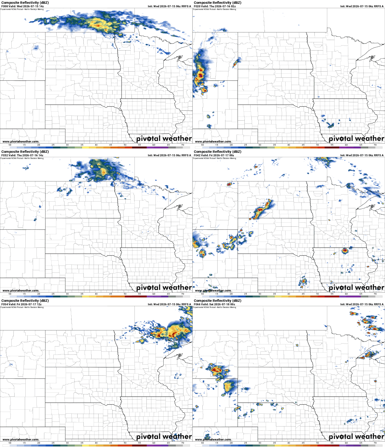
Total rainfall could get up to one-quarter to one-half inch along the international border for some lucky spots into Friday night.

Southern Minnesota may see the chance of some spotty thunder by the second half of the weekend or early next week as the cool front advances, but those chances are also sparse.

