
Air quality concerns continue for the Arrowhead, storm chances ahead
Lower humidity with above average temperatures

Go Deeper.
Create an account or log in to save stories.
Like this?
Thanks for liking this story! We have added it to a list of your favorite stories.


Wildfire smoke and air quality alerts remain our focus through the weekend, with some smoke intrusion possible Saturday night. Our next best chance of showers and thunderstorms comes Sunday night into Monday.
Air quality alert continues for the Arrowhead
An air quality alert is in effect for parts of northeastern Minnesota as another plume of wildfire smoke moves south from ongoing fires in Ontario.
The highest smoke concentrations are expected across northeastern Minnesota into northern Wisconsin, where air quality may reach levels that are very unhealthy.
Farther south smoke is expected to be much less significant. Mostly haze and periods of reduced visibility are possible, especially late Saturday into Sunday across places like east-central and southeastern Minnesota.
Turn Up Your Support
MPR News helps you turn down the noise and build shared understanding. Turn up your support for this public resource and keep trusted journalism accessible to all.
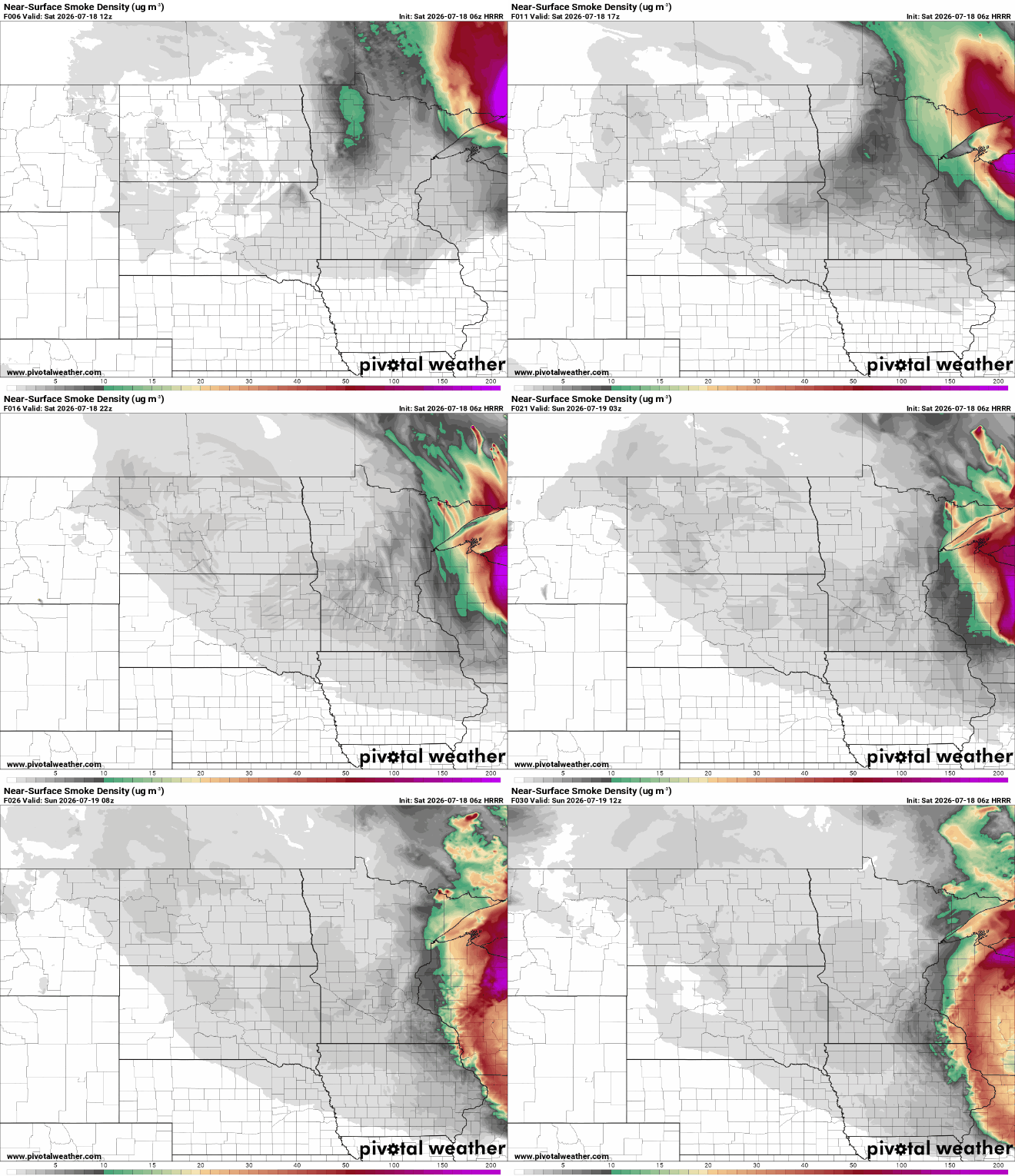
Overall, we're not expecting a repeat of the widespread poor air quality many experienced earlier this week, but things can change as smoke forecasts are updated.
Friday night's cold front will bring a bit of relief across Minnesota, ushering in lower humidity and temperatures a few degrees cooler than we've seen in recent days. Highs on Saturday will reach the upper 80s to around 90 degrees, a welcome break from the extreme heat warnings and heat advisories that covered parts of the state for much of this week.

Our next weather system arrives late Sunday into Monday as a stronger disturbance moves across the northern Plains. There is increasing potential for strong to severe thunderstorms with the potential for hail and damaging winds.

Exactly where the strongest storms develop will depend on the timing of the approaching cold front, something forecast models are still working out.
Behind Monday's cold front, much more comfortable weather settles in. Highs Tuesday will only reach the upper 70s to lower 80s, with temperatures remaining near to slightly below average through the middle of next week.


