
Heat, smoke and storms: An active start to the week
Heat advisory for the Northland; air quality concerns continue including Twin Cities

Go Deeper.
Create an account or log in to save stories.
Like this?
Thanks for liking this story! We have added it to a list of your favorite stories.


Heat, wildfire smoke, and the threat of severe thunderstorms will all play a role in our forecast before cooler, more comfortable air arrives by Tuesday.
Heat, smoke and storms
Wildfire smoke continues to be a concern with air quality alerts continuing for northeastern and southeastern Minnesota. Thicker plumes of smoke will be more concentrated in Wisconsin, but hazy skies and reduced air quality will continue in southeastern Minnesota, including the Twin Cities metro area.

Warmer temperatures for Sunday have prompted a heat advisory for the Northland, except for areas near the North Shore. Heat advisory in effect from 11 a.m. to 8 p.m. with heat indices in the mid-90s possible.

High temperatures will climb back into the upper 80s and lower 90s today, extending the Twin Cities' streak of 90-degree heat to nine consecutive days. That would rank as the third-longest stretch of 90-degree days on record for the metro area, trailing only the 14-day streak in 1936 and the 11-day streak in 1948.
Turn Up Your Support
MPR News helps you turn down the noise and build shared understanding. Turn up your support for this public resource and keep trusted journalism accessible to all.

Ahead of Monday's cold front, hot and humid conditions will continue. Afternoon heat index values will climb well into the 90s, with portions of southern Minnesota potentially approaching 100 degrees.

Strong to severe thunderstorms are possible late Sunday night into Monday. The first opportunity arrives late Sunday night as storms develop across the Dakotas and move east into Minnesota.
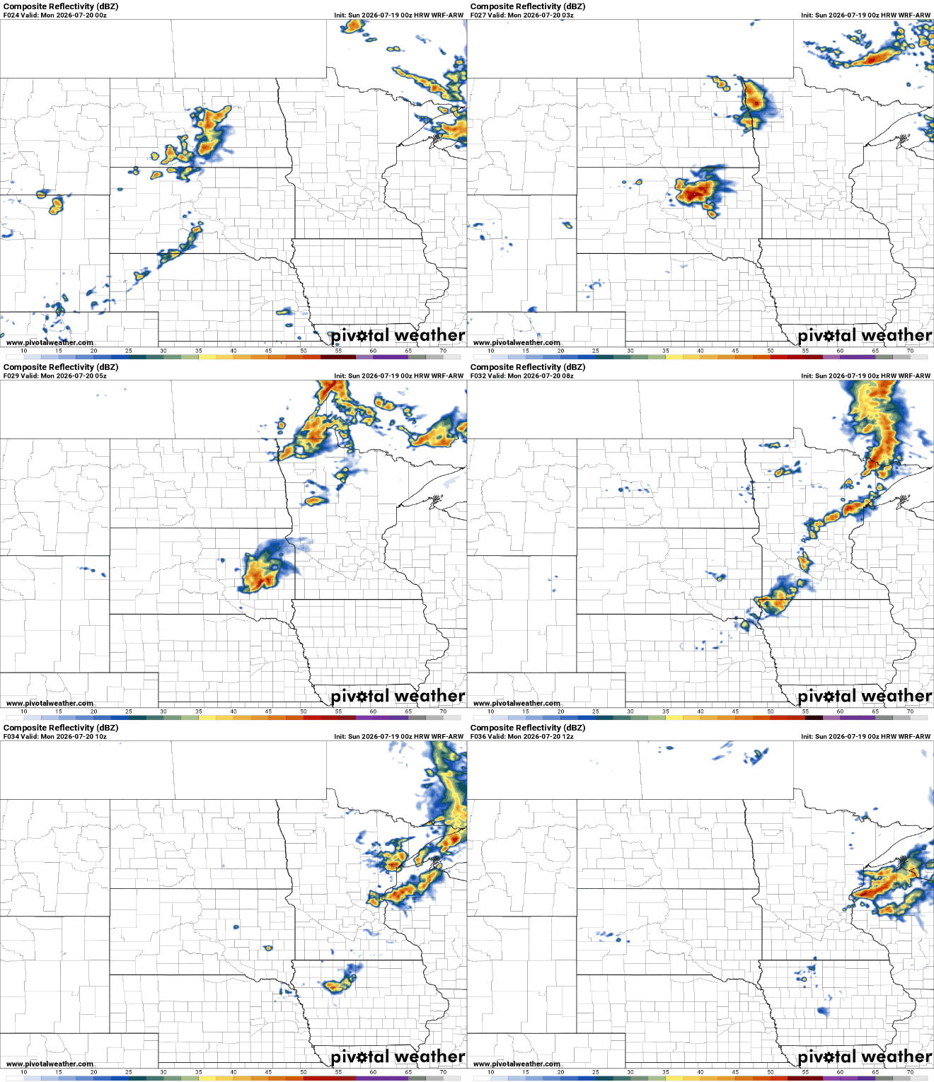
These storms may organize into a large thunderstorm complex, known as a mesoscale convective system (MCS), capable of producing widespread damaging wind gusts.
A second round of storms is possible Monday afternoon as a cold front moves through the Upper Midwest.
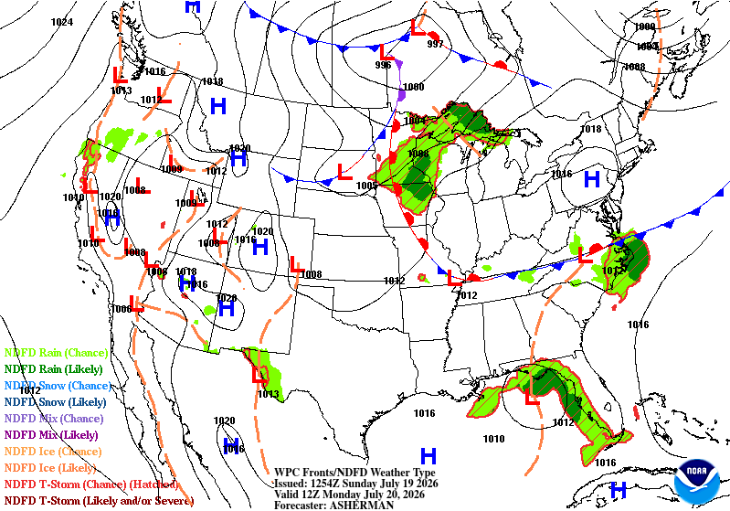
The exact location of the front, and whether morning storms linger long enough to limit afternoon redevelopment, will determine where the greatest severe weather threat sets up.

At this time, Wisconsin has the highest risk for severe weather, where an enhanced risk (level 3 of 5) has been outlined by the Storm Prediction Center. If storms develop, all severe weather hazards will be possible.
Behind the cold front, much cooler air will settle into the region Tuesday. High temperatures will drop into the upper 70s and lower 80s, slightly below normal for mid-July, with noticeably lower dew points The middle of the week also looks relatively quiet, offering a welcome break after several days of heat and storm chances.

