
Finally some relief: Cleaner air and a break in Minnesota's historic heat
Seasonal temperatures return in over a week and half

Go Deeper.
Create an account or log in to save stories.
Like this?
Thanks for liking this story! We have added it to a list of your favorite stories.


After what has felt like an endless stretch of heat and smoky skies, there's finally some good news for Minnesota.
Breathe easier, literally
For the first time in days, we don't have an air quality alert due to wildfire smoke. While a little light smoke could drift in overnight on northwest winds, it won't have much impact. That's a welcome change after several days of hazy skies and poor air quality.
Monday also marked a significant milestone in the record books. It was our 10th consecutive day with temperatures reaching 90 degrees or higher, making this the third-longest 90-degree heat wave in Minnesota history. Only the legendary heat waves of 1948 and 1936 lasted longer.
It's been an exhausting run of relentless heat and high humidity.
Turn Up Your Support
MPR News helps you turn down the noise and build shared understanding. Turn up your support for this public resource and keep trusted journalism accessible to all.

A cold front is now sweeping across the region, bringing an end to this remarkable stretch of summer heat.
Ahead of the front, very humid air remains in place with dew points in the 70s and even lower 80s, creating plenty of fuel for thunderstorms. A heat advisory remains in effect until 7 p.m. for much of southern and east-central Minnesota, where heat indices are climbing well into the triple digits.

Any storms that develop will have the potential to produce damaging winds, large hail, heavy rainfall and even isolated tornadoes. The main severe threat remains off to our south and east, mainly affecting northeastern Iowa and Wisconsin.

Once the front passes, a much different air mass will settle in.
It will feel noticeably cooler and far less humid, and that refreshing air will stick around through the middle of the week. High temperatures Tuesday through Thursday will top out in the upper 70s to lower 80s, while overnight lows fall into the 50s and 60s.
Even more noticeable will be the drop in humidity, with dew points falling into the 50s and even the 40s at times.
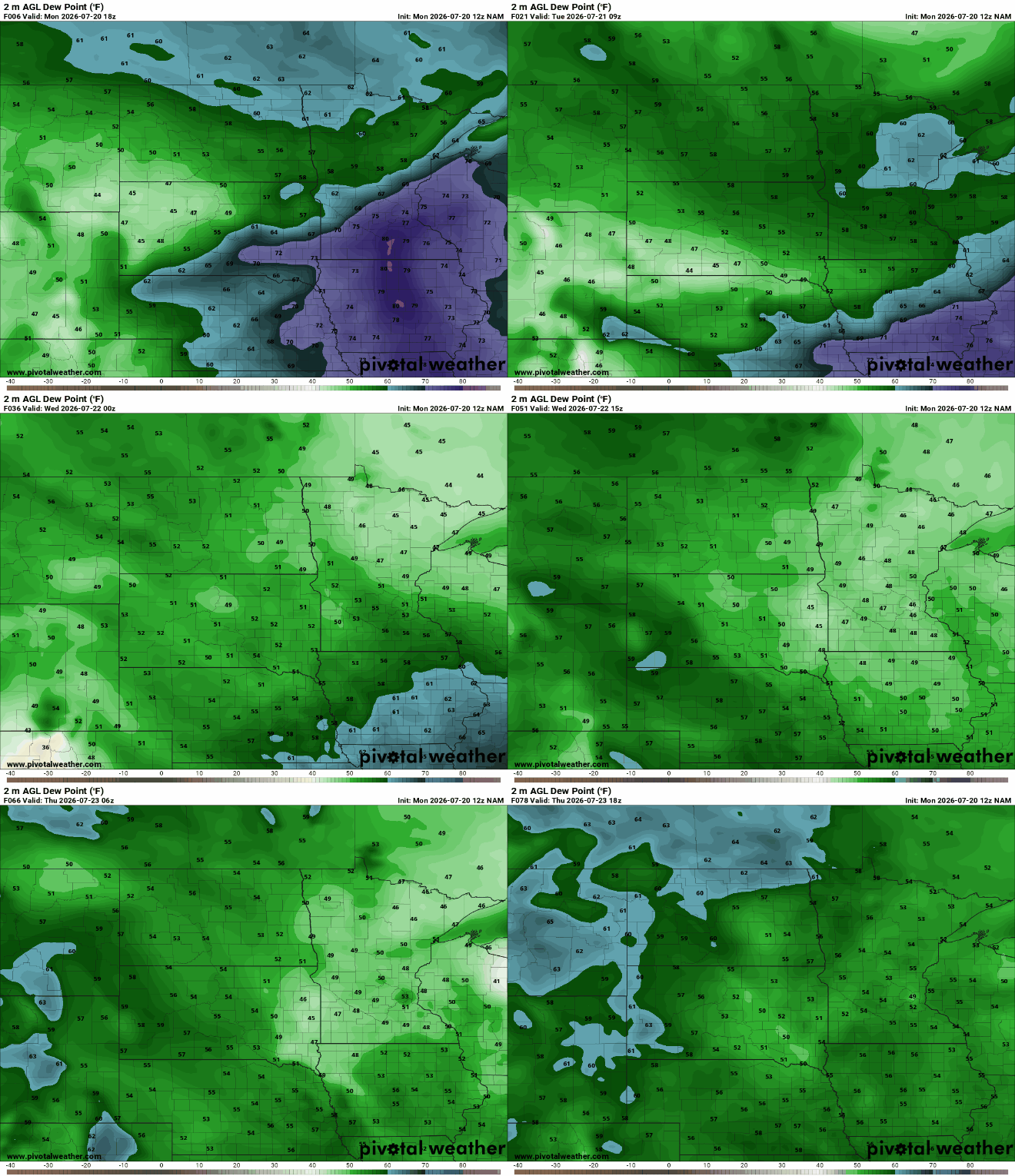
After 10 straight days of 90-degree heat, it'll be a welcome opportunity to open the windows, spend time outside and give air conditioners a well-earned break.
The cooler weather won't last forever, though. By next weekend, the summer heat begins to build back into the Upper Midwest. High pressure is expected to remain over the Plains as temperatures climb once again, with highs potentially returning to the 90s by Saturday and Sunday.
For now, enjoy the break. Cleaner air, lower humidity, and comfortable temperatures are exactly what Minnesota needs after one of its longest and most intense heat waves on record.

