Updraft® - Minnesota Weather News

Two rounds of thunder with another heat wave starting
The 90s are back by Saturday as we track severe weather

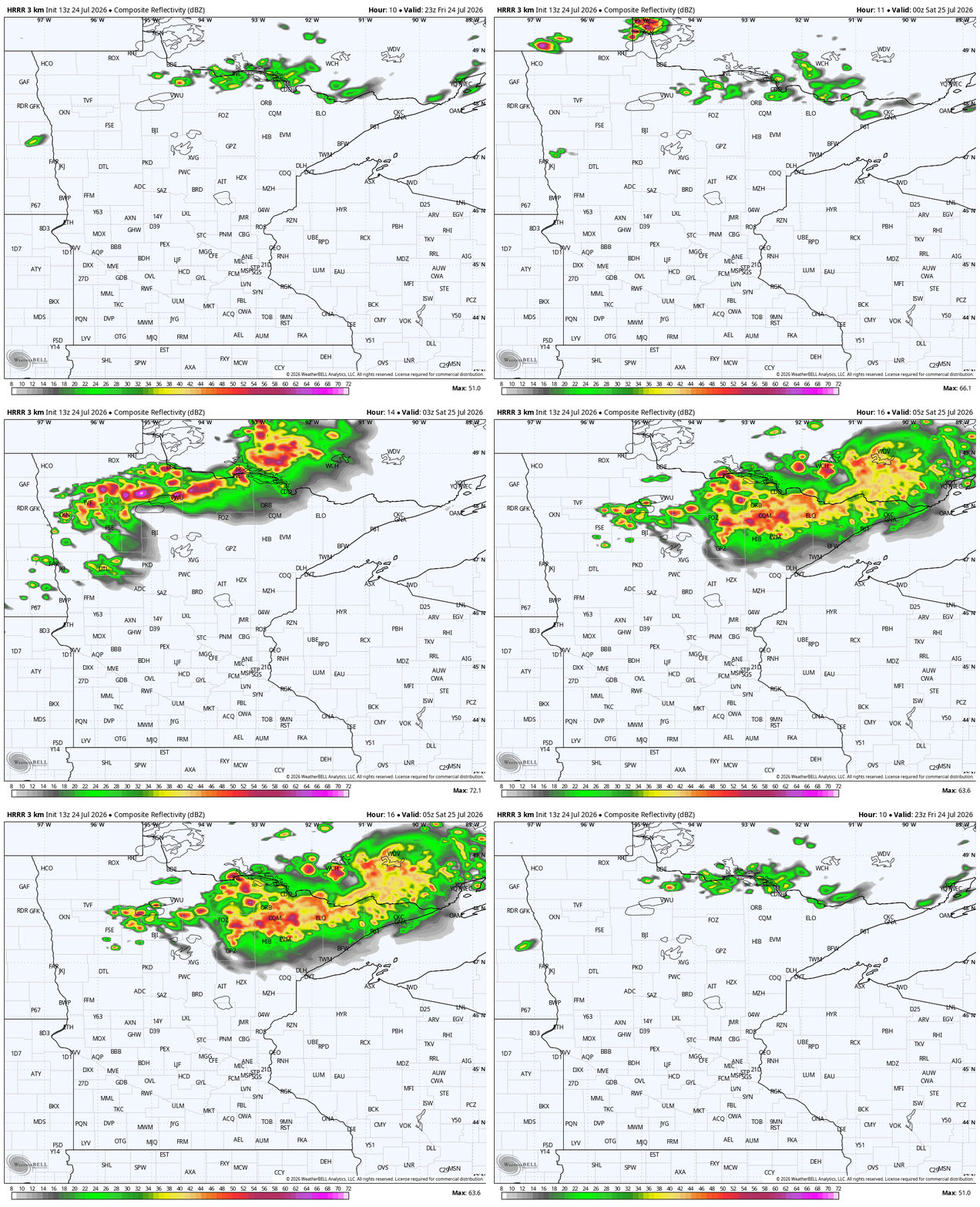
Storm timing
This is a GIF of the storm timing for Friday night.
National Weather Service

After sprinkles held our temperatures down through the Twin Cities Friday morning, we still await the true arrival of the heat wave which is coming this weekend. Just as a reminder, most of Minnesota is dry on Friday, at least once the morning sprinkles pass.

spcFRI
Severe weather outlook Friday into Friday night
Iowa State University Environmental Mesonet

We will get some limited sunshine at times on Friday across the state. That sunshine primes the pump for severe weather chances in far northern and northwestern Minnesota Friday evening, with the mesoscale convective system line of storms. A lot of us will have temperatures in the lower to middle 80s; that’s just a little bit warmer than what we’ve had each of the past couple of days as the heat ridge develops to our south.

They will also be a few tiny little leopard spot showers (that’s what I call garden variety showers because to me, they look more like a leopard’s randomized spot pattern) along the interstate 90 corridor.

The main event for the state as a hole is the severe weather chance Friday evening. The Storm Prediction Center in Oklahoma is highlighted the northernmost five percent of Minnesota for a little bit higher tornado risk closer to 7 p.m. to 10 p.m.

Storm timing
This is a GIF of the storm timing for Friday night.
National Weather Service

There could also be some damaging winds, along with a larger hail. Given the expanded drought that we just saw become official on Thursday, in the Boundary Waters, there is that increased risk for wildfires. Basically, we don’t want to see lightning over dry forest. That could act as a fire starter.

On the other hand, the downpours that eventually come with the thunderstorms Friday should help Fire activity a little bit in the Boundary Waters. It does look like the heaviest rain will be more in northwestern, parts of Minnesota, however. We cannot rule out an isolated tornado in the far north, closer to Lake of the Woods.

severe parameter
This is the SigTor marker for tornado potential Friday evening. The purple zone in NW MN is the biggest spot in the country today.
National Weather Service

Saturday is the first big-time jump in temperatures we’ve noticed this week. Many of us will have abundant sunshine, a little bit more humid conditions, and the southern tier of Minnesota, and high temperatures going well into the 90s in many places. Saturday is still a pretty dry day.

That’s apart from some scattered rain in the Arrowhead Saturday morning — that should offer a little boost for busy firefighters.

Highs
Here are the low temperatures for Saturday AM, as seen on the National Blend of Models maps for Minnesota.
National Weather Service
highs2
Here are the high temperatures for Saturday PM, as seen on the National Blend of Models maps for Minnesota.
National Weather Service
toasty trend ahead
The next round of 90s kicks off! The last one, nine days straight above 90°, was the second hottest stretch ever recorded for that time period, with only 1936 besting 2026.
National Weather Service

Sunday is perhaps the biggest question in the extended forecast period. How strong will storms become if we have too much cloud-cover? Will the clouds strangle the chance of hitting 100 degrees in spots? A much broader region of the state — almost all of Minnesota, really — is in this yellowed risk map. That’s slight risk, aka level two out of five.

The extreme heat warnings are posted all over now, and the middle-to-upper 90s are going to be very noticeable. We are also officially in the corn sweat part of the yearly calendar, and the humidity will be really present along the Iowa and South Dakota state lines. The heat wave should last through at least Thursday, possibly even longer.

spc SUN NT
Severe weather outlook for Sunday into Sunday night
Iowa State University Environmental Mesonet
Sunday showers
Here's one outlook for Sunday afternoon, though we expect some more thunder than this is currently showing.
National Weather Service
