
The once and future fires: Boundary Waters explained
Go Deeper.
Create an account or log in to save stories.
Like this?
Thanks for liking this story! We have added it to a list of your favorite stories.


Wildfires are nothing new in Minnesota. They’ve been forming by lightning, often from what we call, dry, thunderstorms, for pretty much all of history.
There are even matching tree ring records that show wildfires beginning along the modern day Canadian border and slow slowly venturing south towards the Gulf Coast. Last fall, I spoke with Dr. Cecil Frost. He is a fire historian based in North Carolina, and I met with him on the campus of Duke University. He told me about these truly mammoth fires, which also went from the Rocky Mountains to the Appalachian mountains. This tree ring science - dendrochronology - can show us how far fires spread. But they were really common!
Because there was no one to put these fires out, wildfire returned to the Minnesota landscape every few years, and turned through the brushy under story. With wildfires so common, thickets and brush and other ground-based material was quickly burned off, and so fires were more ‘gentle’ than we might have today.

When dry thunderstorms arrived on July 6, the 2026 version of wildfires had, pardon the cliche, the perfect storm. The winter snowpack was fully melted and totally gone. We’d seen reports of creeks running ultra-low near the Boundary Waters, the Mississippi had its lowest late spring flow on record, and much more. The point here is this: on paper, the drought never looked that bad. Despite being at a really low drought, we knew things were dry. Sven Sundgaard wrote me this on July 13th: “it's easy to forget they've had a fraction of the rain we have.. one Ely area coop is 1.78” only since June 1…. Normal up there (June 1- present ) is 5.59.”

If you notice the date above - July 6th - that might seem like a mistake, right? After all, the wildfires exploded in growth on July 13th. So, what gives? These lightning strikes a week before hit a single tree and probably smoldered quietly; it’s much the same if you were to try and protect an ember in a wet campfire. When weather conditions became ripe for massive growth (up to 40X in less than a day on the Camp Fire!), those embers spread. We had truly unprecedented temperatures in the Boundary Waters, with at less nine weather stations climbing above 100 degrees. Collectively, this was the hottest day in the history of this part of the state. On a rolling average, this was the second hottest stretch for this time of year on record. See the note from Dr. Mark Seeley.

In just the last couple of days, more than 1,000 firefighters and other support staff around Superior National Forest have made massive leaps forward in fire containment. We also just had some incredibly helpful rains Friday night. In addition, other lightning storms have mostly spared us - even though they were over the same area. That was incredibly lucky. Here’s a quote from Superior’s late Saturday briefing:
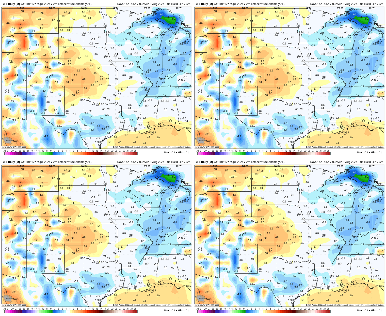
“Last night’s storm brought measurable rainfall across the fire area, with 1 to 1.5 inches recorded over the northwestern portion of the perimeter and 0.42 inches observed near Ely. The showers will moderate fire behavior in the short term, but above normal temperatures and sunny skies today will dry fuels and support surface fire activity by the afternoon.”
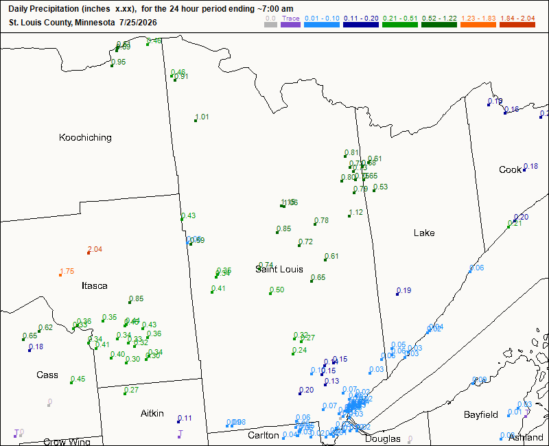
That really shocked me! Even after all that rain Friday night, by Saturday afternoon, it was effectively fire risk time once again!
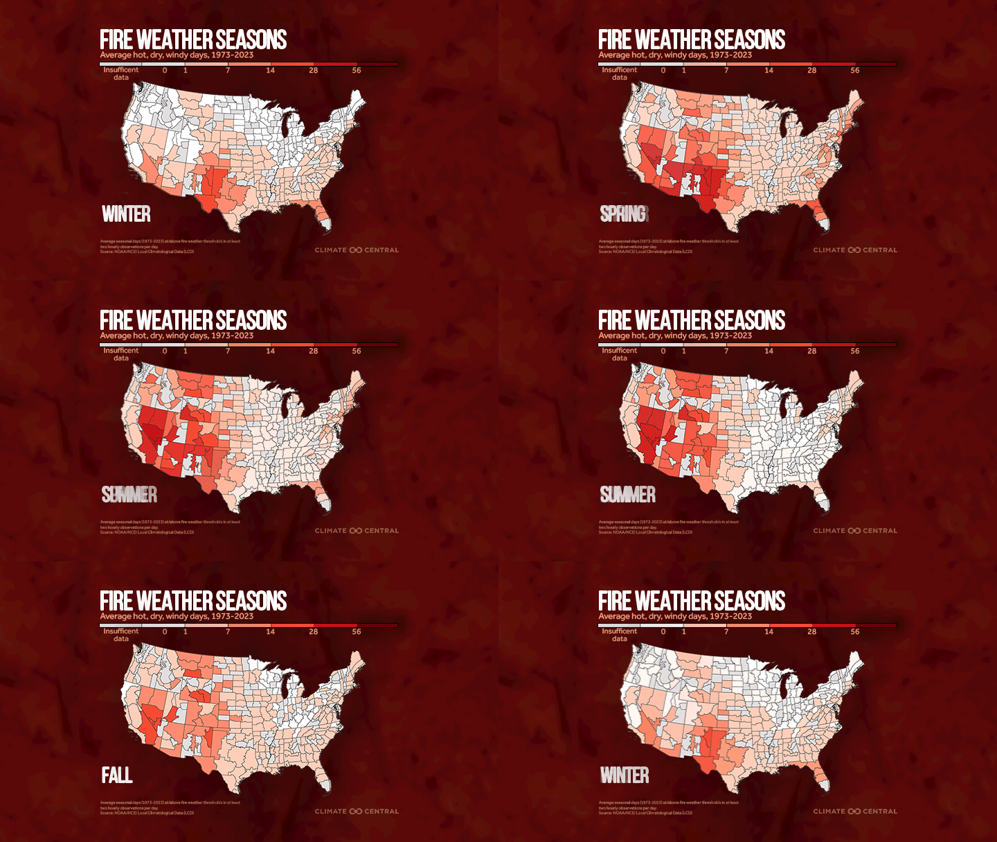
I’ll be the first to admit: the climate change impact since 1970 for Minnesota wildfires have been fairly flat. We’re not going to hype that risk because of this huge event. That said, you can check out the spring and fall fire weather days in Minnesota. Summer and winter are not as favored for wildfires. One thing we are seeing more of, though, is derechos. These long-lived wind events (you may have heard of the Bemidji Blowdown or the 1999 Boundary Waters Blowdown) do indirectly add wildfire risk. With millions and millions of logs knocked down, dried out, and sitting, that acts as kindling if a wildfire does form. We have a ClimateCast coming very soon about the increasing risk of decrechos, with science coming from Northern Illinois University’s meteorology team.
Turn Up Your Support
MPR News helps you turn down the noise and build shared understanding. Turn up your support for this public resource and keep trusted journalism accessible to all.

