Conditional storm threat with heat continuing Monday
Expect a slight drop in temperatures, dew points Monday
Go Deeper.
Create an account or log in to save stories.
Like this?
Thanks for liking this story! We have added it to a list of your favorite stories.
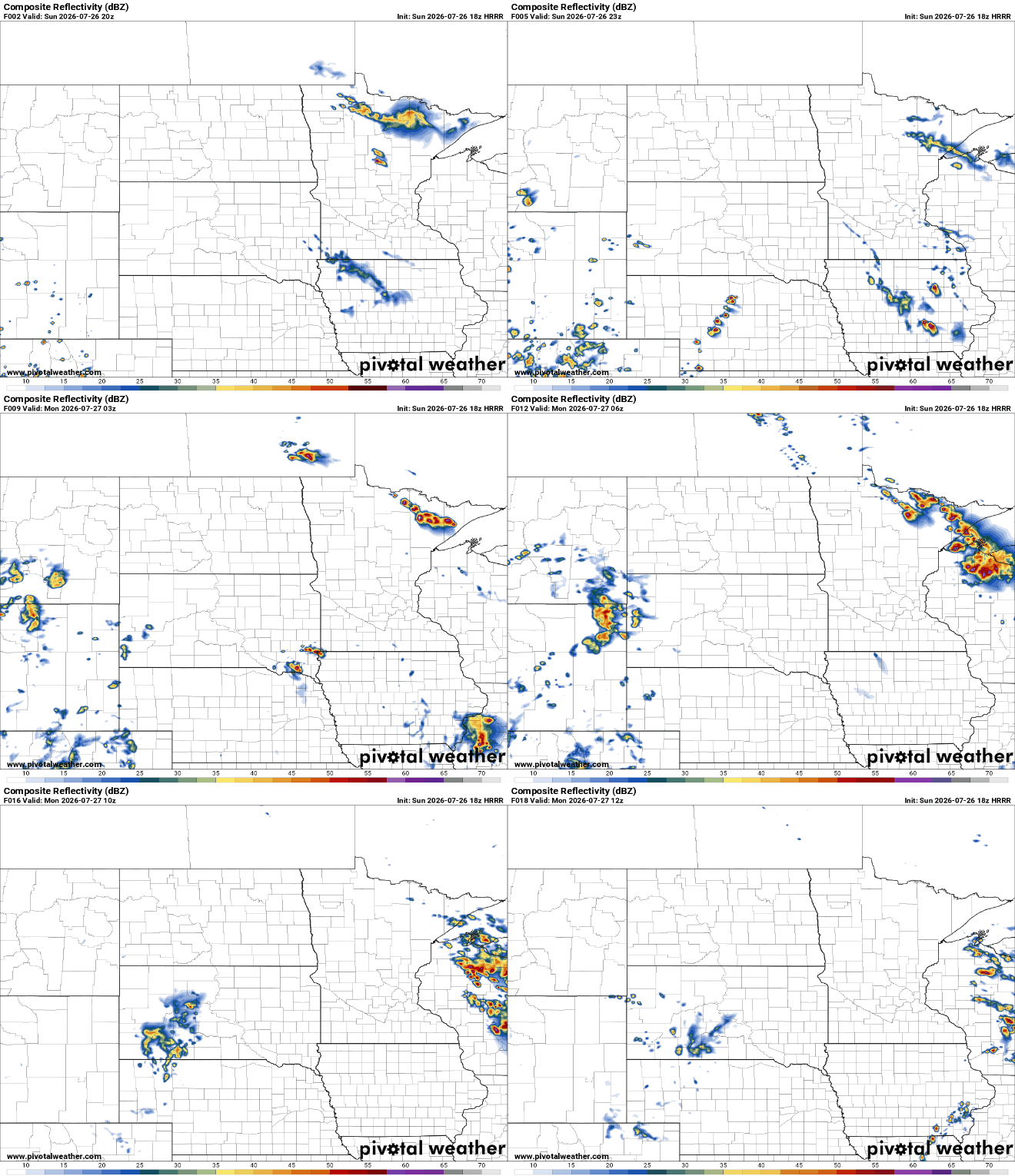
Some storms are possible this evening and overnight; mainly northeast Minnesota into Wisconsin. The heat continues this week though not quite as hot and humid by Tuesday.
Conditional storm threat with heat continuing
A very steamy Sunday could lead to some evening and overnight thunderstorms for some. The threat is conditional since the atmosphere is capped across much of central and southern Minnesota. That means it’s too warm in the mid-levels of the atmosphere to allow surface air to ascend and produce storms.

We expect some storms to fire up in northeast Minnesota into Wisconsin, just north of the strongest cap, or mid-level layer of warm air. These storms would then travel east southeast into the overnight Sunday.

There’s an enhanced severe risk (level 3 of 5) for far east-central and northeast portions of Minnesota into Wisconsin. The main threats will be from damaging wind gusts and large hail, but an isolated tornado can’t be ruled out.

A weak cool front slides across the state Monday. It will mostly bring a wind shift with north winds 10-20 mph. Temperatures and dew points will drop slightly into Tuesday, but Monday will still be pretty hot across southern Minnesota.

Tuesday through Thursday will be ever so slightly cooler with highs still near 90 degrees for many in central and southern Minnesota. The next cool front moves through Thursday night into Friday which will bring the next chance of some thunder and another subtle drop in temperatures and dew points behind it for the weekend.
Turn Up Your Support
MPR News helps you turn down the noise and build shared understanding. Turn up your support for this public resource and keep trusted journalism accessible to all.
