
Rain coming to drought-impacted Minnesota
Cooler temps this weekend

Go Deeper.
Create an account or log in to save stories.
Like this?
Thanks for liking this story! We have added it to a list of your favorite stories.


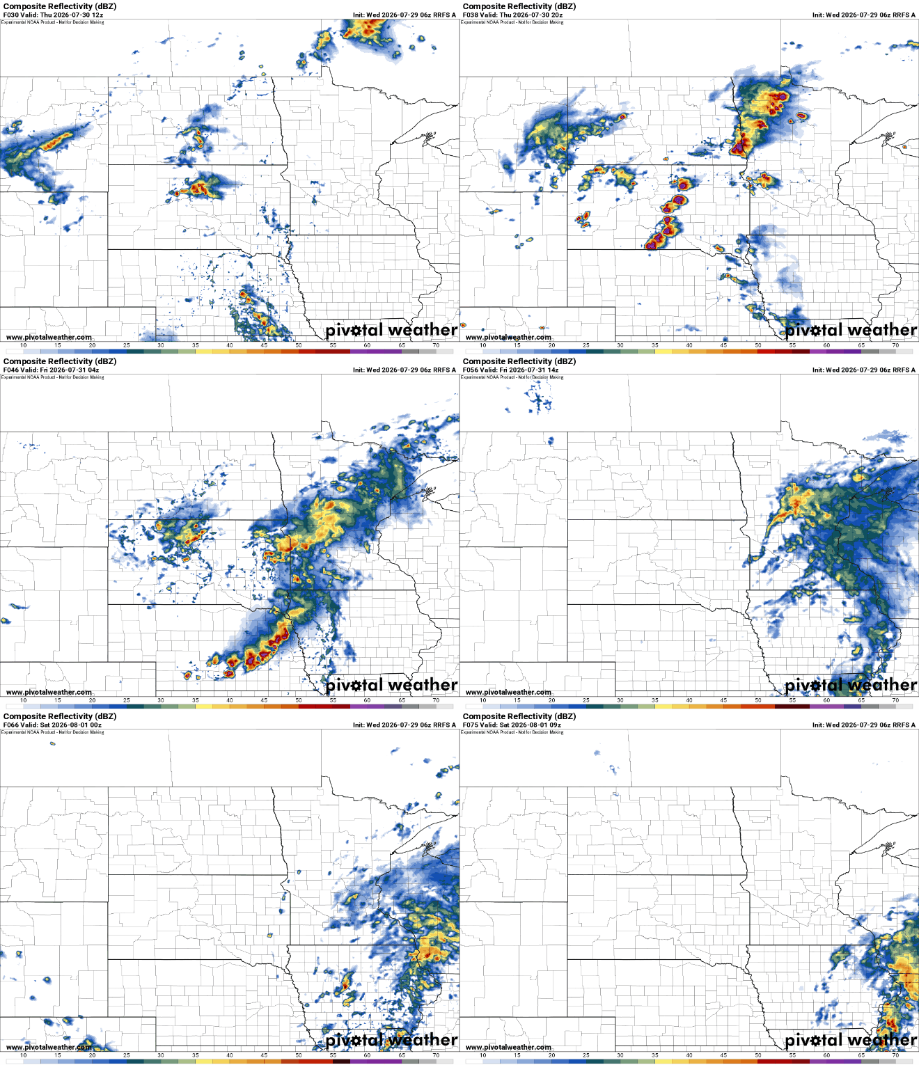
Needed, heavy rain is coming to southwestern Minnesota and across the state in the next 40 hours, temporarily easing drought conditions.
The weekend shapes up to be cooler. More rain is likely early next week.
Drought conditions bake Minnesota, but rain is near
Last week’s drought conditions report showed much of Minnesota needing rain.
In southwestern Minnesota, ranchers the past few days have used the USDA’s Condition Monitoring Observer Reports on Drought tool to report how dry it is on their pastures. Some have taken cows off the land a couple of months ahead of schedule. Grass is gone, creeks are drying and hay is struggling.
Turn Up Your Support
MPR News helps you turn down the noise and build shared understanding. Turn up your support for this public resource and keep trusted journalism accessible to all.
In the Twin Cities, the shallowest soil moisture is only 0.4 percent of normal. Conditions get a lot better way deep down in the soil, but it may be time to water your garden in a big way.
We will see at farmer’s markets later this summer how this drought impacts the yield, and subsequently, the price of fruits and vegetables not grown in greenhouses.

Rain Thursday into Friday
After a toasty Wednesday, Thursday morning will be pleasant and noticeably cooler. The clouds begin to roll in and the humidity jumps up a notch.
Here are the forecast highs and lows:


We still climb back into the 90s all across Minnesota with rain in the later afternoon into the evening.
Some of this lingers in southwestern Minnesota. Several weather maps bring a couple of inches of fresh rain to areas like Marshall and Worthington. That would be great.
The rain picks up after dusk Thursday into the early morning hours of Friday. The actual frontal passage happens Friday evening, and it may bring a hit of rain from northwest to southeast.
A couple of severe storms seem possible in central Minnesota, closer to Brainerd and Bemidji, which is where things have popped up all summer long.
Cooler weekend; more rain early next week
The weekend shapes up to be cooler, though still pretty close to the weekly average. That means highs in the middle 80s across much of Minnesota. Lows are a little above normal, in the middle 60s in most spots.
There will also be some river valley fog, though perhaps a little less than the dense fog advisories we’ve had in recent days.
The afternoon model runs from the the European Centre for Medium-Range Weather Forecasts and the National Oceanic and Atmospheric Administration’s Global Forecast System show a big front and widespread rain Monday night into Tuesday. Hopefully, this doesn’t pack severe weather.
We should warm back up by the weekend of Aug 8-9. There are signals for a few more powerful fronts and rainmakers into the extended forecast, but I’m always a little skeptical this far out.

