
Much needed rain and thunder could be on the way
More seasonable temperatures this weekend

Go Deeper.
Create an account or log in to save stories.
Like this?
Thanks for liking this story! We have added it to a list of your favorite stories.


Thursday will be another very warm and muggy day, but some rain and thunder is on the way for many of us — and we could really use it.
Slightly cooler, more seasonable temperatures follow.
Much need rain and thunder on the way
We have one more hot and muggy day on the way Thursday. Afternoon highs will be in the mid to upper 80s to even near 90 degrees again for some. Clouds will be on the increase ahead of some needed moisture.

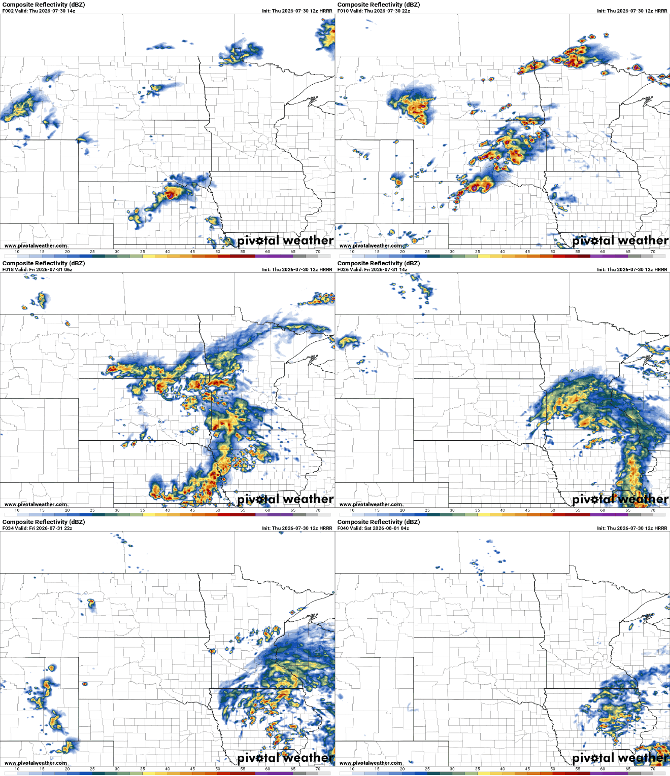
Scattered showers and storms will develop in western Minnesota later in the day Thursday. Some of those initial storms could be strong or severe. Showers and thunder will then fill in east overnight into Friday morning.
Turn Up Your Support
MPR News helps you turn down the noise and build shared understanding. Turn up your support for this public resource and keep trusted journalism accessible to all.
There’s a marginal severe risk (level 1 of 5) for western Minnesota for those afternoon and evening storms Thursday. Most storms will be of the garden variety as they move east overnight.

Needed rain as drought deepens
The big headline is that things are very dry for most and this moisture comes just in time.
Many areas could see 1 to 2 inches of rainfall into Friday with some locally higher amounts up to 3 or 4 inches. With the nature of thunderstorms, however, not everyone will get ample moisture evenly.
The forecast models are narrowing in on southwestern Minnesota and the Minnesota River Valley getting the most significant amounts.

Behind the system, more seasonable temperatures and sunshine move in the for the weekend. We’ll see highs in the 80s with a slight dip in dew points. Another front next week could drop dew points even more by midweek.


