
Rain on target despite drought rising
We need at least a foot of rain to alleviate drought

Go Deeper.
Create an account or log in to save stories.
Like this?
Thanks for liking this story! We have added it to a list of your favorite stories.


Thunderstorms and heavy rain roll in later Thursday, wrapping up for most by noon Friday. Minnesota’s drought conditions, though, continue to worsen.
Much of Minnesota down a foot of rain
The latest report from the National Drought Mitigation Center shows drought conditions deepening across Minnesota.
Based on National Oceanic and Atmospheric Administration data, here’s how much rain several parts of Minnesota would need, spread out over three months, to alleviate drought without causing flooding:
Northwest: 14.01 inches
North-central: 19.56 inches
Northeast: 14.69 inches
Southeast: none
South-central: 12.15 inches
Southwest: 12.22 inches
Twin Cities area: 16.22 inches
Central: 12.15 inches
West-central: 10.01 inches
That’s a whole lot of rain.
Turn Up Your Support
MPR News helps you turn down the noise and build shared understanding. Turn up your support for this public resource and keep trusted journalism accessible to all.
For reference, Minneapolis and St. Paul average just over 31 inches of precipitation over an entire year, melted snow included. To get rid of drought would require about six months of rain in half that time!
While the lilies and hydrangeas may look great now, this drought is not going to leave soon.
Rain on the way for many
On Thursday, we’ll top out in the lower 90s across the region, except perhaps far northern Minnesota where the rain starts the earliest.
Along the Canadian border, some booming thunderstorms start bringing downpours around 4 p.m. Thursday near Lake of the Woods. For many other spots, especially southwestern Minnesota, the rain gets here just before midnight.
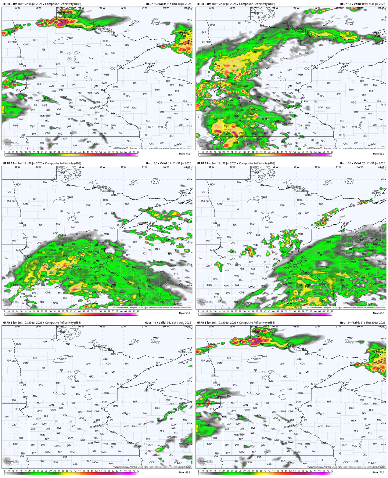
The latest data makes kind of a Pac-Man shape for rain totals. That would leave Duluth, Brainerd, and east-central Minnesota a lot more dry than it once looked.
Rain rolls through the Twin Cities around dawn on Friday. It will be a cooler day with largely overcast skies, but we’re not looking at an all-day rainout.
Friday should be in the mid-70s, although some maps show quite a bit warmer temperatures. We could have much higher temps in northern Minnesota, where the clouds will not linger.


The weekend is all dry, so go out and enjoy the more moderate temps!
The next best chance of rain is still next Monday night into Tuesday. Some of that front could be pretty powerful.
While we’re NOAA’s Storm Prediction Center doesn’t have Minnesota in a severe outlook yet, we would not be surprised if that changes given the dynamics for this time of the year.
Later into next week, we have more quiet weather and some middle 80s for highs across the state.

