
Some needed moisture Friday ahead of a nice weekend
More seasonable temperatures into next week

Go Deeper.
Create an account or log in to save stories.
Like this?
Thanks for liking this story! We have added it to a list of your favorite stories.


We’ll have lots of clouds and scattered showers and thunder Friday. Sunshine will break out slowly from north to south. A nice, seasonable weekend is on the way.
Some needed moisture Friday ahead of a nice weekend
A flood warning is posted through 1:45 p.m. Friday for Sibley, Le Sueur, and Nicollet counties. Radar estimates up to 6 inches of rain has fallen through midmorning Friday. Le Sueur measured 4.95 inches through 7 a.m. Friday.

As expected, a swath of heavy rainfall set up along the Minnesota River overnight Thursday night into Friday morning. An axis from Willmar through Gaylord and Le Sueur received up to 3 to 6 inches of rainfall (red dots).
In the Twin Cities, most rainfall ranges from one-quarter inch to 1 inch through midmorning Friday.
Turn Up Your Support
MPR News helps you turn down the noise and build shared understanding. Turn up your support for this public resource and keep trusted journalism accessible to all.

A flood watch continues for portions of west-central and south-central Minnesota through midday Friday as the rain continues. Some of it will potentially be heavy with another 1 to 3 inches possible in some localized areas.

Our latest disturbance continues to keep clouds, showers and some thunderstorms around much of central and southern Minnesota into western Wisconsin Friday morning. Those showers and thunderstorms will gradually become more widely scattered and spotty during the afternoon and evening.
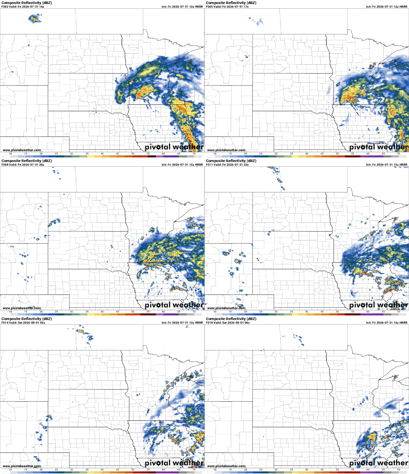
Sunshine will break out slowly from north to south. That means afternoon highs will be warmest in northern Minnesota where low to mid-80s are likely. We’ll see cloud and rain-cooled highs in the 70s across most of central and southern Minnesota.

The weekend is looking absolutely gorgeous. We’ll have a lot of sunshine. Temperatures will be more seasonable with a slight dip in dew points. Highs Saturday and Sunday should be in the mid-80s — close to normal.

Another cool front will touch off some spotty showers and thunderstorm chances Tuesday and bring a further dip in dew points and temperatures for midweek next week. We may be in for quite a break from 90-degree temperatures we’ve had for most of the state.


