
NW storms, then largely rain-free week ahead

Go Deeper.
Create an account or log in to save stories.
Like this?
Thanks for liking this story! We have added it to a list of your favorite stories.


We promised a carbon copy day didn’t we? And well, it was very pleasant all across Minnesota. Perhaps some nighttime rain would have helped the garden and nearby ranchers but, all in all, not a bad weekend!
You may have heard about Monday evening’s thunderstorm threat. If not, storms are still coming for parts of Minnesota. Most of the acreage across the North Star state, however, should probably still plan on watering plants throughout the week; we’re certainly not all getting rain!


Prior to the rain itself, we have a hotter and soupy Monday. We should have lots of sunshine as the ‘convective debris’ clouds from northern Minnesota may have a hard time reaching the rest of the state. So, plan on it being hotter than the weekend. The primary - possible - severe threat is still from the NE corner of South Dakota (near the Sisseton Hills) over to Fergus Falls and then up to International Falls. This goes from 8:00 p.m. Monday - 2:00 a.m. Tuesday. Following that time slot, some others may get rain, but not likely for the Twin Cities and points south of that.
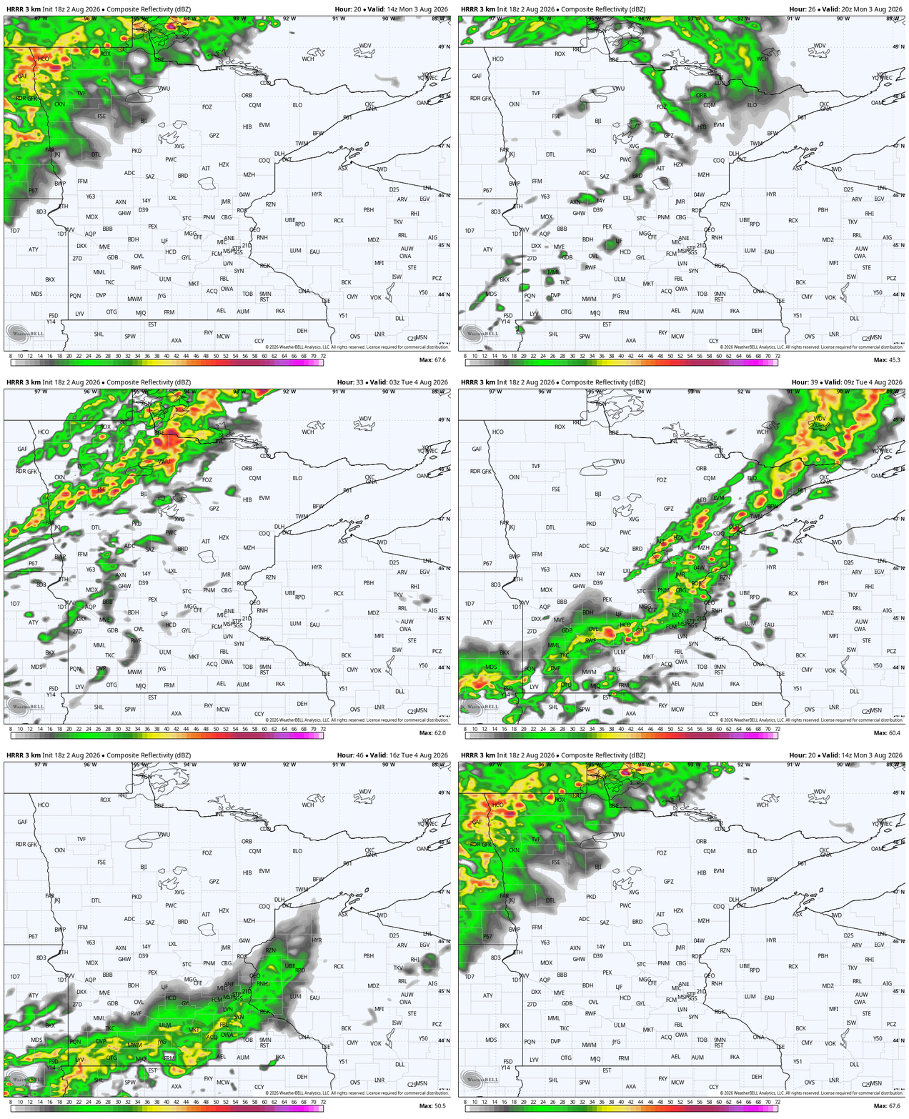

Outside of this brief round of strong storms on Monday night, most of the rest of the workweek is dry, albeit marginally cooler. The next best chance of rain on the American weather maps is Friday evening, followed by Sunday. The next best chance of rain on the European maps is Saturday evening. No matter the timing, and those details will eventually iron themselves out for us, that’s still several days of dry weather into the future.
Extras:
The Minnesota River Valley got a tremendous amount of helpful rain on Thursday night into Friday of last week. We talked about what that could mean for the meandering watercourse. Well, now that things have had time to move downstream, we still haven’t had flooding issues. Take the Minnesota River at the Morton gauge, for example. The river has climbed five feet since Friday and we’re still roughly four feet from ‘action’ stage. That surprised me given the volume of water that went into the basin. This is really a sign of just how low the water was, to still be so far away from any concern.

For the week ahead, temperatures will start to drop a little once we get past Monday’s delayed and weakened front. It’s not a major change but something we’ll keep our eyes on.

Turn Up Your Support
MPR News helps you turn down the noise and build shared understanding. Turn up your support for this public resource and keep trusted journalism accessible to all.

