
Advancing cool front increases storm chances Monday into Tuesday
Temperatures and dew points will drop behind the front
Go Deeper.
Create an account or log in to save stories.
Like this?
Thanks for liking this story! We have added it to a list of your favorite stories.


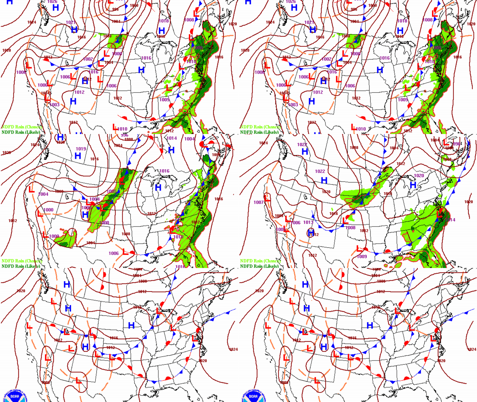
An advancing cool front out of the Dakotas will touch off more storms late Monday into Tuesday morning. Behind the front we’ll see another dip in temperatures and dew points.
Advancing cool front increases storm chances Monday into Tuesday
It’ll be a bit warmer and more humid Monday ahead of an advancing cool front. Thunderstorm activity in northwest Minnesota will slowly fizzle out this morning. Afternoon highs will be in the 80s for most.

More storms will develop late this afternoon and evening into the overnight across northwest and north-central Minnesota. Some of those storms could be severe initially. Activity will then attempt to move south and east overnight. We’ll likely see a broken line of showers and some thunder in southern Minnesota into Tuesday morning.
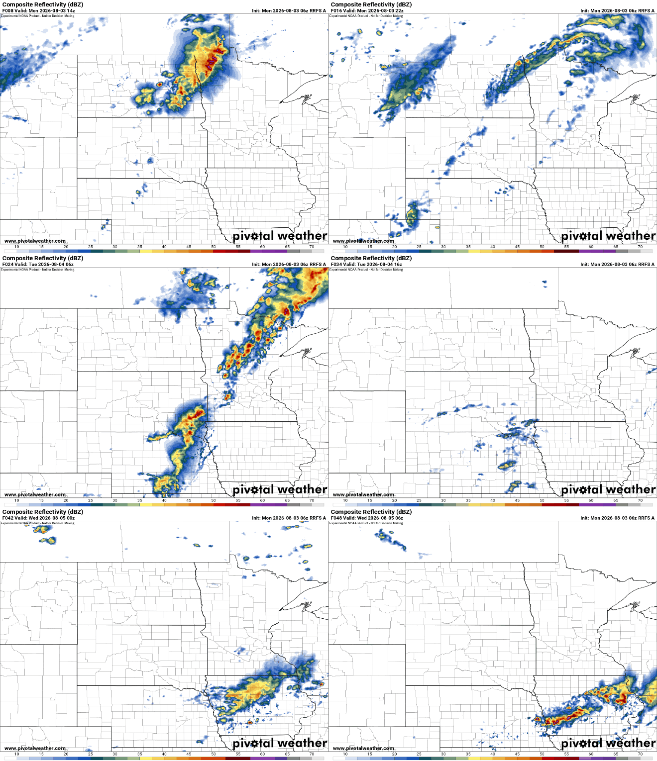
There is a slight risk (level 2 of 5) for severe storms across northwest and north-central Minnesota late Monday into Monday night. All hazards are possible but particularly damaging wind gusts and large hail.
Turn Up Your Support
MPR News helps you turn down the noise and build shared understanding. Turn up your support for this public resource and keep trusted journalism accessible to all.

Dew points will be more muggy Monday, back into the 60s and 70s for most, but behind the front dew points will drop again for Tuesday and Wednesday into the comfy 50s.
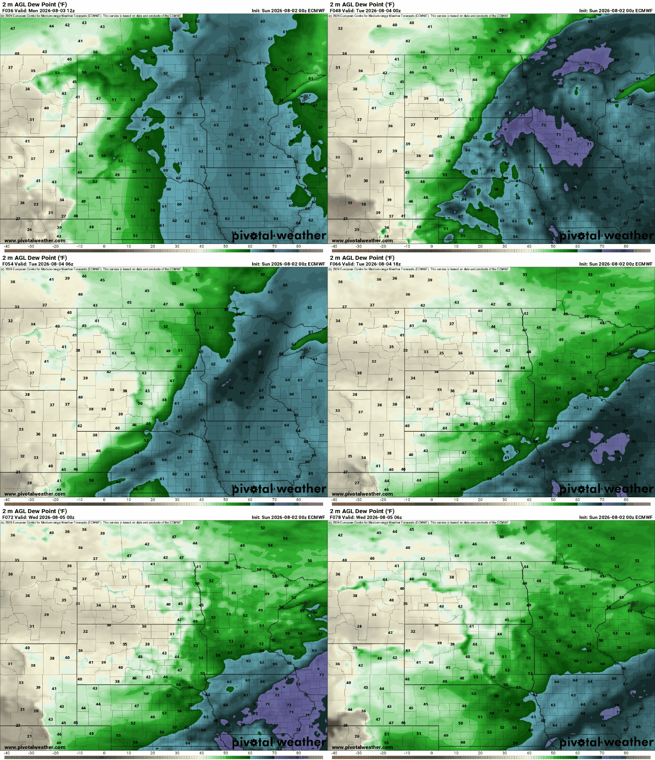
Highs Tuesday and Wednesday will be in the 70s for most of the state with perhaps only 60s in far northern Minnesota.

Temperatures and dew points will tick upward a bit for the end of the week and weekend after a few comfortable and cooler days.

The increase in temperature and dew points by the weekend, combined with a couple fast-moving upper level disturbances will bring in some spotty thunderstorm chances. Northern Minnesota could see some thunderstorms Thursday with a statewide chance by late Saturday.

