
Slightly cooler-than-normal Wednesday before temperatures, dew points increase
Spotty storm chances late week into the weekend

Go Deeper.
Create an account or log in to save stories.
Like this?
Thanks for liking this story! We have added it to a list of your favorite stories.


Cooler and drier air lingers along with lots of sunshine. Thursday will still be comfortable, but warmer. Dew points and temperatures increase along with chances of spotty thunder Friday.
Slightly cooler-than-normal Wednesday before temperatures, dew points increase
It was a cool start Wednesday with morning lows in the 40s and 50s for much of the state. Brimson dipped to 36 degrees, 38 in Hibbing and 39 in International Falls, Embarrass and Cook. The Twin Cities saw a low of 61 degrees — only the sixth such time since July 1 that we’ve been below 66 degrees, the peek average low temp in mid to late July. The normal value is 19.
We’ll have plenty of sunshine Wednesday with a few more fair-weather cumulus clouds developing northeast Minnesota. Temperatures will actually be a bit cooler than normal, mostly in the 70s with a sprinkling of a couple of low 80s.

Look for one more coolish overnight Wednesday, though temperatures will be slightly warmer, mostly in the 50s to low 60s.
Turn Up Your Support
MPR News helps you turn down the noise and build shared understanding. Turn up your support for this public resource and keep trusted journalism accessible to all.

Thursday will continue to be bright for most and a few degrees warmer. Low to mid-80s will become more widespread, especially across central Minnesota Thursday afternoon.

Dew points remain very comfortable, in the 50s and 40s Wednesday through Thursday, but will increase again Friday ahead of a weak cool front. We’ll see dew points in the 60s to even low 70s for some by Friday midday.
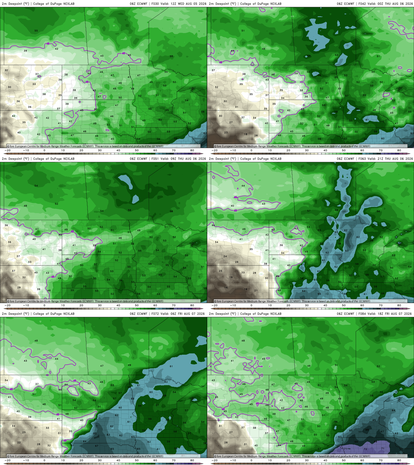
That front will meander back and forth in the region over the weekend into early next week. The surface boundary between muggy and drier air, combined with a few, fast-moving upper level disturbances will produce some occasional isolated to spotty thunderstorm chances.
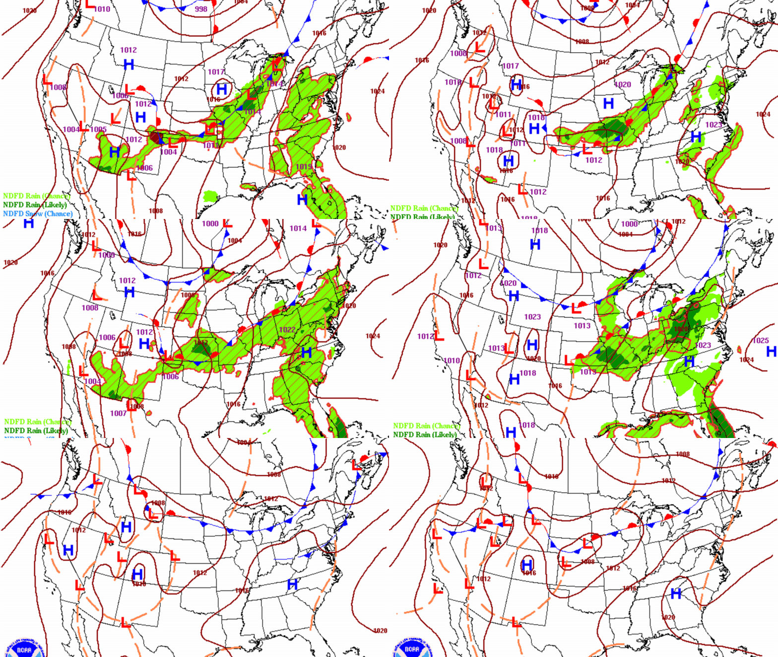
The first will be for northern Minnesota Wednesday night into Thursday, then a statewide chance late Friday and Saturday followed by a slightly better chance of more widespread activity, potentially, early Monday.
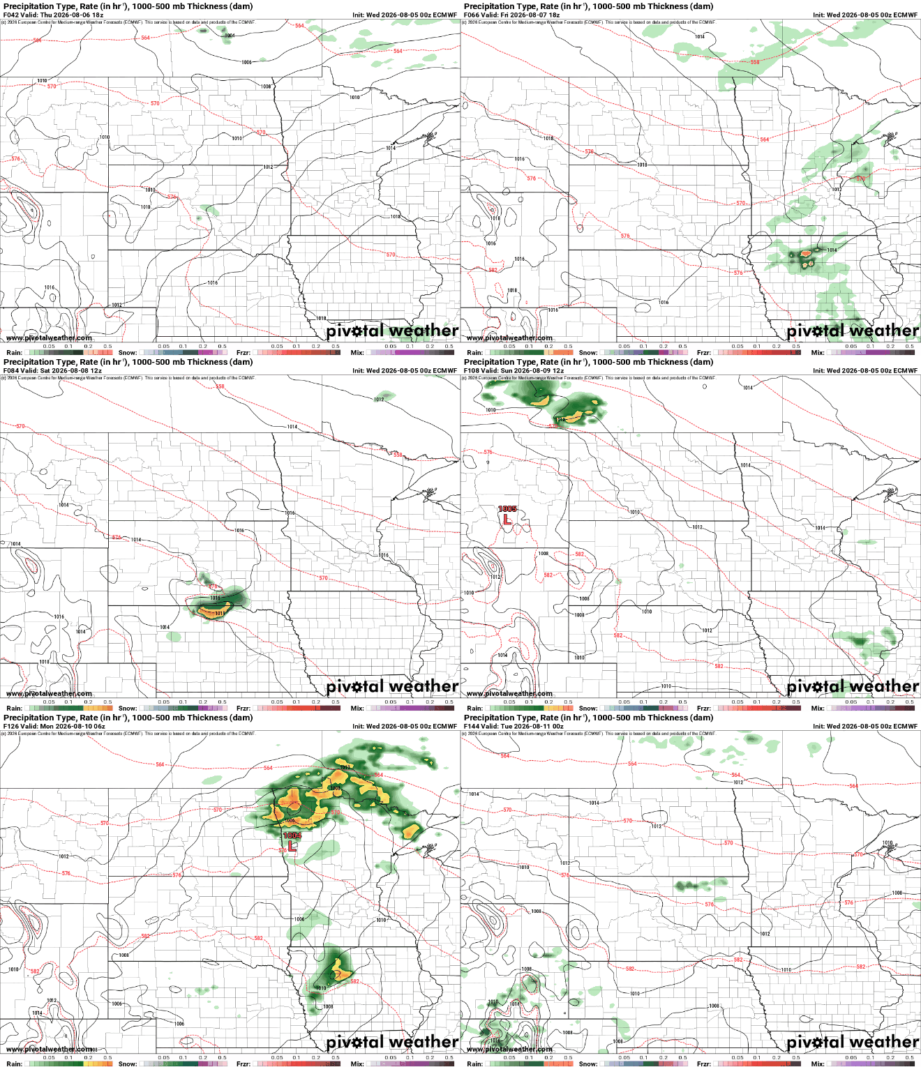
Total rainfall will leave most thirsty as any activity over the next several days will be very hit and miss. Remember: We need 1 inch of rain per week just to keep up with normal so this map means deficits will continue to grow. Most areas of the state that are in drought are behind by 3 to 9 inches, year-to-date.


