
Overnight storm chances with marginal severe weather threat
Temperatures seasonal heading into next week
Go Deeper.
Create an account or log in to save stories.
Like this?
Thanks for liking this story! We have added it to a list of your favorite stories.


Minnesota remains locked into a somewhat active weather pattern, bringing periodic chances for showers and thunderstorms through the upcoming week. While there will be several opportunities for rain, there will also be plenty of dry hours mixed in. Temperatures are expected to stay close to seasonal averages through midweek before trending slightly cooler by next weekend.
Storm chances increase Saturday night into Sunday
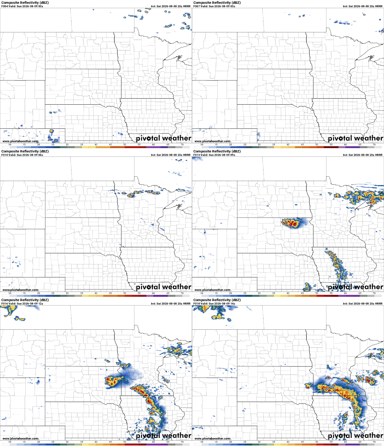
After a pleasant August day, precipitation moves back into the forecast Saturday night. The greatest chance for rain and storms will develop late Saturday night and continue into early Sunday morning. A developing area of low pressure over the Dakotas, combined with increasing dew points and strengthening low-level winds, will provide the ingredients needed for thunderstorms to form across eastern South Dakota and western Minnesota before tracking southeastward.
There remains a marginal risk (level 1 of 5) for mainly southwestern, southeastern and southern Minnesota. The main concerns will be strong winds, hail, lightning and heavy rainfall.

As the Sunday morning storms move east, scattered showers and isolated thunderstorms may linger into Sunday, particularly eastern Minnesota. Even so, much of the day will not be a washout, with dry periods expected between any passing showers.
Looking ahead to next week, Monday appears to be the quietest day of the forecast period. Expect near-normal temperatures, a mix of sun and clouds, and generally pleasant conditions. Another disturbance is expected to arrive Tuesday, bringing the next chance for showers and thunderstorms.
Turn Up Your Support
MPR News helps you turn down the noise and build shared understanding. Turn up your support for this public resource and keep trusted journalism accessible to all.

