
Pleasant weekend start gives way to unsettled weather
Seasonal temperatures with comfortable humidity Saturday

Go Deeper.
Create an account or log in to save stories.
Like this?
Thanks for liking this story! We have added it to a list of your favorite stories.


Plenty of sunshine, low humidity, and temperatures in the lower 80s will make for a nearly perfect August day to spend outside. It’s the kind of forecast that reminds us summer still has plenty left to offer.
Spectacular Saturday ahead
Saturday will bring pleasant summer weather across Minnesota, with plenty of sunshine, comfortable humidity levels, and temperatures climbing into the upper 70s and low 80s. The combination of seasonable warmth and relatively dry air will make for an enjoyable day outdoors before rain and thunderstorm chances return later Saturday night and continue periodically into early next week.

The best opportunities for rain in the forecast will arrive during the overnight and early morning hours, including Saturday night into Sunday morning, Sunday night into Monday morning, and again early Tuesday. Not everyone will see rain, and many hours between these rounds will remain dry.
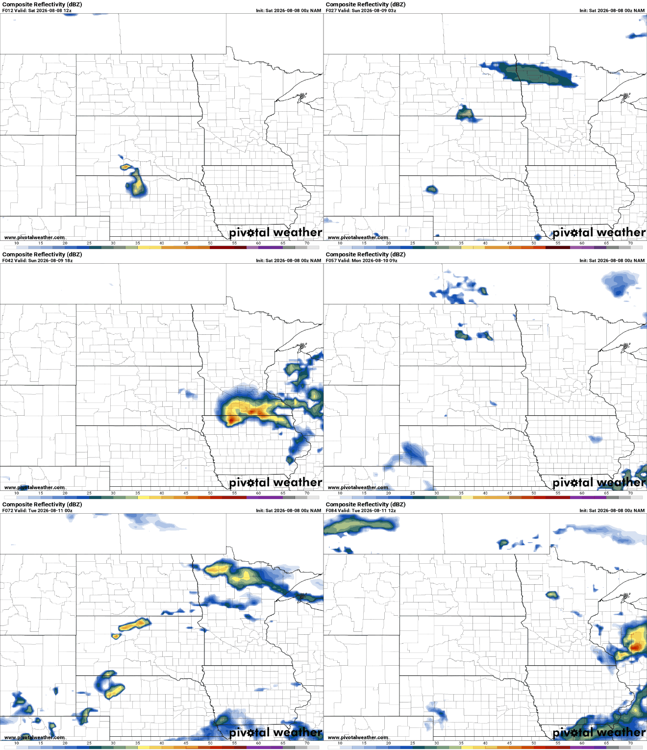
A few storms during these periods could become strong, especially across southwestern and southern Minnesota. The Storm Prediction Center has placed parts of southern and southwestern Minnesota in a marginal risk (level 1 out of 5) for severe weather for Saturday.

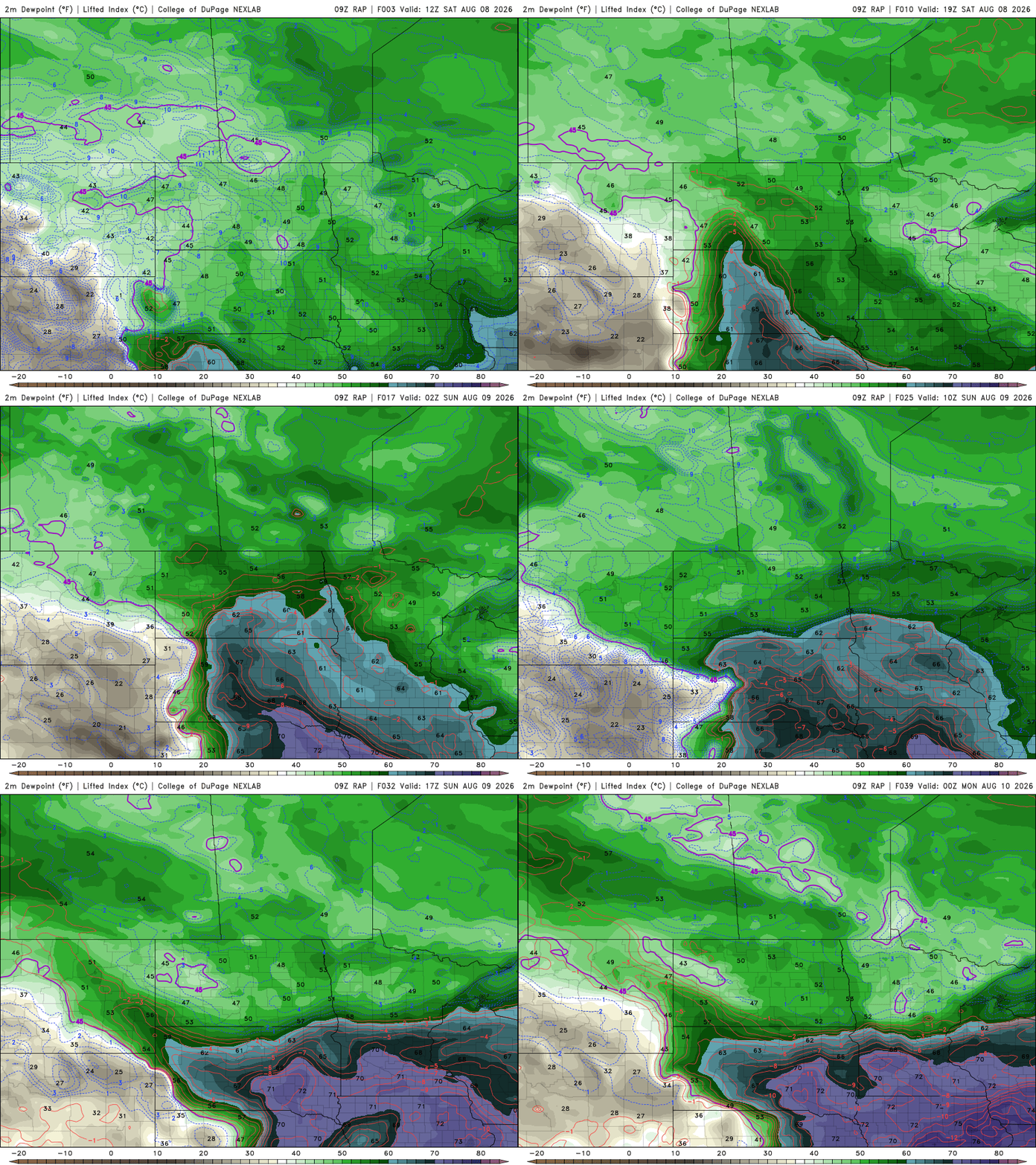
Humidity levels will also make a gradual comeback. Dew points in the comfortable 50s on Saturday will climb into the 60s, and in some areas near 70 degrees, by Sunday.
By Tuesday, the weather pattern begins to settle down as high pressure returns to the Upper Midwest.
Temperatures will stay close to seasonal averages through Wednesday, with highs generally in the upper 70s to low to middle 80s. Then, a cooler push of Canadian air arrives late in the week. Highs will slip back into the 70s beginning Thursday, while overnight lows settle into the 50s. It’s not a dramatic cool-down, but it may be enough to remind Minnesotans that summer’s second half is quietly underway.

Turn Up Your Support
MPR News helps you turn down the noise and build shared understanding. Turn up your support for this public resource and keep trusted journalism accessible to all.

