
Another chance at rain Friday night followed by a subtle cooldown
Most areas will still be left wanting for sufficient moisture

Go Deeper.
Create an account or log in to save stories.
Like this?
Thanks for liking this story! We have added it to a list of your favorite stories.


Our latest disturbance is creating some scattered showers across southern Minnesota Thursday. Friday will be dry for most ahead of the next chance of rain Friday night into Saturday.
Another chance at rain Friday night followed by a subtle cooldown
Scattered showers will wind down across central and southern Minnesota Thursday morning, but there will be some lingering instability. A few isolated showers or thunderstorms are possible Thursday afternoon in central and southern Minnesota.
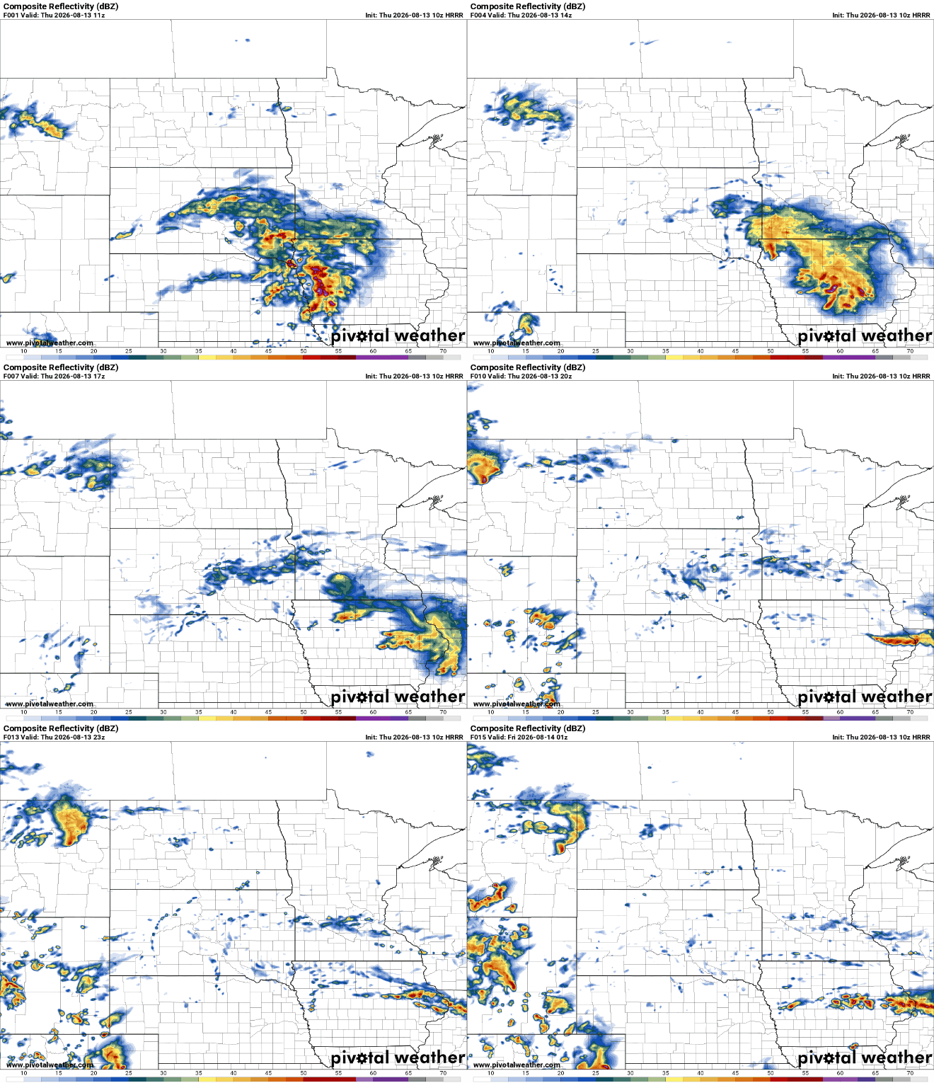
Highs Thursday will be back in the low 80s for east-central Minnesota with 70s in southern Minnesota due to lingering clouds. Highs will be in the 70s in northern Minnesota where cooler, drier air remains. We should see some afternoon sun.

Friday will be pleasant for much of the day across central and northern Minnesota with highs back in the 70s to low 80s. Clouds will increase in southern Minnesota in the afternoon.
Turn Up Your Support
MPR News helps you turn down the noise and build shared understanding. Turn up your support for this public resource and keep trusted journalism accessible to all.

The cloud cover is moving in ahead of the next upper-level disturbance which will attempt to create scattered showers across much of Minnesota late Friday into Friday night and Saturday. Unfortunately, it doesn’t look like most will get an adequate soaking.
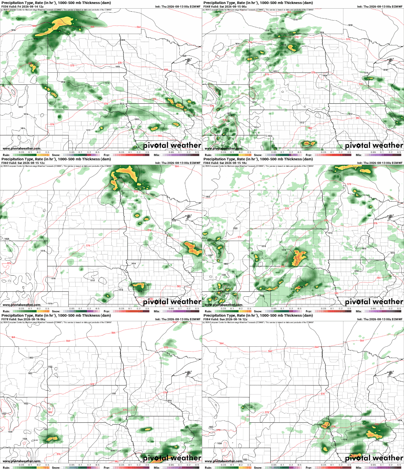
A few lucky spots in southeastern Minnesota may see up to 1 inch or more of rain, but in between we’ll see significantly less. Most areas will see one-quarter inch or less of rainfall.
Behind it, Sunday and Monday bring back sunshine and ever so slightly cooler temperatures and a dip in dew points again to more comfortable levels.

A space view of the total solar eclipse
If you were in Minnesota Wednesday, you didn’t get a good view of the total solar eclipse that went from Greenland through Spain. (Grand Portage, at the tip of Minnesota’s Arrowhead, did see 6 percent of the sun obscured by the moon early Wednesday afternoon.)
But we can view it from space!
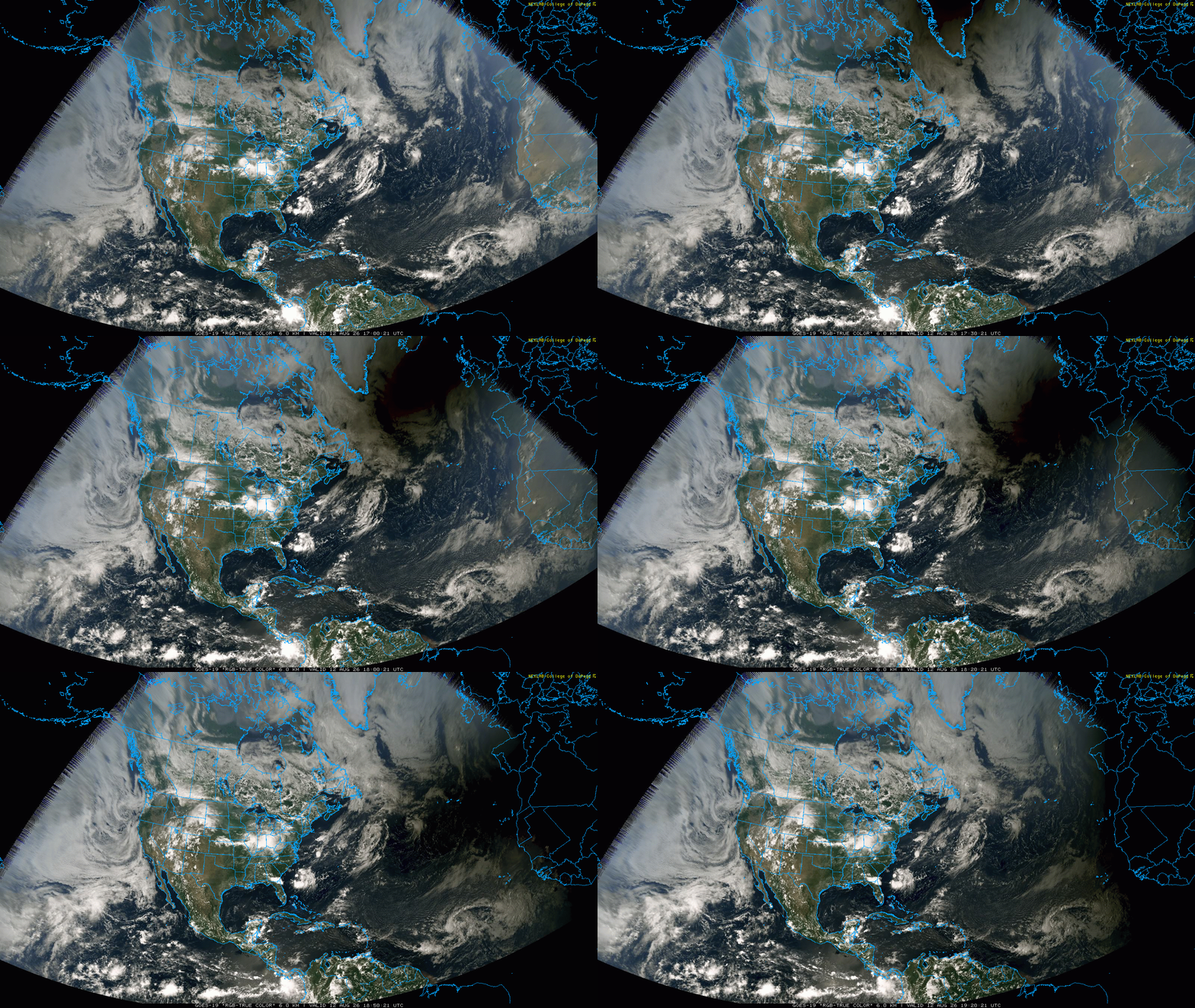
The image above is a visible satellite loop from about noon to 2:20 p.m. Wednesday local time as the moon blocked the sun, fully from Greenland, across the northeast Atlantic and across Spain, creating a big, moving shadow
The next total solar eclipse on earth is Aug. 2, 2027, when totality will sweep across North Africa through Egypt and the Middle East.

