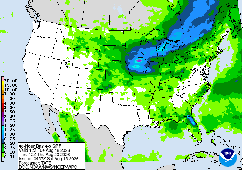
Showers and storms Saturday, comfortable weather Sunday

Go Deeper.
Create an account or log in to save stories.
Like this?
Thanks for liking this story! We have added it to a list of your favorite stories.


Showers and thunderstorms make an appearance Saturday before quieter and more comfortable weather settles in for Sunday and Monday.
Showers and storms Saturday, more sunshine Sunday
Showers and thunderstorms will take center stage Saturday, with sticky dew points in tow.
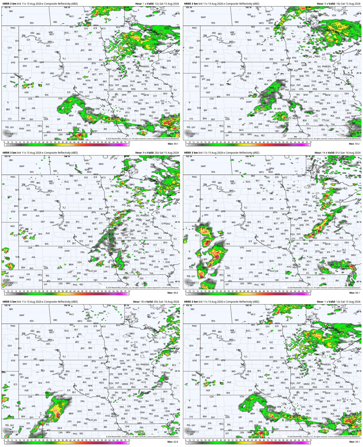
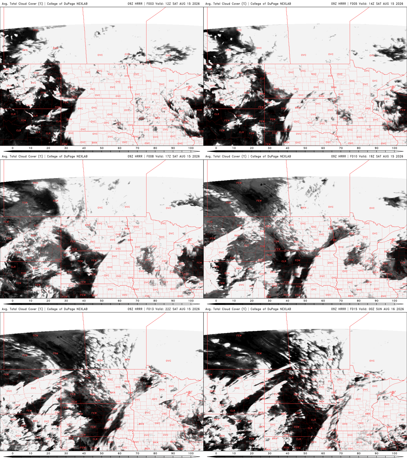
Clouds will be tough to shake, with low stratus likely lingering through much of the day. As our next disturbance approaches from the west and a cold front moves through Saturday night, scattered to potentially numerous showers and thunderstorms are expected, with additional activity possible Saturday afternoon and evening.
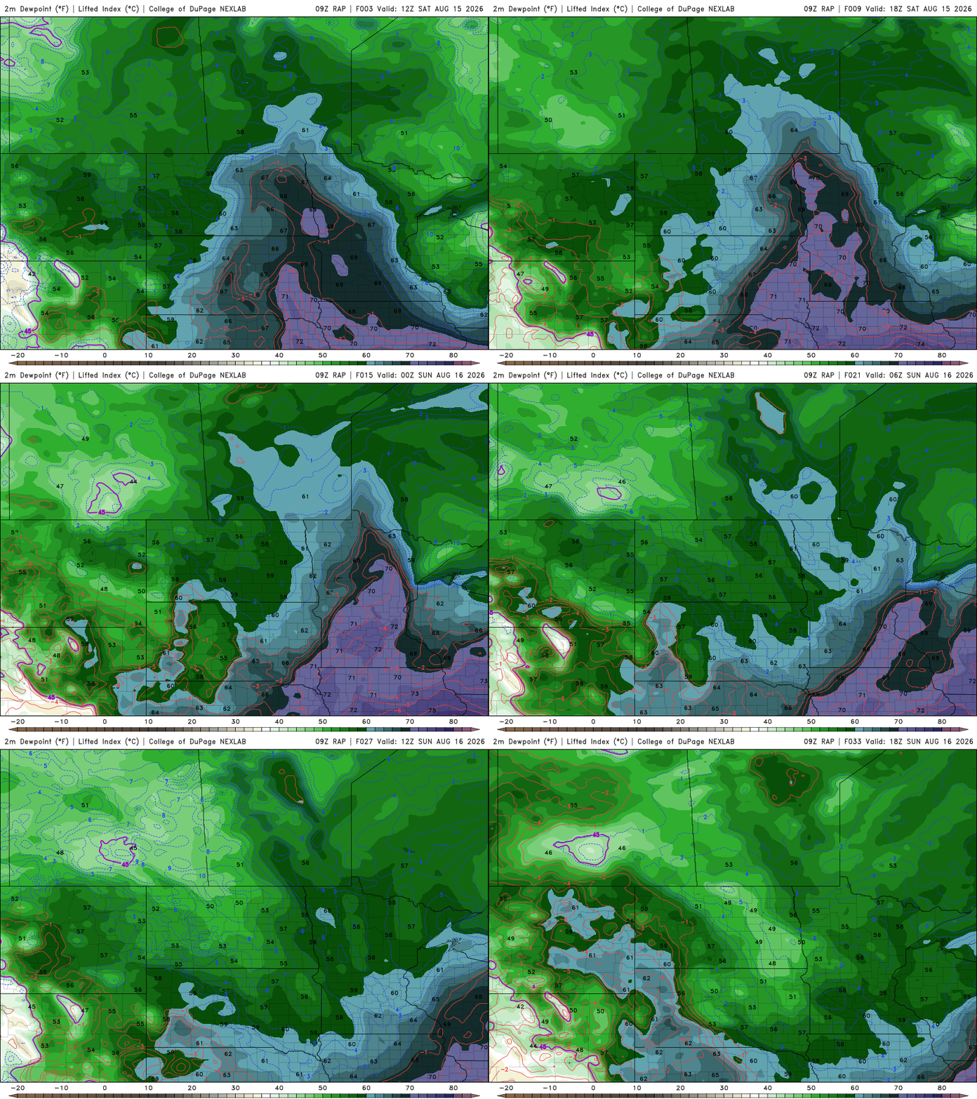
Dew points in the 60s and 70s will be replaced behind the front, with readings dropping into the 50s and low 60s by Sunday.
Turn Up Your Support
MPR News helps you turn down the noise and build shared understanding. Turn up your support for this public resource and keep trusted journalism accessible to all.
With how dry the landscape is across much of Minnesota, any rain will be welcome. Some areas of northern Minnesota could pick up a healthy half inch to an inch of rain Saturday.

Once the front moves through Saturday evening, much drier air will arrive from the northwest. Sunday should bring a noticeable improvement, with decreasing clouds, comfortable humidity and seasonal temperatures in the upper 70s to around 80 degrees.

Monday looks pleasant as well, but another weather system will arrive Tuesday, bringing another opportunity for showers and thunderstorms.
One thing worth watching is the potential for several inches of rain in some areas Tuesday and Tuesday night. While that could certainly be beneficial, the latest weather models suggests the heaviest rainfall may once again favor areas that don't need it as badly, while north-central and northern Minnesota could miss out on the bulk of the rain.