
Spotty thunder chances ahead of a cool front late Monday into Tuesday
Another chance of thunder Friday
Go Deeper.
Create an account or log in to save stories.
Like this?
Thanks for liking this story! We have added it to a list of your favorite stories.


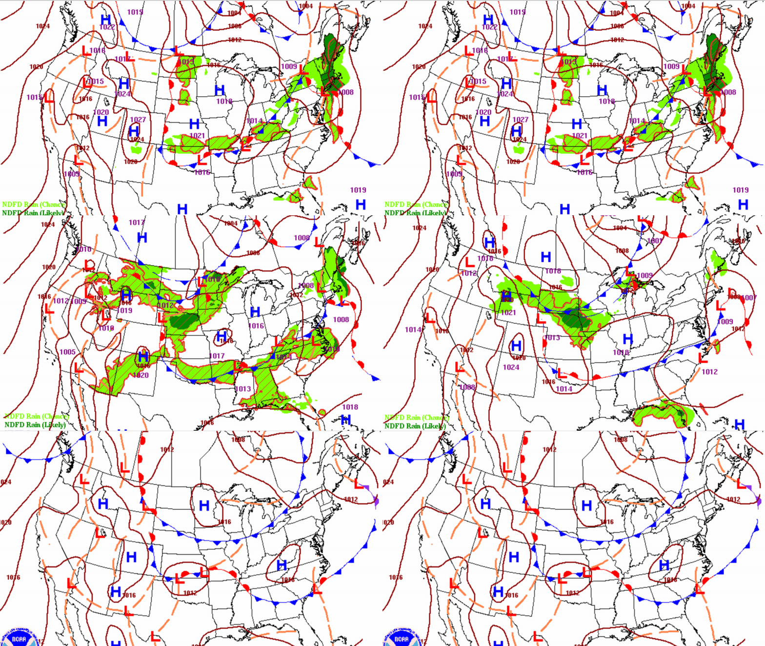
A cool front will touch off some spotty storms for northern Minnesota Monday afternoon and statewide Monday night. High pressure builds in for Wednesday and Thursday.
Spotty thunder chances ahead of a cool front late Monday into Tuesday
Southern Minnesota will have a pleasant day with sunshine and highs in the low 80s. Dew points should be mainly in the 50s still though they’ll increase late in the day into tonight, south, Northern Minnesota will see increased cloud cover and highs in the mid 70s.

As expected, most of us were left wanting for rainfall over the weekend. A lucky swath of east central and north central Minnesota did see 1 inch or more but most of us saw much less. In fact, the Minneapolis-St. Paul International Airport received just 0.02 inches. Cambridge however saw 1.78 inches.

We’ll start to see some showers and thunderstorms pop-up in northwest Minnesota and the eastern Dakotas midday ahead of an advancing cool front. Spotty storms will then spread across northern and far western Minnesota by late Monday afternoon and evening. What’s left will trickle south and southeast overnight Monday night. We’ll have some lingering instability touching off a few storms yet in southern Minnesota Tuesday as the front continues to slowly advance south.
Turn Up Your Support
MPR News helps you turn down the noise and build shared understanding. Turn up your support for this public resource and keep trusted journalism accessible to all.
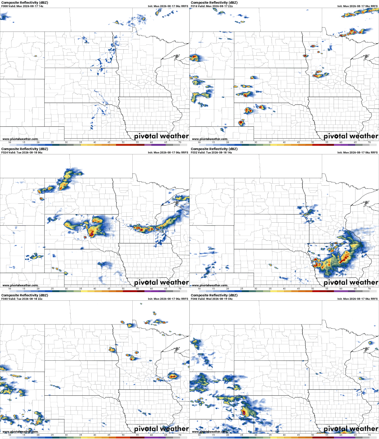
There is a marginal severe risk (level 1 of 5) for much of central and southern Minnesota with a slight risk (level 2 of 5) for southwest Minnesota Monday into early Tuesday. The main threats would be isolated large hail and a damaging wind gust or two in western Minnesota.

Don’t look for a lot of rainfall however for most. A few lucky, highly localized spots will get some good downpours but most will see under a quarter to half inch of rain.
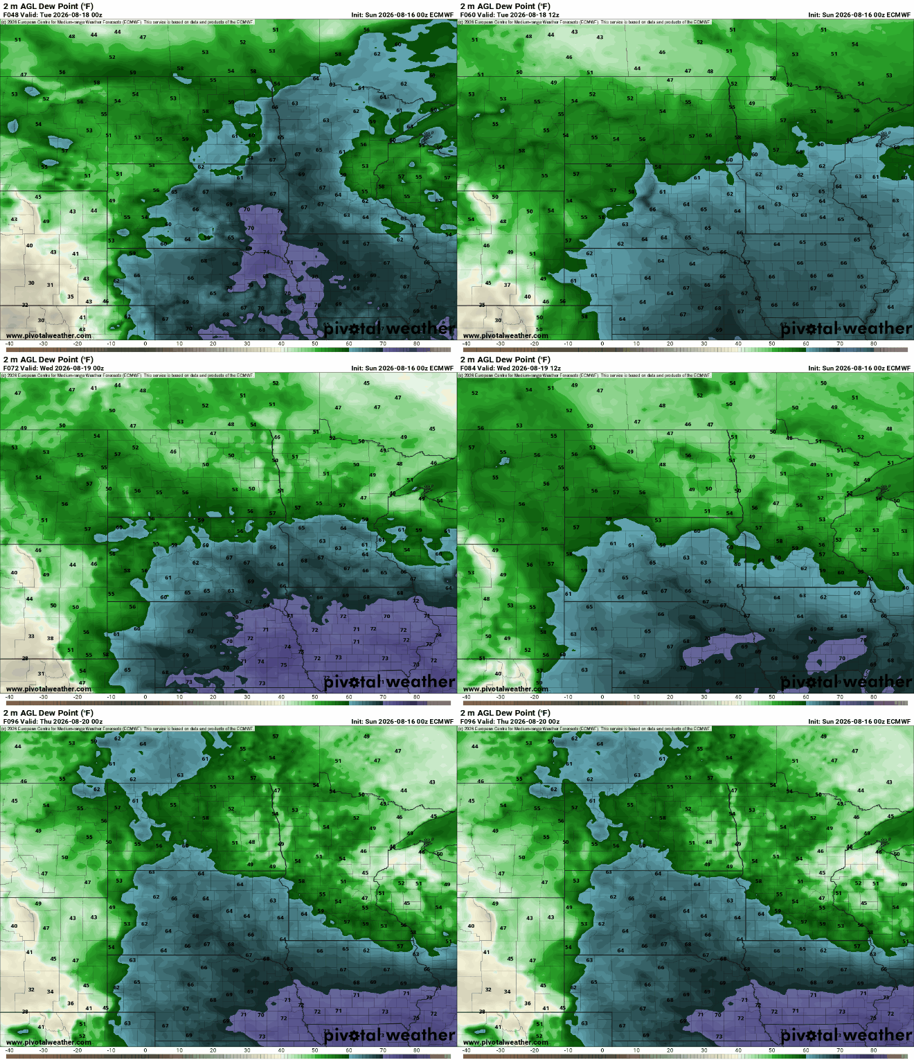
Behind the front, dew points will start to drop Tuesday into Wednesday as high pressure builds in. Dew points will drop from the 60s into the 50s with even some 40s in northern Minnesota.
We’ll have a pleasant midweek with sunshine and slightly cooler highs for Wednesday. Most of the state will see highs in the 70s Wednesday before 80s return Thursday.

Another cool front will slide through Thursday night into Friday touching off just another spotty chance of showers and thunderstorms. There will be another slight dip in temps and dew points for the upcoming weekend again.
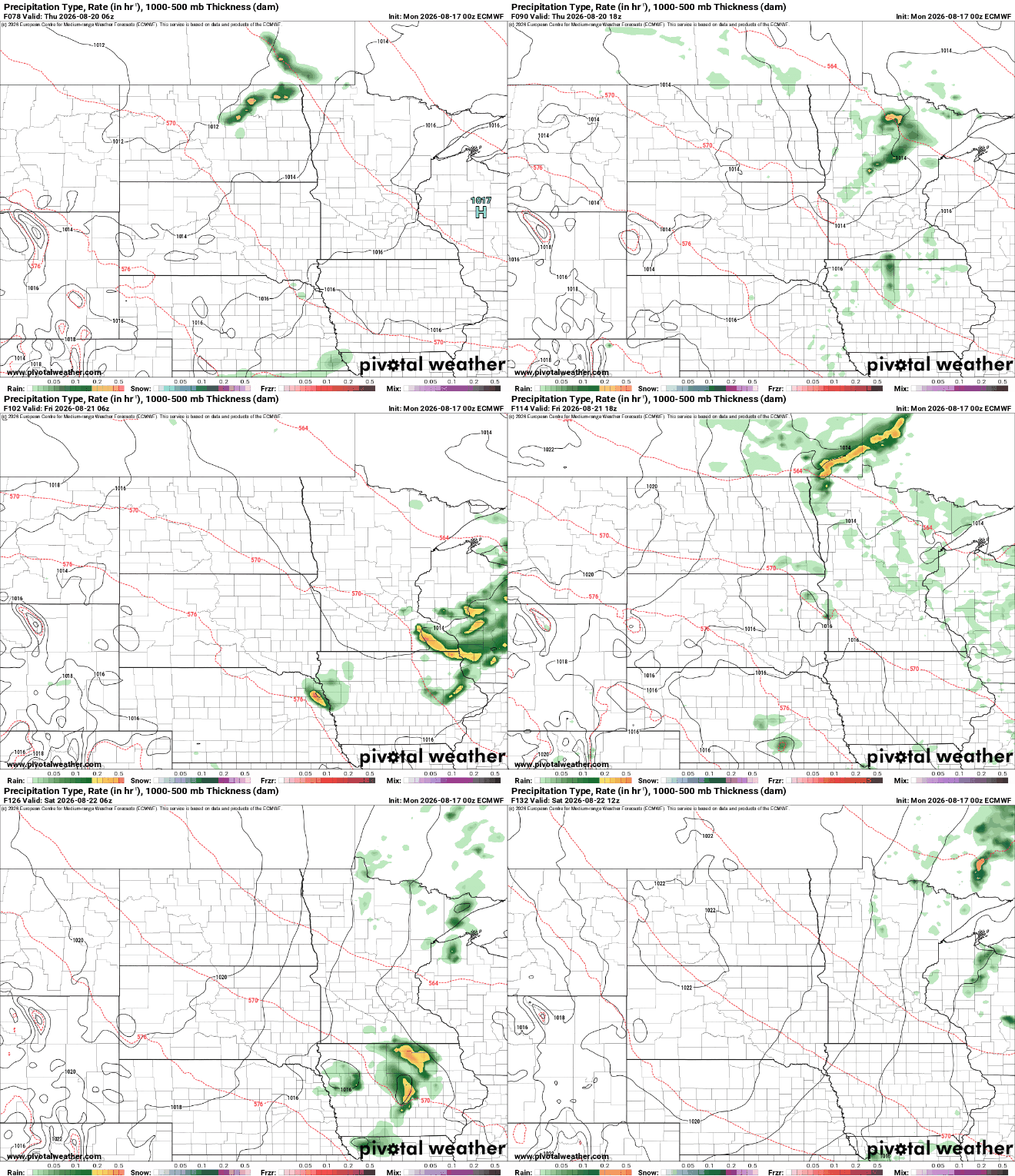
Total rainfall between our two chances this week will not be sufficient for most. As is usually the case, if you get one of those good thunderstorms you can see some highly localized, higher amounts but most of us will see under a half inch of total weekly rainfall.


