
Rain on Thursday, still toasty for Fair

Go Deeper.
Create an account or log in to save stories.
Like this?
Thanks for liking this story! We have added it to a list of your favorite stories.


Thursday severe weather risk
Thursday will bring an uptick in thunderstorm activity across Minnesota as another disturbance moves southeast out of the Canadian Prairies and across the Upper Midwest.
Additional moisture will progress northward into Minnesota and set the stage for scattered showers and storms later in the day. The first round of showers will develop across northern and central Minnesota during the morning and midday hours. The more interesting part of the forecast comes Thursday afternoon and evening as a cold front pushes southeast across the state. Scattered thunderstorms will develop along and ahead of this boundary.
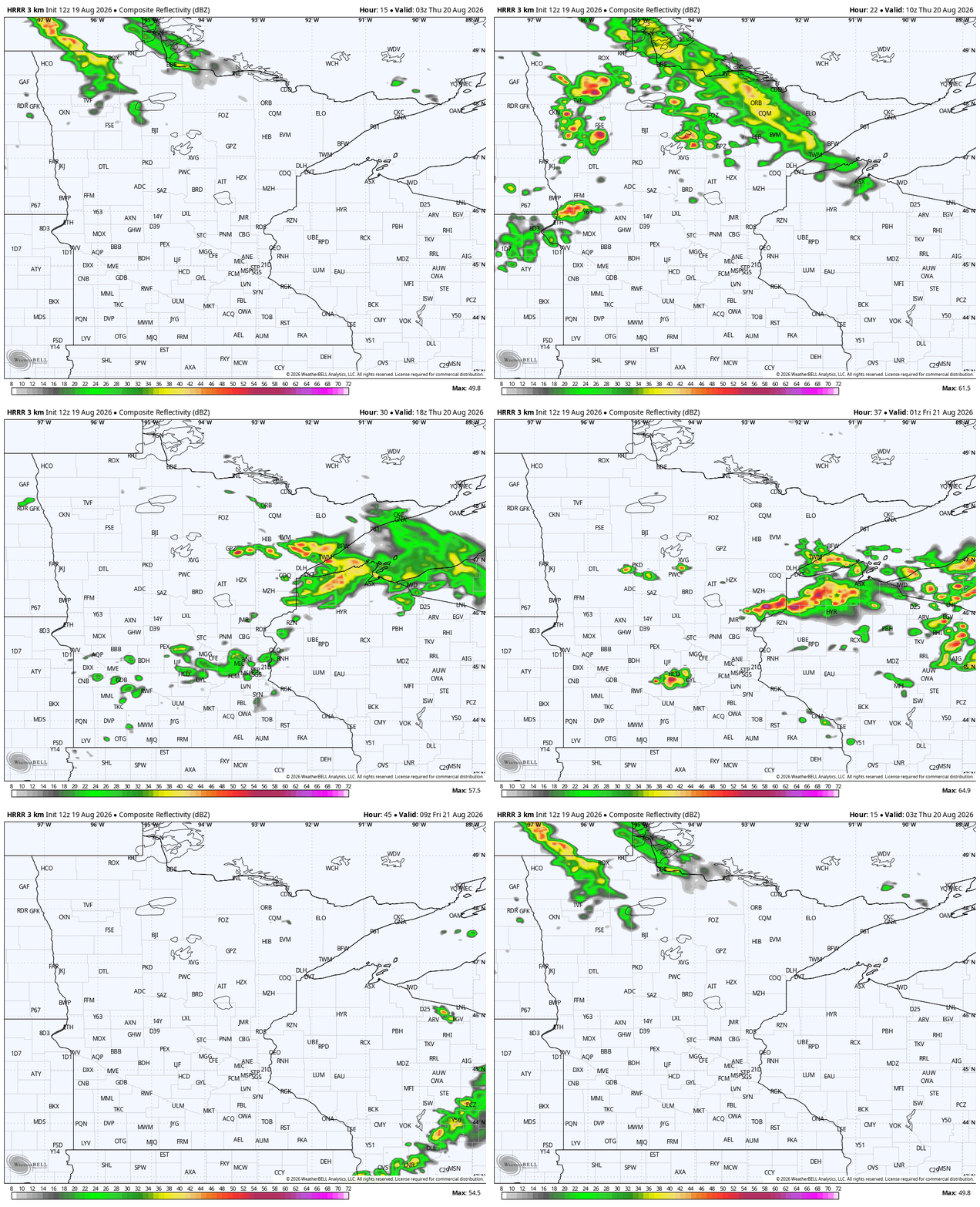
The primary concerns will be damaging wind gusts and large hail within the strongest storms. A brief tornado cannot be completely ruled out, but it does not appear to be the primary concern at this time. The Storm Prediction Center has placed areas from the southwest corner of the state through the Twin Cities within a slight risk (2 out of 5) for severe weather on Thursday. Overall, Thursday looks like a scattered storm day with a low-end severe weather threat.

Heat sticking around
Sven Sundgaard sent Mandy and I a message Wednesday morning with some juicy weather stats. If you’ve ever been curious, yes, this is what meteorologists actually do! After riding the highs into the 90s, we have not been there all August, at least as of this writing on the 19th. This is the time of the year that we start seeing steady but fairly fast changes in our typical weather. Of course, the average weather is not necessarily what we’ll end up seeing week to week. For now, were losing one degree off of the average high in the Twin Cities every four or five days!

That adds up real fast. By early September, that skyrockets to a degree every three days! The other day, we wrote about how tightly bunched the normal last 90°, 80°, 70°, and 60° days are together on the calendar. This is not just some geeky weather stuff (which we also love!). This is the weather playing out fast, in our real lives!
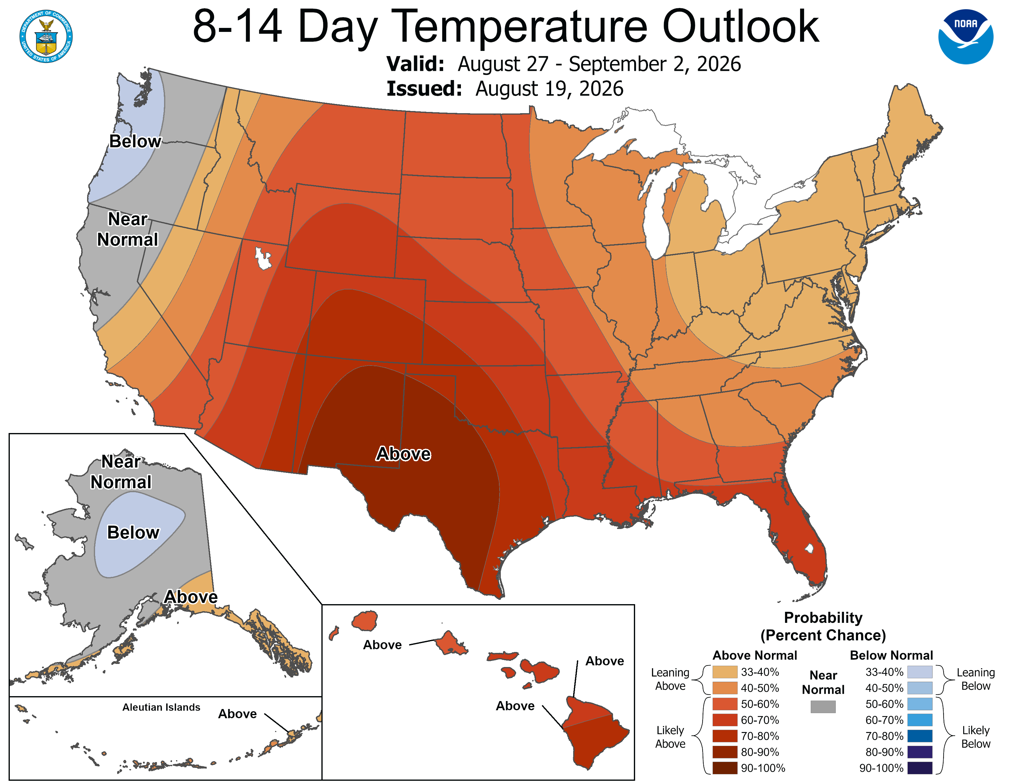
Despite all of that, we’ll be mostly above average, and on most days, for the foreseeable future. The 8-14 day temperature outlook is warm, as are the daily values. Lower 80s may not jump off the page, but they are a little warmer than you’d expect this time of the year.
Turn Up Your Support
MPR News helps you turn down the noise and build shared understanding. Turn up your support for this public resource and keep trusted journalism accessible to all.

