
Warmer, more muggy air and storm chances return Thursday
A beautiful weekend is shaping up
Go Deeper.
Create an account or log in to save stories.
Like this?
Thanks for liking this story! We have added it to a list of your favorite stories.


Warmer and more muggy air is already returning Thursday on the back side of Wednesday’s high ahead of the next front. That also means the chance of storms returns Thursday.
Warmer, more muggy air and storm chances return Thursday
High pressure continues to drift off to the southeast of Minnesota. This allows for return flow from the south. That means warmer temperatures Thursday with highs returning to the low to mid-80s for much of central and southern Minnesota Thursday afternoon.

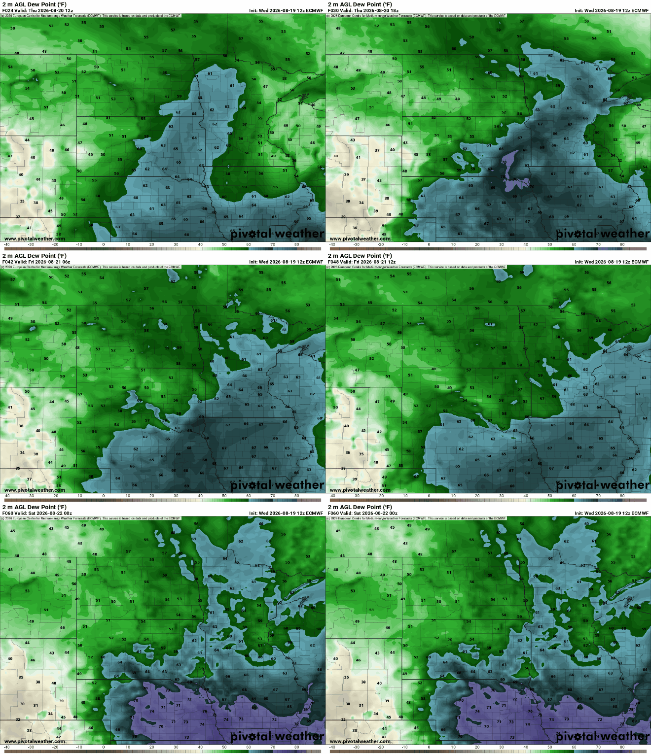
It also means dew points will be increasing Thursday. By Thursday evening, it will be quite muggy across central and southern Minnesota into western Wisconsin. Look for dew points to return to the 60s with some 70-degree dew points possible in far southern Minnesota at least.
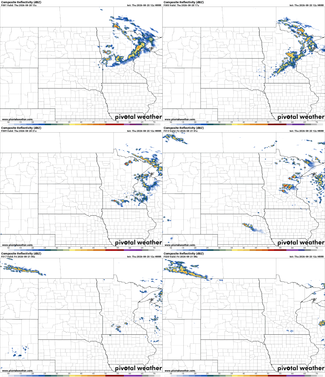
The increase in heat and moisture is already producing a broken area of showers across central and northern Minnesota Thursday morning ahead of the next cool front. We can expect some midday showers in central and southern Minnesota potentially, depending on how much can hold together. Redevelopment of storms late in the afternoon and evening Thursday is likely in central, southern Minnesota and western Wisconsin.
Turn Up Your Support
MPR News helps you turn down the noise and build shared understanding. Turn up your support for this public resource and keep trusted journalism accessible to all.
Some storms that redevelop late Thursday afternoon and evening in central and southern Minnesota and western Wisconsin could turn strong or severe. There’s a slight (level 2 of 5) severe risk for much of central, southern Minnesota into western Wisconsin.

Friday will still be warm. Highs will be back in the low 80s south with 70s north. These readings are a couple of degrees above normal yet.

We may see a couple of pop-up thunderstorms, especially north Friday afternoon and evening due to some lingering instability as dew points slowly drop through the day.
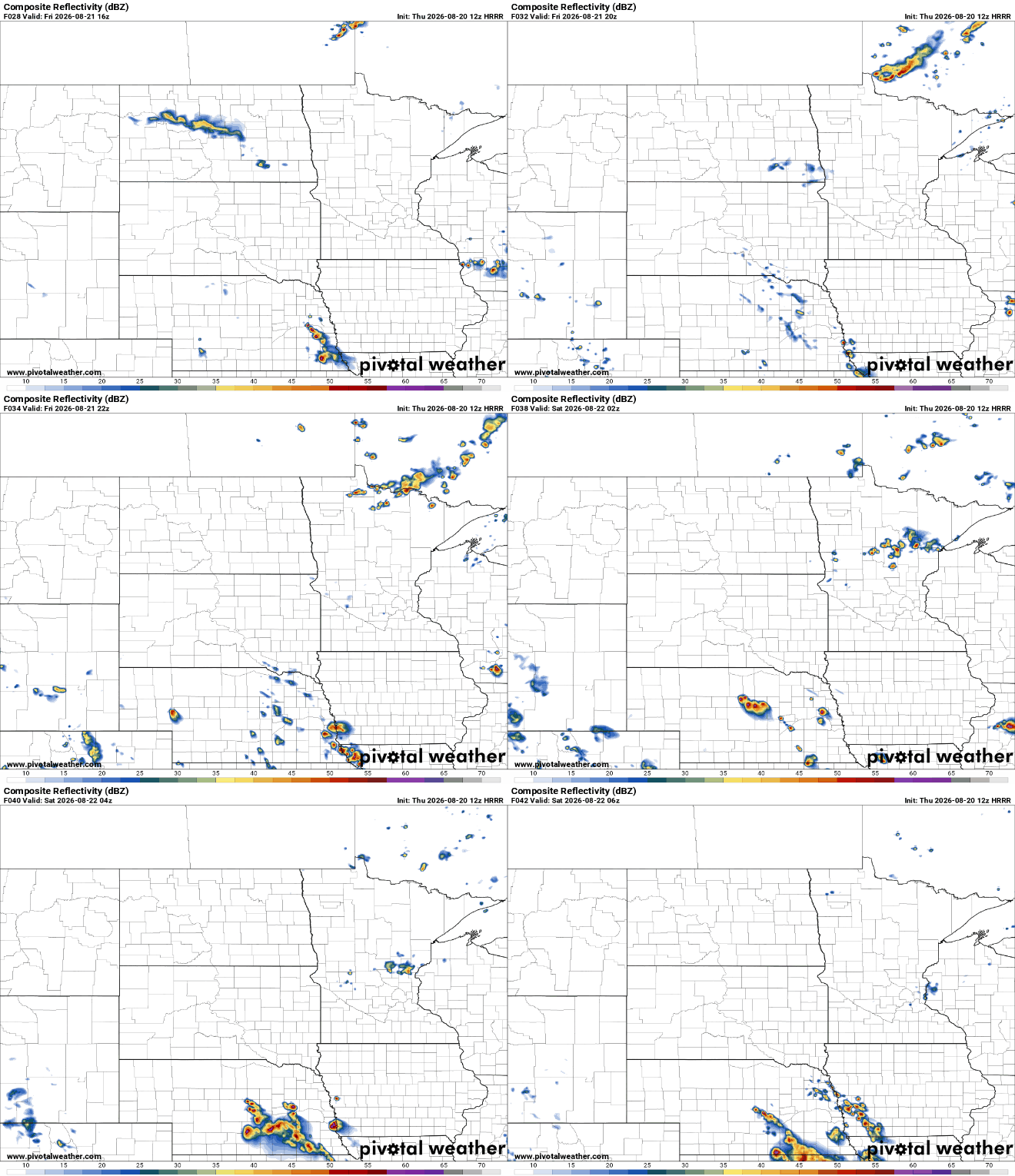
The weekend will be beautiful with comfortable dew points in the 50s and highs mostly in the 70s to near 80 degrees.

We may have a spotty storm chance early next week ahead of an increase in temperatures again. Overall temperatures look to be at or above normal into next week for the start of the Minnesota State Fair already next Thursday.


