
Storm chances early in the week, comfortable start to the fair
Strong to severe storms possible Monday and Tuesday
Go Deeper.
Create an account or log in to save stories.
Like this?
Thanks for liking this story! We have added it to a list of your favorite stories.


Minnesota is in for a more active stretch of weather over the next couple of days, with thunderstorms possible Monday night into Tuesday morning and again Tuesday afternoon and evening. A calm stretch expected for the start of the Minnesota State Fair.
Active start to the work week
Our weather pattern becomes more active to start the work week, bringing several opportunities for much-needed rain along with a renewed threat for thunderstorms. While a few storms could become strong or severe, temperatures will remain fairly seasonal through the week, with highs ranging from the 70s up north to the 80s across southern Minnesota.
High temperatures Monday will climb into the 70s across northern Minnesota, with warmer 80s expected farther south.

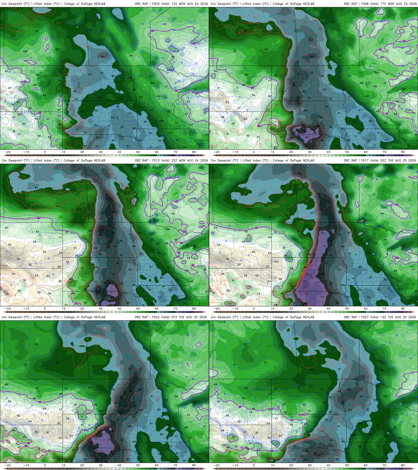
Meanwhile, dew points will rise into the 60s, bringing a noticeable increase in humidity and providing additional fuel for showers and thunderstorms beginning Monday night.
Turn Up Your Support
MPR News helps you turn down the noise and build shared understanding. Turn up your support for this public resource and keep trusted journalism accessible to all.
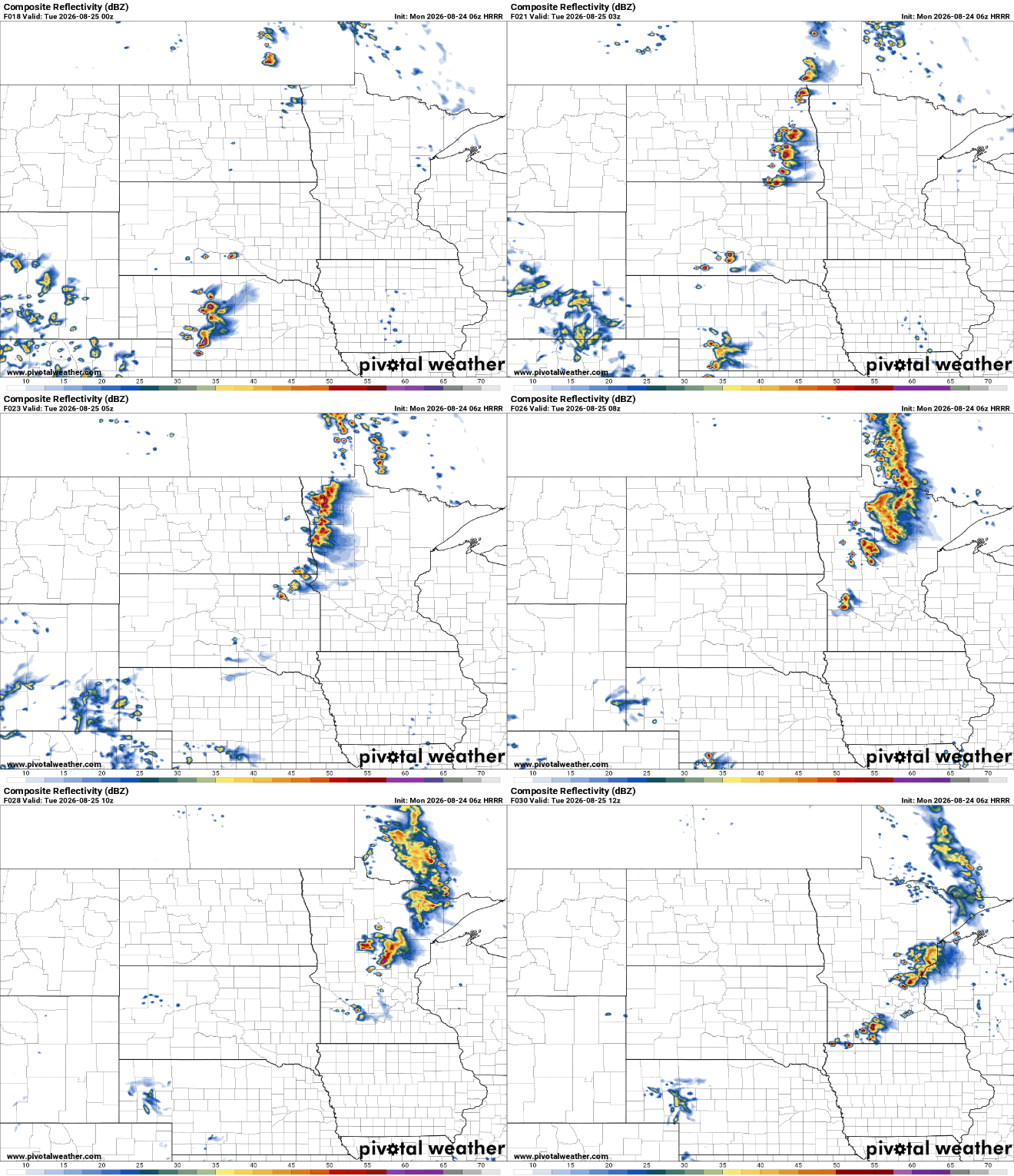
A cluster of storms is expected to develop across eastern North Dakota Monday night before moving east into Minnesota after midnight. Some of these storms could initially produce large hail and damaging winds, but they are expected to gradually weaken as they move into Minnesota.
The greatest opportunity for overnight rainfall will be across west-central Minnesota, where showers and thunderstorms could continue into Tuesday morning. Some light rain may linger across portions of southern Minnesota through the middle or late morning.
The Storm Prediction Center has placed the Red River Valley in a level 2 out of 5 slight risk for severe weather, with a level 1 out of 5 marginal risk extending into areas near Lake of the Woods, Bemidji, Alexandria and Morris.

Tuesday afternoon and evening could bring another round of thunderstorms, especially across eastern Minnesota and western Wisconsin. A few strong to severe thunderstorms are possible Tuesday afternoon and evening, with damaging winds and large hail the primary concerns. A slight risk remains across a majority of the state.

Cooler, drier air will settle in behind Tuesday’s front, setting the stage for a comfortable start to the Minnesota State Fair. Dew points will drop into the 50s, with temperatures hovering in the low 80s.

After a quieter stretch Thursday and Friday, the weather pattern looks to become more active heading into next weekend. Several disturbances are expected to move through the northern Plains and Upper Midwest, bringing increasing chances for much-needed showers and thunderstorms from Friday night through Sunday.

