
Minnesota Weather: Rain in Arrowhead; pleasant State Fair start

Go Deeper.
Create an account or log in to save stories.
Like this?
Thanks for liking this story! We have added it to a list of your favorite stories.


Expect some storms Tuesday in northeastern Minnesota through late afternoon and evening.
The weather looks great to start the Minnesota State Fair Thursday and Friday, with highs in the lower to mid-80s.
Humid Tuesday afternoon with some rain chances
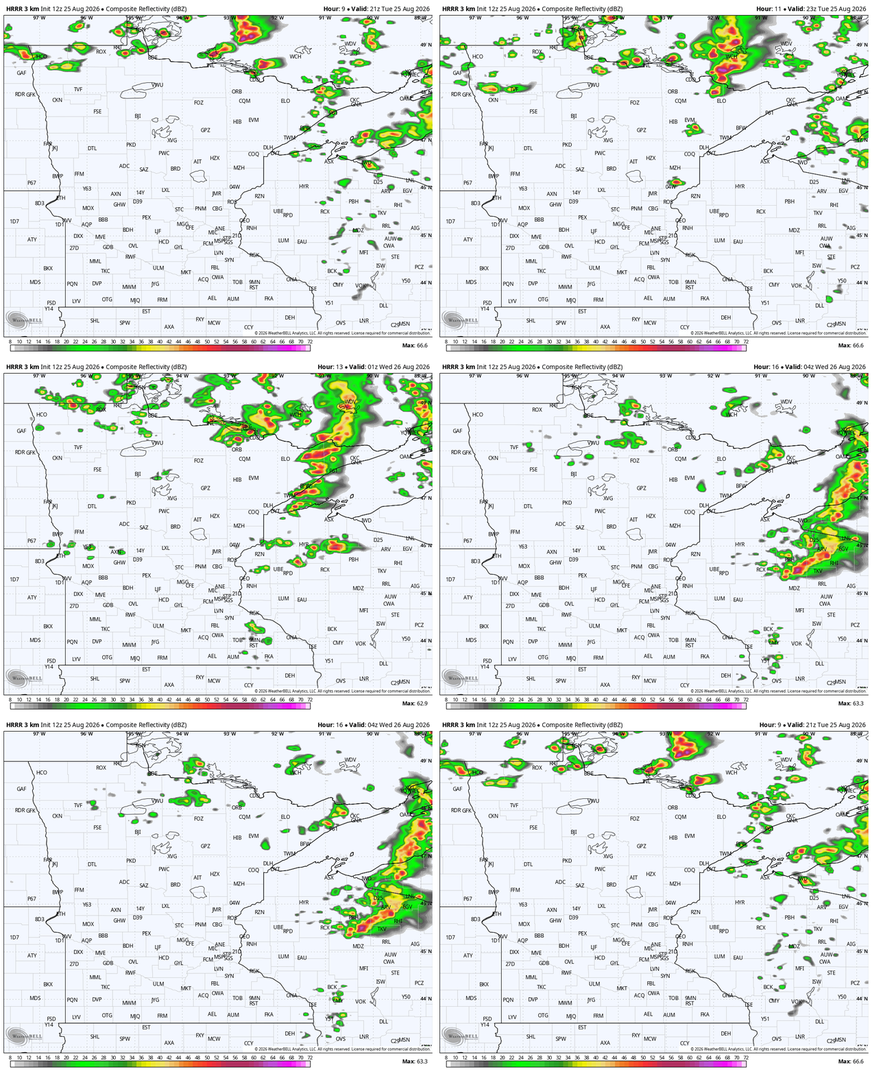
Despite the cloud cover, rain was tough to come by Tuesday for many Minnesotans.
Northeastern Minnesota will see some storms into the late afternoon and evening. Some could be on the severe side right before they cross into Lake Superior or Wisconsin. Most of the storm threat is between 4 p.m and 8 p.m.
Turn Up Your Support
MPR News helps you turn down the noise and build shared understanding. Turn up your support for this public resource and keep trusted journalism accessible to all.
Even with all the clouds across the state, the winds coming out of the south are making it pretty warm and definitely a little more humid. Dew points are in the low to mid-60s. The south wind pushes all the way to the Canadian border.
Tuesday night will be on the warmer side, except for the Coteau des Prairies plateau in southwestern Minnesota.

Wednesday is a pretty tricky forecast. We will have clouds throughout eastern Minnesota, given the colder air up high from the upper-low. From experience, we’d expect a few colder rain showers to jostle between clouds and sunshine. That will often suppress the high temperature.
The weather maps, though, have backed off of that for Wednesday, showing us highs in the lower 80s around the Twin Cities, but I’m not totally convinced we will be that warm.


Weather looks good for State Fair’s start
You couldn’t really ask for a better forecast Thursday and Friday — the first two days of the Great Minnesota Get-Together.
There will be lots of sunshine and fairly mild temperatures Thursday. Friday will be a little cooler in the morning. Both days are worry-free on the weather, with highs in the lower to middle 80s. You will definitely want some serious SPF sun protection!
While Thursday and Friday look really pleasant all across the state, the weekend will bring some rain chances. Those start late Friday night near Sioux Falls, S.D. This could lead to a rainy morning on Saturday, although the weather data is looking drier for the back half of Saturday.
Rain returns overnight Saturday into Sunday. This looks heavier, which we’re hoping helps with the drought. From there, we have off-and-on smaller rain threats into next week.
Midday data from the European Centre for Medium-Range Weather Forecasts and from the National Oceanic and Atmospheric Administration’s Global Forecast System show a powerhouse storm next week on Friday evening into the following Saturday morning, even though they don’t agree on the storms’ exact direction.

