
A gorgeous Friday before a more muggy, unsettled weekend
At least spotty storms are possible this weekend
Go Deeper.
Create an account or log in to save stories.
Like this?
Thanks for liking this story! We have added it to a list of your favorite stories.


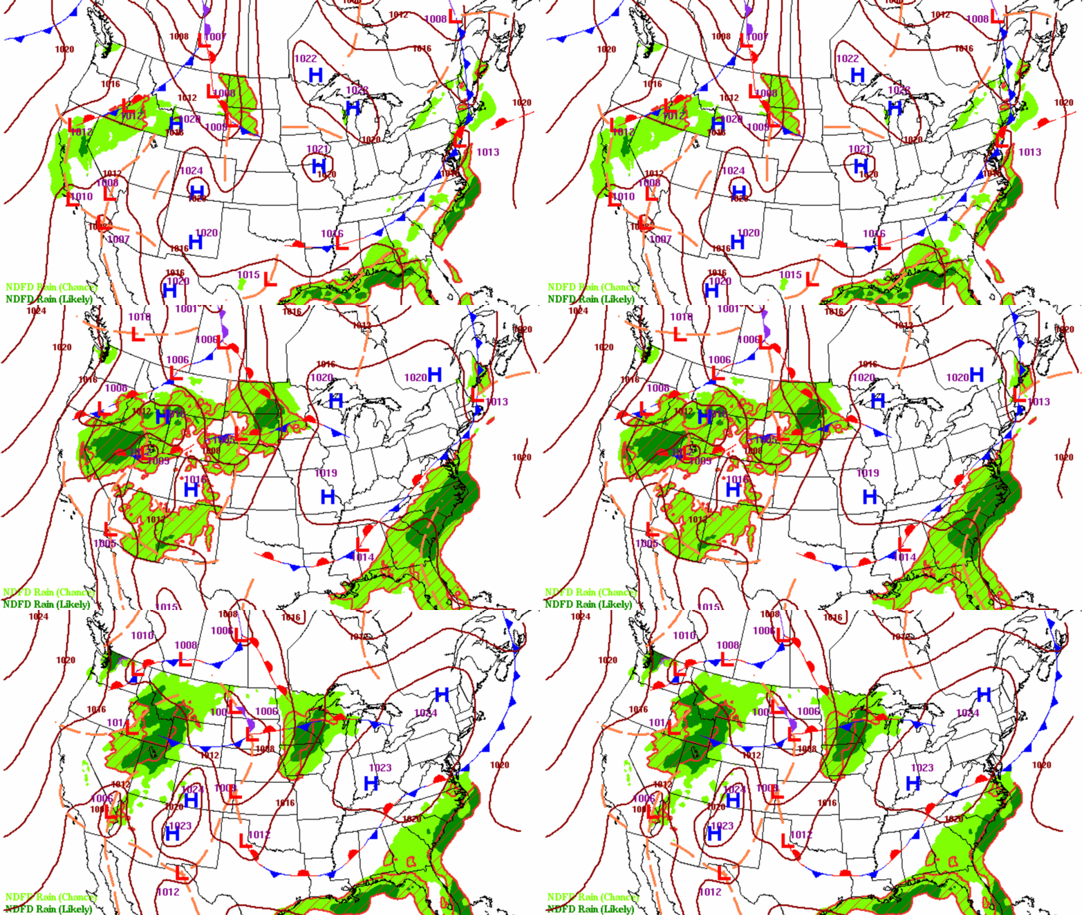
Friday will be beautiful again as high pressure starts to depart. The first of a few chances of spotty storms develops late Friday night into Saturday. Muggy air also returns this weekend.
A gorgeous Friday before a more muggy, unsettled weekend
High pressure is still in control of Minnesota’s weather for most of Friday. We’ll see plenty of sunshine and temperatures that will be a few degrees warmer.
Most of central and southern Minnesota will see highs in the low to mid-80s and dew points will still be comfy, primarily in the 50s. The only hint of changes ahead will be an afternoon increase in some high clouds.

Warmer and more humid air starts to move in Friday night into the weekend. We’ll see dew points increase from the comfortable 50s into the 60s and even low 70s at times late Saturday into Sunday.
Turn Up Your Support
MPR News helps you turn down the noise and build shared understanding. Turn up your support for this public resource and keep trusted journalism accessible to all.
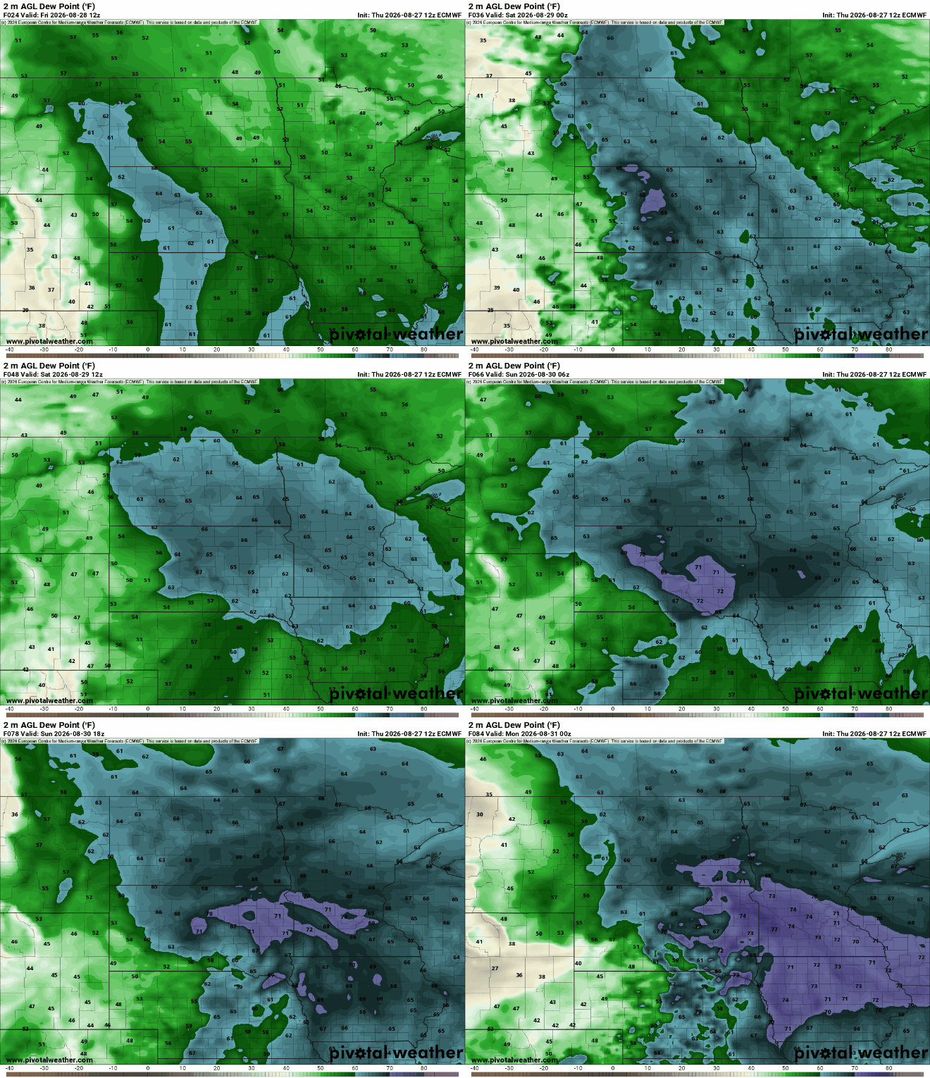
That increase in heat and moisture combined with a series of upper level disturbances moving through aloft will touch off the chances of some spotty showers and thunderstorms this weekend into midweek. No day will be a washout but the pattern becomes less settled.
The first and best chance comes late Friday night into Saturday morning. Most of central and southern Minnesota should see morning rain Saturday before drying out in the afternoon with decreasing clouds.
Activity will be more isolated on Sunday and Monday with better chances north.
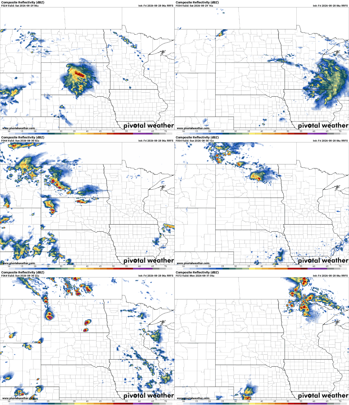
If you’re looking for a lot of rainfall, you’ll likely be disappointed.

Highs Saturday and Sunday will be pretty warm, well into the 80s. Saturday may see lingering cloud debris but Sunday looks potentially brighter and hotter.

Temperatures about 5 to 10 degrees above normal persist into next week. We’ll see highs well into the 80s next week, while normal highs now are in the 70s pretty much statewide.

The pattern remains potentially unsettled through the middle of the week. The next best chance of rain is likely Tuesday.

