
Heat dome spins in shower chances across southern Minnesota
Several rounds of rain at night ahead

Go Deeper.
Create an account or log in to save stories.
Like this?
Thanks for liking this story! We have added it to a list of your favorite stories.


It’s likely going to rain Saturday morning. We have a few more rounds of early rain Sunday, Monday and Tuesday. But there is no jumbo soaking rain out there hiding for Minnesota.
Fine weather Friday at State Fair; rain likely Saturday
Fairgoers may have noticed clouds increasing throughout Friday afternoon. But fear not, the daytime hours of the Minnesota State Fair are all fine Friday. There may be a few very isolated showers as the Ferris wheel and midway close for the evening, but that’s about it.
In southwestern Minnesota, there will be some rumbles of thunder late Friday before midnight. The best overall chance of strong storms and big downpours is in south-central Minnesota in the early hours of Saturday. Up to 1 inch of rain is possible for the Minnesota River Valley.
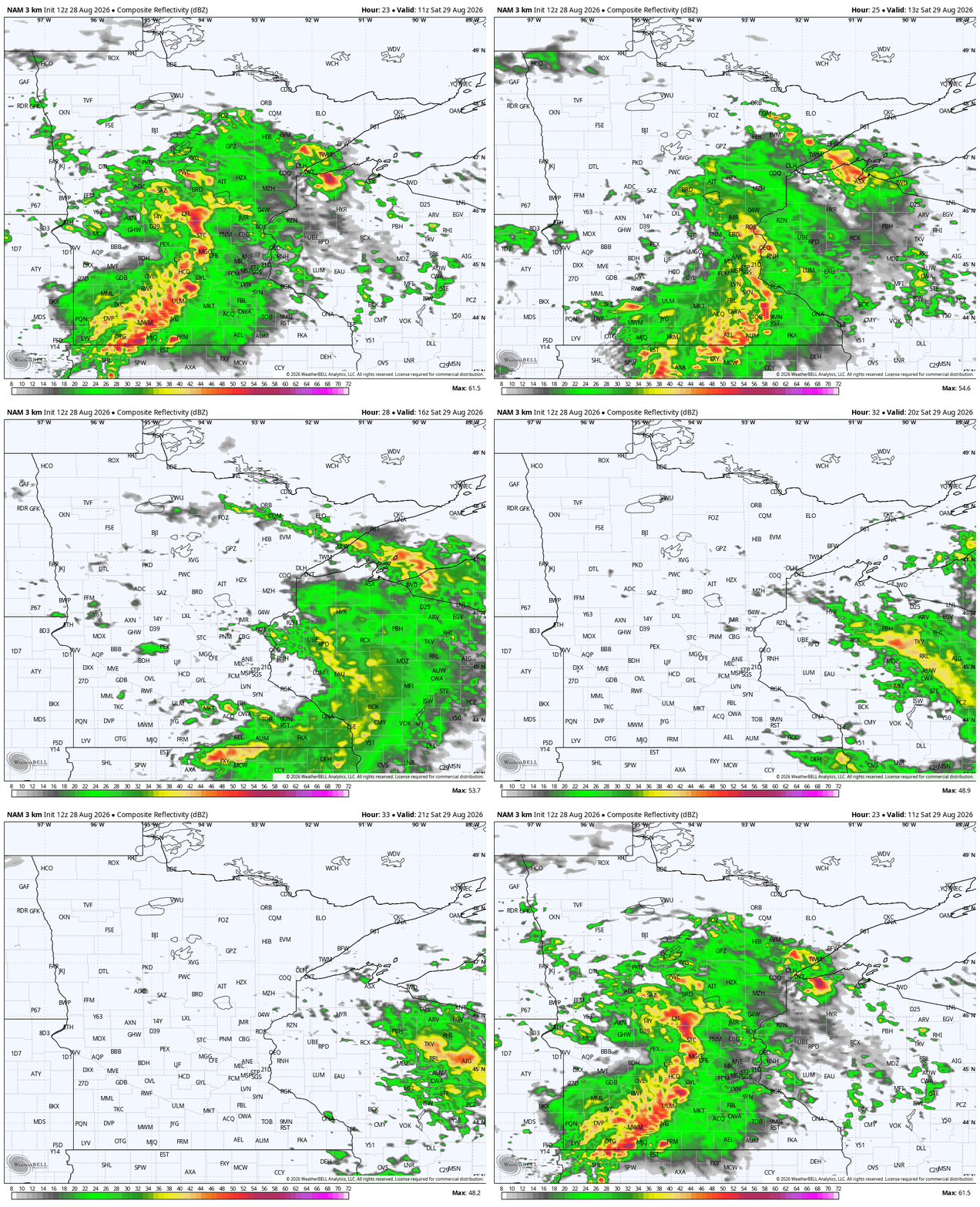

If you are heading to outdoor plans on Saturday — including the Minnesota State Fair — there will be rain. The best chances of rain across the broader region are in the southern half of Minnesota. The highest chance for rain around the Twin Cities is between 6 a.m. and 10 a.m.
Turn Up Your Support
MPR News helps you turn down the noise and build shared understanding. Turn up your support for this public resource and keep trusted journalism accessible to all.
I would still prepare for lower rain chances as late as 1 p.m. Saturday. We should be dry after that.
It will be a pretty warm day. There could be more clouds in central Minnesota that could hold temperatures a little lower, slightly below the late-August averages for Duluth, Brainerd, Fergus Falls and other cities.
There may also be a few rain showers very early Sunday, but these mostly skip around the state.
That possible rain looks very hit and miss and very light. Sunday and Monday will also be noticeably hotter, closer to 90 degrees in the southern parts of the state. Farther north, most will be in the lower to mid-80s.

There are increasing signs of lighter but stagnant rain over the far southern end of Minnesota, along the Interstate 90 corridor. There is some window for rain in the Twin Cities on Tuesday morning, but more of it could be closer to Red Wing.
In between these two zones is one of the deepest droughts in the state to date.
On the maps below, the European Centre for Medium-Range Weather Forecasts and NOAA's Global Forecast System differ on timing but are similar in positioning rain sometime Tuesday.



