
It's a fair-ly muggy forecast; relief is on the way
Rain chances Tuesday night into early Wednesday

Go Deeper.
Create an account or log in to save stories.
Like this?
Thanks for liking this story! We have added it to a list of your favorite stories.


The heat and humidity aren’t going anywhere just yet. Muggy conditions will stick around through Monday before a cold front sweeps through and brings a noticeable drop in dew points.
Another muggy day to start the week
It was a hot and humid day across Minnesota, with heat indices topping 100 degrees in southwestern Minnesota and dew points climbing into the 70s. The combination of heat and humidity made for some oppressive conditions, especially across southwestern Minnesota.

Unfortunately, the muggy weather isn’t quite finished yet. Warm and humid conditions will continue into Monday, with temperatures remaining in the 80s and dew points staying elevated. That means it will continue to feel sticky and uncomfortable, particularly during the afternoon.

The big change comes Monday as a cold front moves through Minnesota from west to east. Behind the front, dew points will drop sharply, bringing much drier and more comfortable air into the state.
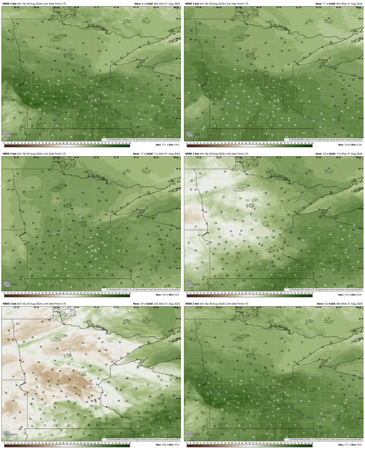
Northern Minnesota will see some of the first relief, with dew points dropping into the 50s. The Twin Cities metro will remain muggy through at least the first half of Monday before the drier air arrives.
Another chance for rain will arrive late Tuesday into early Wednesday as a disturbance moves across the region, potentially bringing more widespread light rain.
Turn Up Your Support
MPR News helps you turn down the noise and build shared understanding. Turn up your support for this public resource and keep trusted journalism accessible to all.

