
Warmer-than-normal temperatures with a couple chances of storms
Overall, significant, soaking rains are unlikely

Go Deeper.
Create an account or log in to save stories.
Like this?
Thanks for liking this story! We have added it to a list of your favorite stories.


It’ll be very warm and muggy Monday with decreasing dew points this afternoon. The next chances of thunder develop Tuesday night and Thursday.
Warmer-than-normal temperatures with a couple chances of storms
Dew points will be decreasing slowly through the day Monday as northwest winds blow in drier air. Dew points will drop from near 70 Monday morning across southern Minnesota into the low 60s by evening.
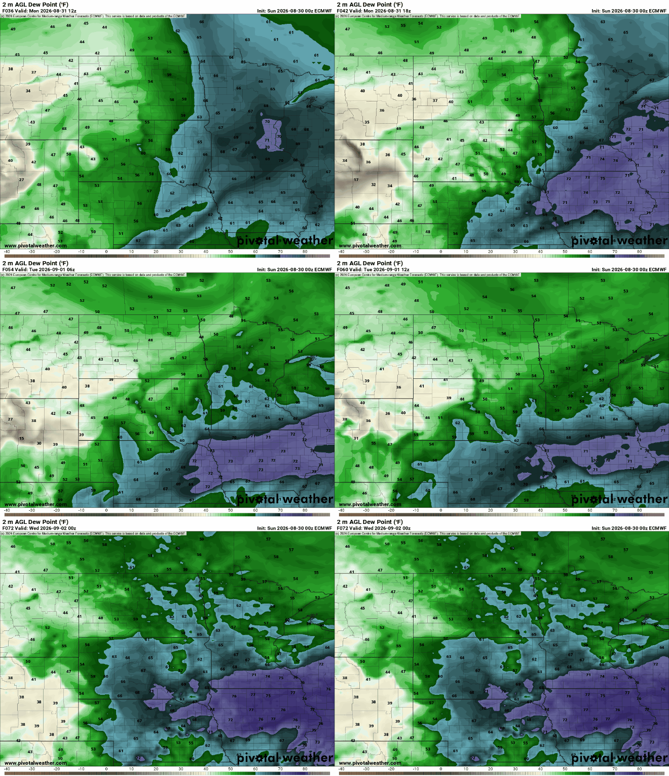
It will be a very warm one for the last day of August. Highs will be in the upper 80s to near 90 degrees in southeastern Minnesota with upper 70s far north.

Tuesday will be warm as well to kick off September. Afternoon highs will again be well into the 80s across most of central and southern Minnesota with dew points in the 60s and 50s.

The next chances of precipitation develop Tuesday night into early Wednesday and again Thursday as a pair of upper-level disturbances moves through our region. Unfortunately, neither look to produce widespread soaking rains but more spotty showers and storms.
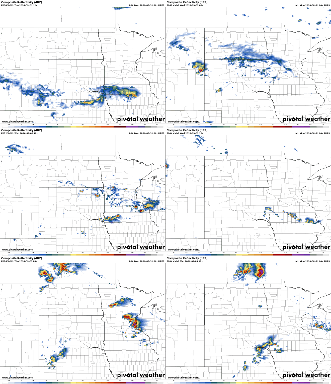
Total rainfall will leave most needing more of course, keeping with our summer theme of drought. Far southern Minnesota may see some significant and beneficial rainfall totals.

The Labor Day weekend is looking decent with above-normal temperatures and mainly dry conditions, though some isolated storms are not out of the question.
Turn Up Your Support
MPR News helps you turn down the noise and build shared understanding. Turn up your support for this public resource and keep trusted journalism accessible to all.

