
After Wednesday morning storms, when's the next chance for rain?

Go Deeper.
Create an account or log in to save stories.
Like this?
Thanks for liking this story! We have added it to a list of your favorite stories.


Welcome to meteorological fall, y’all!
September through November is what meteorologists consider to be autumn, simply for cleaner record keeping. We start fall with nearly 80 percent of Minnesota being in a drought, and we are predicting that most of the state will still be in a drought by the time we hit winter.

It’s time that we go hunting for rain to help ease our drought.
There are going to be some strong or even severe storms Tuesday night into early Wednesday morning. This should bring a fairly widespread swatch of one inch rain totals to far southern Minnesota.
Turn Up Your Support
MPR News helps you turn down the noise and build shared understanding. Turn up your support for this public resource and keep trusted journalism accessible to all.
Most weather maps have the heaviest bands around Pipestone-St. James-Mankato-Faribault-Wabasha. Some models suggest about a half inch band of rain hitting the Twin Cities around 4 a.m., though not all of them do.
As for wind damage potential, we have a slight risk primarily for the Interstate 90 corridor. Once again, this all could be before dawn.
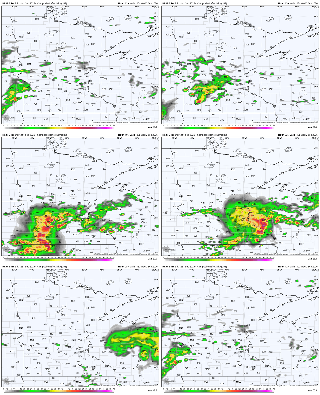
Newer data also has a similar-looking complex of thunderstorms on Thursday, albeit a little later into the day.
The high resolution maps coming out on Tuesday afternoon (as we type this Updraft) have this more in the early afternoon Thursday, while other data has these storms in the mid-morning. These could also bring a burst of heavy rain. For now it’s on more of a Montevideo to Minneapolis track.
Other data has some rain across central Minnesota on Friday and Saturday nights, both still showing up after a couple of days. There is not a ton of rain in the northeastern quarter of Minnesota, however.
We’ve got to travel farther from home to hunt for more rain. First there’s the Gulf, where Edouard has been newly names as the fifth storm of the Atlantic hurricane season. The so-called spaghetti plots — named because the center-point of each low tracked by the computer shows up as a line, creating what looks like a bowl of spaghetti — coil the storm north.
A couple of days ago, some of the crumbs of Edouard were trying to move into Minnesota by the end of the weekend. Now that all fades into Oklahoma.


If not the Gulf, where else could rain come from to help ease our drought? In the image below, you see a big comma shape near Alaska. This Aleutian low also fades away, even though there are some scattered shower chances early next week.
We actually want to look way beneath that, off the west coast of Mexico. There’s a big powerhouse storm there, which will likely be named Marie. Admittedly, this is probably grasping at straws, but there’s a small chance that some leftover moisture from Marie gets caught up in another storm over the northern Rocky Mountains.
There’s a distant chance of seeing some rain from that in Minnesota around Sept. 10. Still, drought is likely to continue for a while, Minnesotans.

