
State Fair forecast: Rain wraps up just as the fair is opening for business

Go Deeper.
Create an account or log in to save stories.
Like this?
Thanks for liking this story! We have added it to a list of your favorite stories.


High winds will move across southern Minnesota early Wednesday, likely including the Minnesota State Fair. After that, we have a quiet day with comfortable temperatures and humidity plus increasing sunshine.
Early Wednesday storms
You might hear some rumbles near the State Fair early Wednesday unrelated to all the rides that have been wowing thousands of fair patrons for days. We have some early morning strong-to-severe thunderstorms moving west to east.
Those storms could pack really heavy rains and even some damaging winds in the predawn hours Wednesday. These should wrap up well before most people get to the fairgrounds.
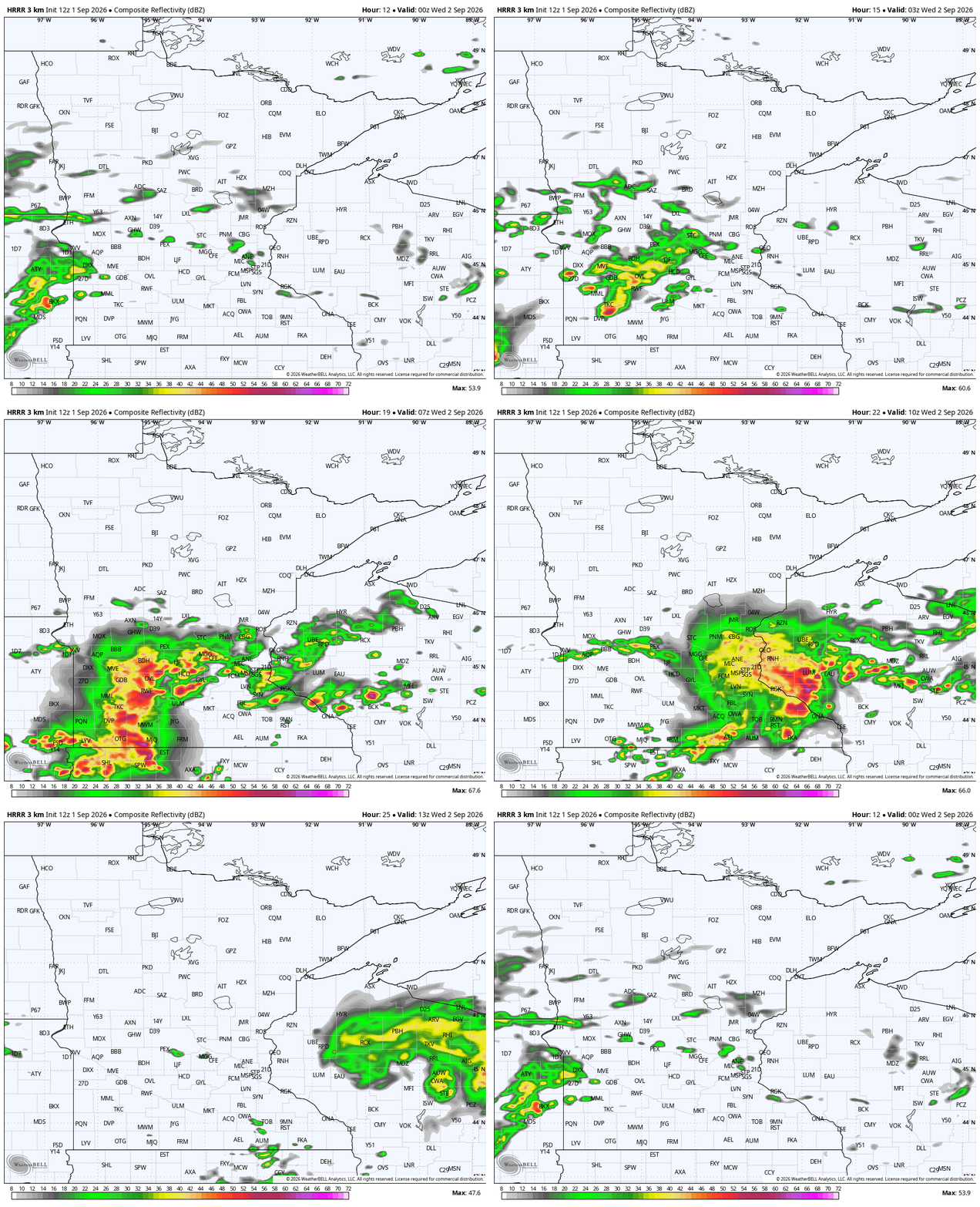
What makes Wednesday’s weather really interesting is that while we will be cooler during the afternoon hours, the humidity is just as high. Normally, you see both the humidity and afternoon temperatures drop behind the front, but not this time around.
Dew points still appear to hover around 70 pretty much all day, thanks to a light and variable wind. In a typical frontal scenario, winds will move to out of the northwest and will push drier air to the southeast.
We also expect more sunshine in the afternoon as we continue to dry out.

Turn Up Your Support
MPR News helps you turn down the noise and build shared understanding. Turn up your support for this public resource and keep trusted journalism accessible to all.

