
Very humid with periodic thunderstorm chances
Temperatures could be near 90 degrees to start the weekend

Go Deeper.
Create an account or log in to save stories.
Like this?
Thanks for liking this story! We have added it to a list of your favorite stories.


Very humid air is moving back in and that will touch off some thunderstorm activity Thursday into early Friday. The weekend will be hot and humid with a periodic thunderstorm.
Humid air and periodic thunderstorm chances
Thursday into Thursday night will be unsettled at times thanks to heat and humidity and our latest upper level disturbance moving through the region.
We’ll have spotty showers and storms this morning in southeastern Minnesota with more isolated activity in the Twin Cities potentially at any point in the day.
More organized storms will develop in eastern North Dakota and northwestern Minnesota late Thursday into the overnight.
Turn Up Your Support
MPR News helps you turn down the noise and build shared understanding. Turn up your support for this public resource and keep trusted journalism accessible to all.
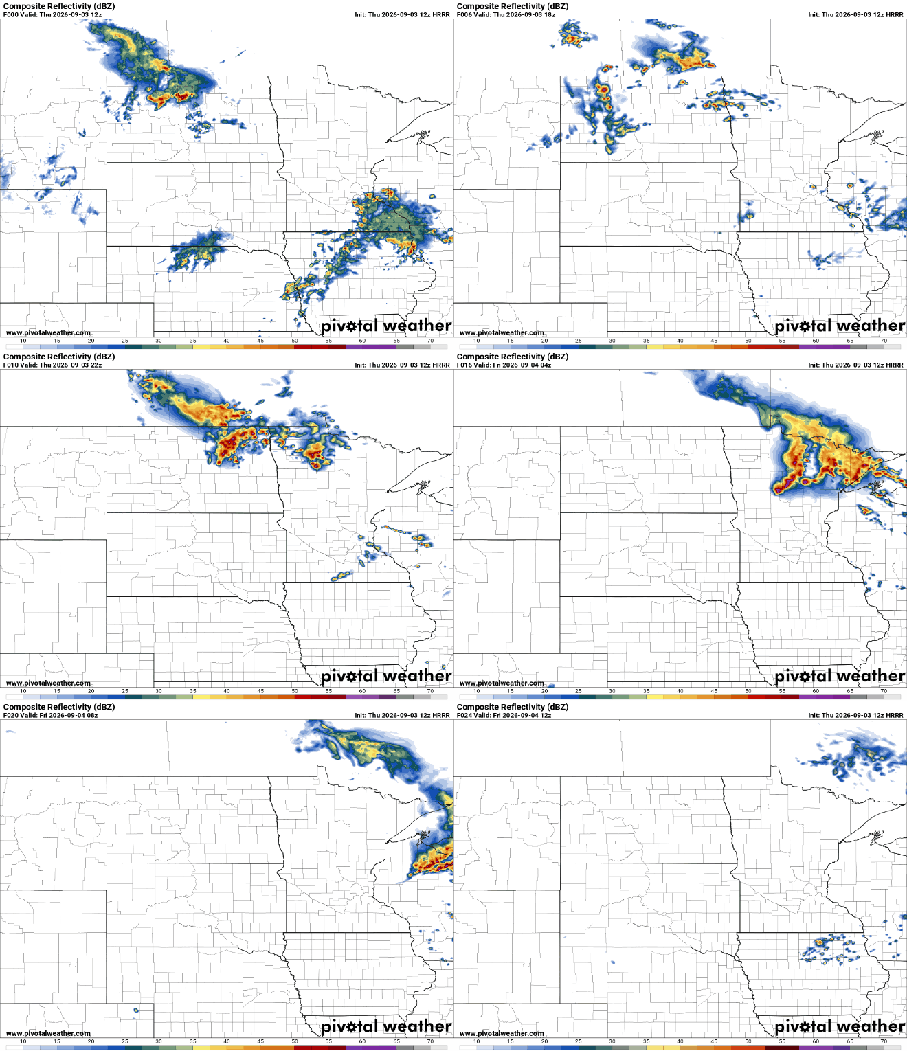
Storms that do develop could turn strong or severe due to the high amounts of moisture. There’s a slight risk (level 2 of 5) of severe storms Thursday into Thursday night for northwestern and north-central Minnesota and a marginal (level 1 of 5) risk elsewhere.
The main potential threats will be from high wind gusts and large hail.
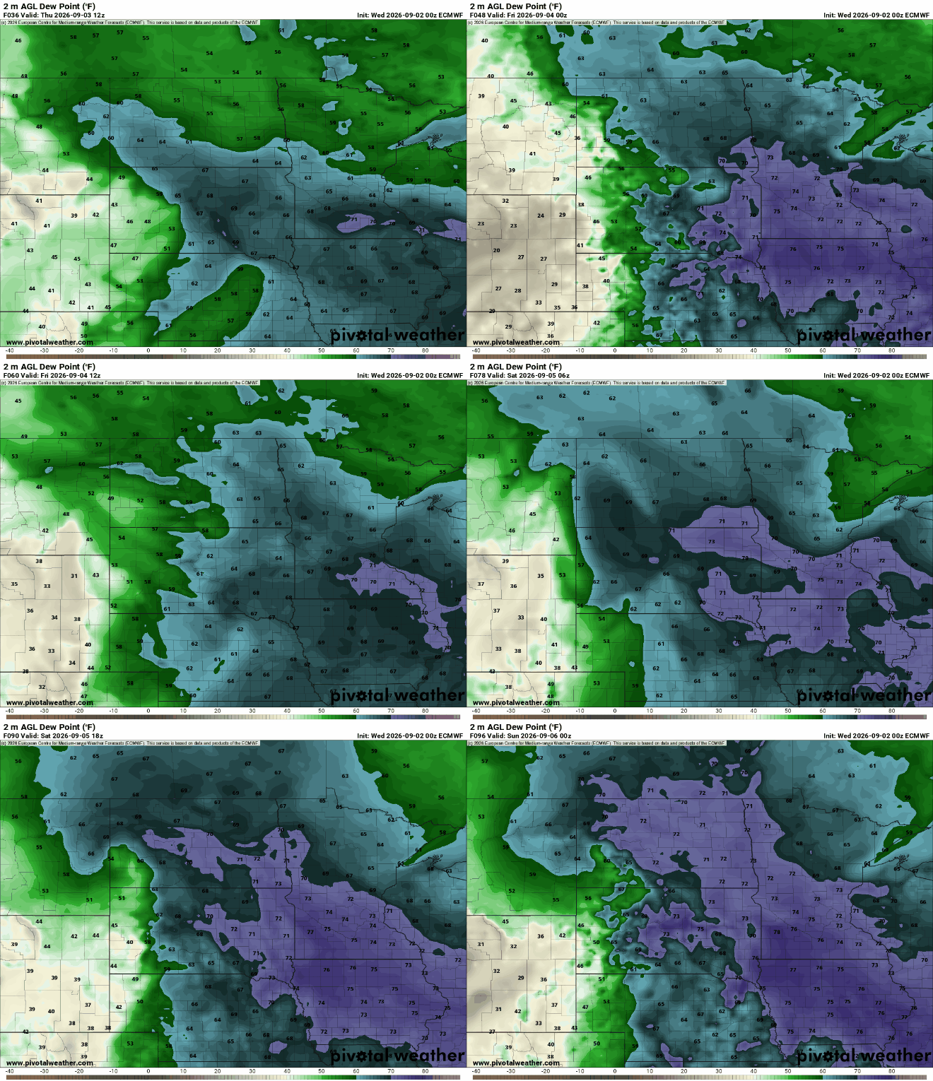
Very humid air is also moving in Thursday, destabilizing our atmosphere and sticking around for most of the holiday weekend. We’ll see dew points in the 70s across much of southern and even central Minnesota Thursday into the weekend.
Highs Thursday afternoon will get toasty for some. We’ll see highs well into the 80s with some 90-degree readings in western Minnesota.

Hot holiday weekend, periodic storms possible
The weekend looks hot as well with highs near 90 to start and at least 80s Sunday and Labor Day. We cannot guarantee a dry weekend.

There will be a periodic thunderstorm, but timing and placing them will be difficult until 24 hours in advance, but no one day looks like a washout.
As of Thursday morning, the best chances appear to be overnight Saturday night and Sunday night with better chances of more widespread storms developing Labor Day into Tuesday morning.
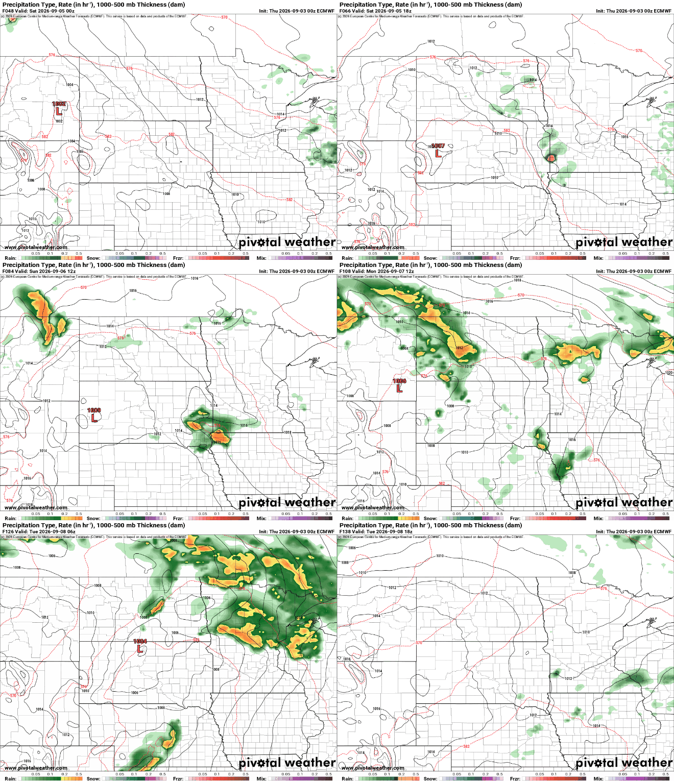
We could see some decent rainfall for much of central and northern Minnesota over the next several days. A widespread 1 to 2 inches of rainfall is possible with much of that coming late Sunday into Monday night.


