
Hot, humid holiday weekend with periodic thunderstorms
Temperatures next week remain warm but closer to normal

Go Deeper.
Create an account or log in to save stories.
Like this?
Thanks for liking this story! We have added it to a list of your favorite stories.


A steamy airmass remains in place Friday through the holiday weekend. We’ll have sunshine Friday, but periodic storms are possible over the weekend and especially early next week.
Hot, humid holiday weekend with periodic thunderstorms
It’ll be a hot one Friday across southern Minnesota to kick off the holiday weekend.
Highs will be in the low 90s south to just mid-70s north. All of those afternoon highs are above normal, however. A heat advisory is posted for the Twin Cities metro area for Friday afternoon and evening.

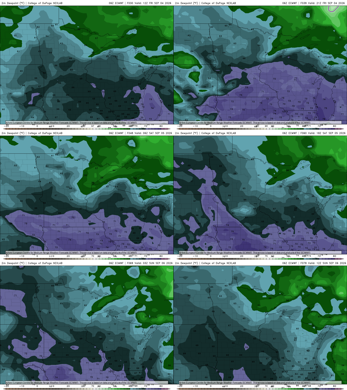
Dew points will remain tropical, in the upper 60s to 70s at times, right through the weekend. That combination of heat and humidity will make it feel like it’s 95 to 100 degrees across southern Minnesota Friday afternoon.
Turn Up Your Support
MPR News helps you turn down the noise and build shared understanding. Turn up your support for this public resource and keep trusted journalism accessible to all.
Saturday will again be very warm with partly cloudy skies. Highs will range from near 90 southwest to near 80 in the northeastern part of the state. Cooler temperatures will prevail immediately near Lake Superior.

We’ll also see the chance of some periodic storms to develop in northwestern Minnesota late Saturday and potentially nearly statewide Saturday night into early Sunday morning.
There will be better chances of perhaps more widespread rain and thunder late Sunday into Labor Day and Tuesday.
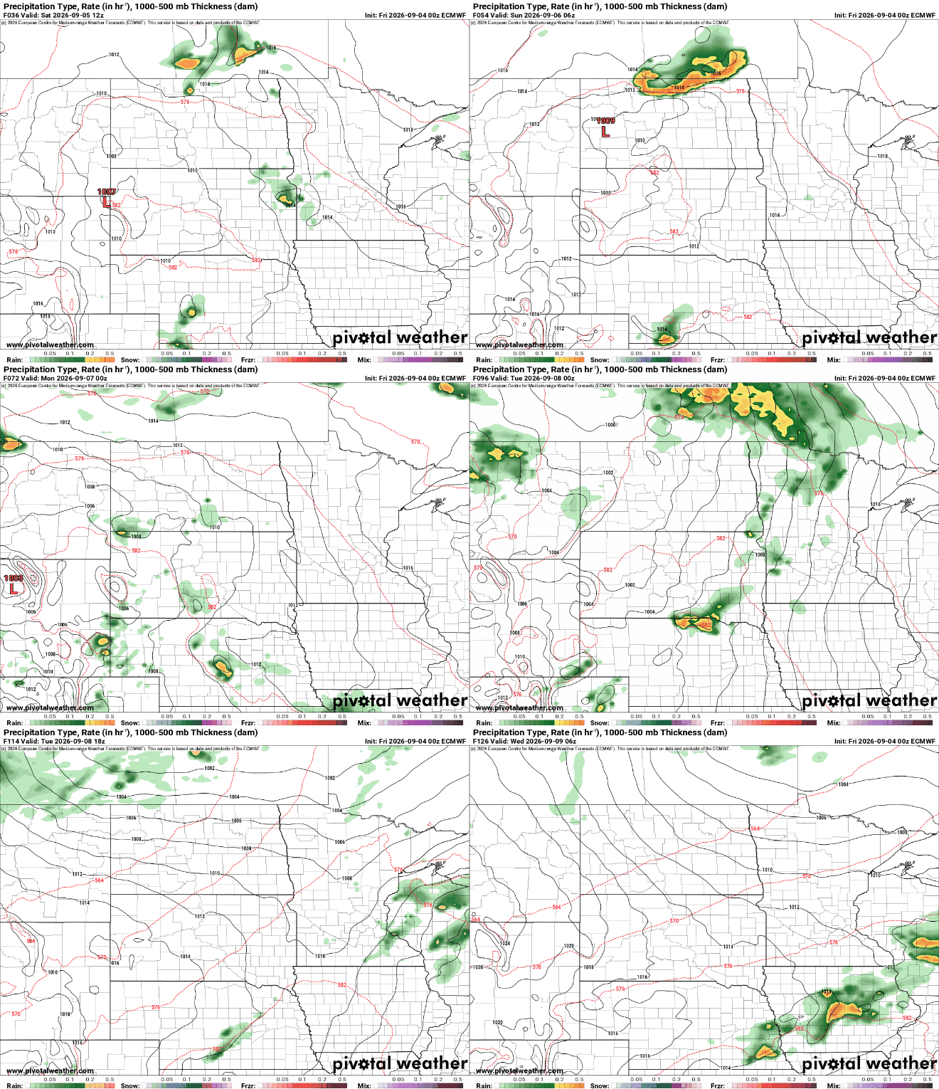
The rainfall could add up to a significant soaking of up to 1 to 2 inches across much of central and northern Minnesota through Tuesday. It won’t be enough to undo the drought, but could dent it a little bit.


