
A stormy end to the Minnesota State Fair
Breezy southeasterly winds

Go Deeper.
Create an account or log in to save stories.
Like this?
Thanks for liking this story! We have added it to a list of your favorite stories.


The final day of the fair and Labor Day will feature a mostly quiet and dry start, with warm temperatures and breezy southeasterly winds. Most of the day should remain dry before a cold front approaches Monday evening, bringing increasing chances for showers and thunderstorms into the evening and overnight hours.
Labor Day starts nice, but storms return later
It’s the final day of the Minnesota State Fair and Labor Day, and for much of the area, the weather will start out looking pretty decent. Temperatures will climb to around 80 degrees, but it will be breezy with southeasterly winds gusting between 25 and 35 mph. Our dew points remain elevated in the lower to mid-60s.

The bigger weather story arrives later today and tonight, when a west-to-east moving cold front brings multiple opportunities for showers and thunderstorms. This cold front will slowly work eastward through the region, but it is not expected to pass through until early Tuesday morning. Before that happens, we could see one or even two rounds of thunderstorms.
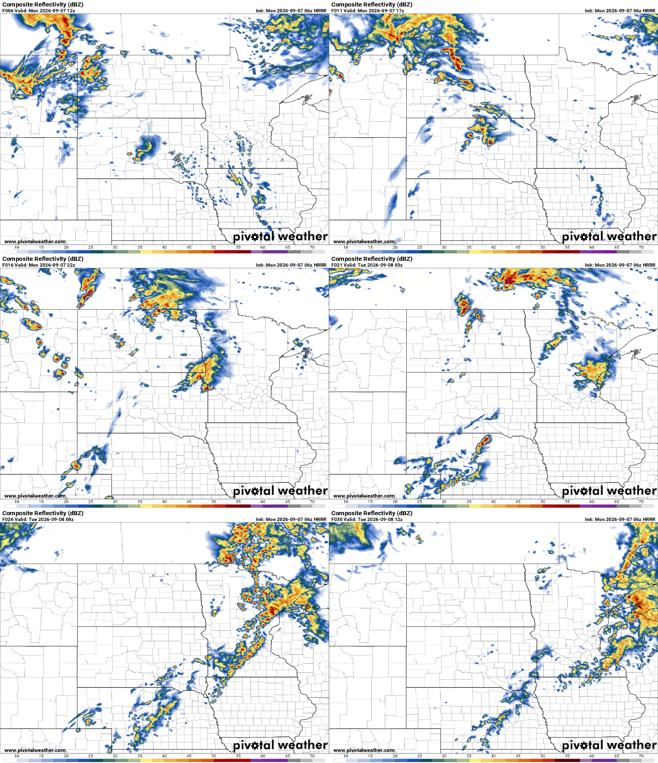
The good news is that this is not expected to be a widespread severe weather event. A few storms could produce gusty winds and large hail, but the overall severe-weather threat remains marginal.

Any lingering showers and clouds should gradually clear by around midday Tuesday. There could be another round of storms during Tuesday afternoon along the stalled boundary. Outside of that possibility, the forecast becomes much quieter.
Wednesday and Thursday currently look like the pick of the week, with drier air and more comfortable temperatures settling in.
Turn Up Your Support
MPR News helps you turn down the noise and build shared understanding. Turn up your support for this public resource and keep trusted journalism accessible to all.

