
Minnesota gets a taste of fall weather by next week
Windy Wednesday; storm potential Friday
Go Deeper.
Create an account or log in to save stories.
Like this?
Thanks for liking this story! We have added it to a list of your favorite stories.


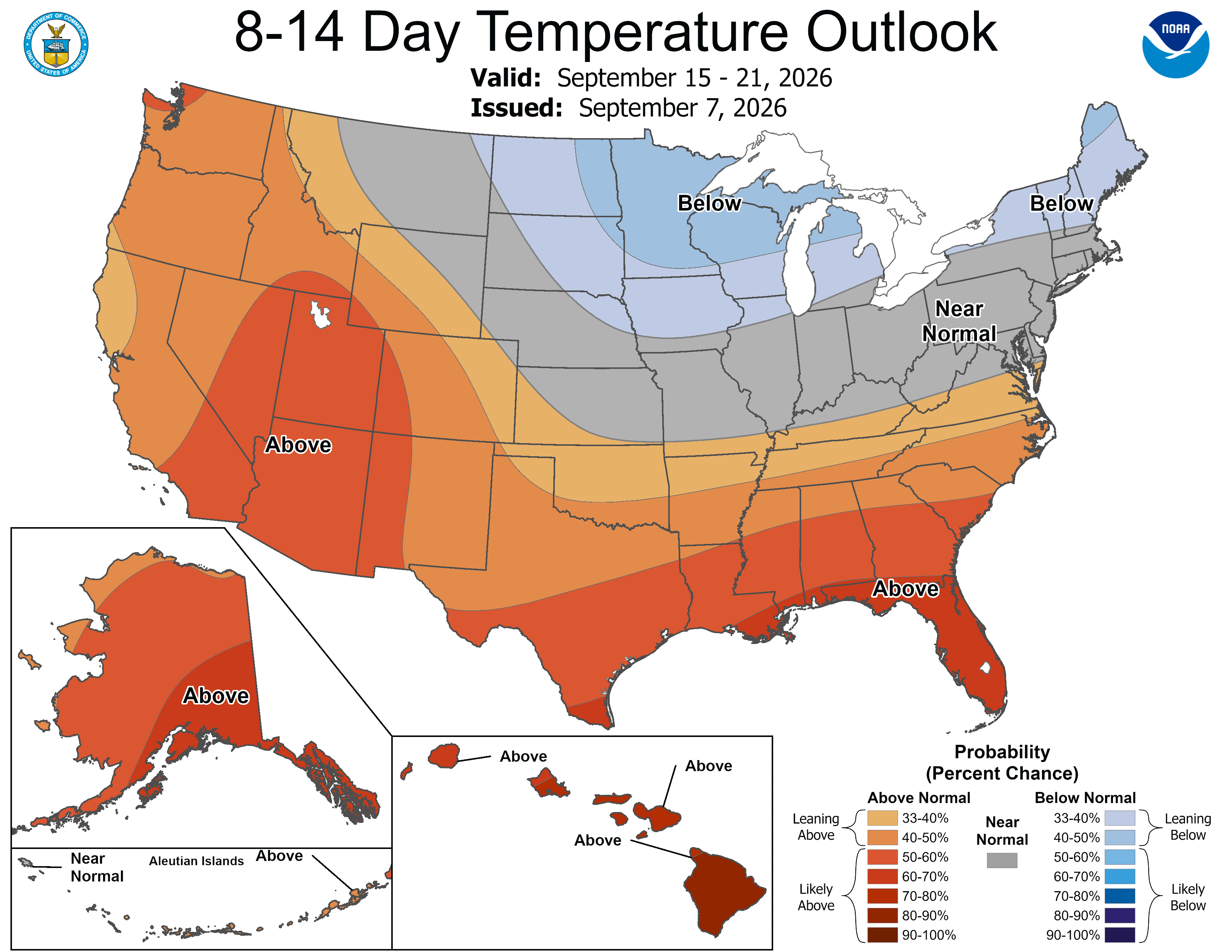
Minnesota’s coldest weather since mid-May is on the way. Highs in the 50s will be widespread early next week. There could be some strong storms Friday night that set the temperature change into motion.
Brief showers chances Tuesday night; Wednesday’s windy
We’ll see overcast skies and cooler temperatures Tuesday evening. We may see a couple of brief rain showers in eastern and southern Minnesota around dinner time. A few of those could clip the Twin Cities.
On Wednesday, we’ll be around average in southern Minnesota — 50s to near 60 for lows, upper 70s to 80 for highs.
It will be windy statewide. There’s an early September gale warning up for Lake Superior. The fetch is coming out of the west-northwest and the big waves will be in the middle of the lake.
Turn Up Your Support
MPR News helps you turn down the noise and build shared understanding. Turn up your support for this public resource and keep trusted journalism accessible to all.
The strong winds will make it much cooler along the North Shore and the Iron Range. Some spots may not make it out of the 50s.
The strongest winds Wednesday are likely to be downslope gusts diving into the Minnesota River Valley. They’ll race east out of South Dakota and nosedive off of Buffalo Ridge in southwestern Minnesota.

We’ll see more leaves coming down across the state. They’ve come down earlier this season because of drought, not because of peak foliage color.


Friday storm potential
Thursday’s weather looks quiet. By Friday night, though, we’re in the bull’s-eye for storm risk as a powerful 994 mb low forms over the state.
“Severe potential could develop across portions of the Plains into the Upper Midwest, according to the National Oceanic and Atmospheric Administration’s Storm Prediction Center.
Given the timing, though, severe weather seems rather unlikely.

Another blockbuster low arrives on Monday. It’ll bring rain that will help ease some drought conditions. although it won’t eliminate drought anywhere in the state.
It will also lead to a temperature drop into next week.
For next Monday, many weather maps don’t even have the Twin Cities getting out of the 50s during the day. Other parts of the state may be much colder. Later on that week, we start to climb a little bit, but we could still be below normal.

