
Crisp, cool evening but a warmup is excepted on Thursday afternoon

Go Deeper.
Create an account or log in to save stories.
Like this?
Thanks for liking this story! We have added it to a list of your favorite stories.


Following a windy day with nearly full sunshine, big waves on Superior, and millions of birds surfing south behind the latest cold front, we have some changes in store beginning on Thursday.
We can’t just bypass Wednesday evening, which looks lovely. There may be just a few cirrus clouds to go along with milder weather. Those clouds still leave us with a vibrant sunset. For the students already back to school, it’s likely to be a little chilly at the morning’s bus stop.
Many in northern Minnesota — especially in the protected valleys near the Iron Range — will be well down into the 40s. A few ‘usual suspect’ places like Tower, Hibbing and Embarrass are likely to be even cooler!
In southern Minnesota, we’re down in the lower-to-middle 50s very briefly. This being early September, we’re still off to the races. Temperatures will eventually get to the lower, or even the middle, 80s around the Twin Cities.
Turn Up Your Support
MPR News helps you turn down the noise and build shared understanding. Turn up your support for this public resource and keep trusted journalism accessible to all.

We should have a great setup to see both the Milky Way and Andromeda this week due to the new moon. Andromeda is in the northeastern sky this time of year, and we’ll have clear skies in the middle of Thursday night if you’re hoping to see two galaxies at once.
Much of Friday is really pleasant, though with storms approaching, we imagine you’ll quickly notice the bump in heat and humidity. For the workweek, Friday is likely to be the hottest and most muggy day we have.
That’s not only true in the Corn Sweat belt, but pushing well north into Minnesota and likely continuing into far southern Canada. As a low pressure center strengthens right over Minnesota, rain will probably begin to gather after 5 p.m.
What's really unique is that the rain develops “from scratch” right over us. Often we will see storms sweeping in from the Dakotas. Not this time around! A few of those storms around 8 p.m. to 12 a.m. could be severe with damaging winds and some medium sized hail.
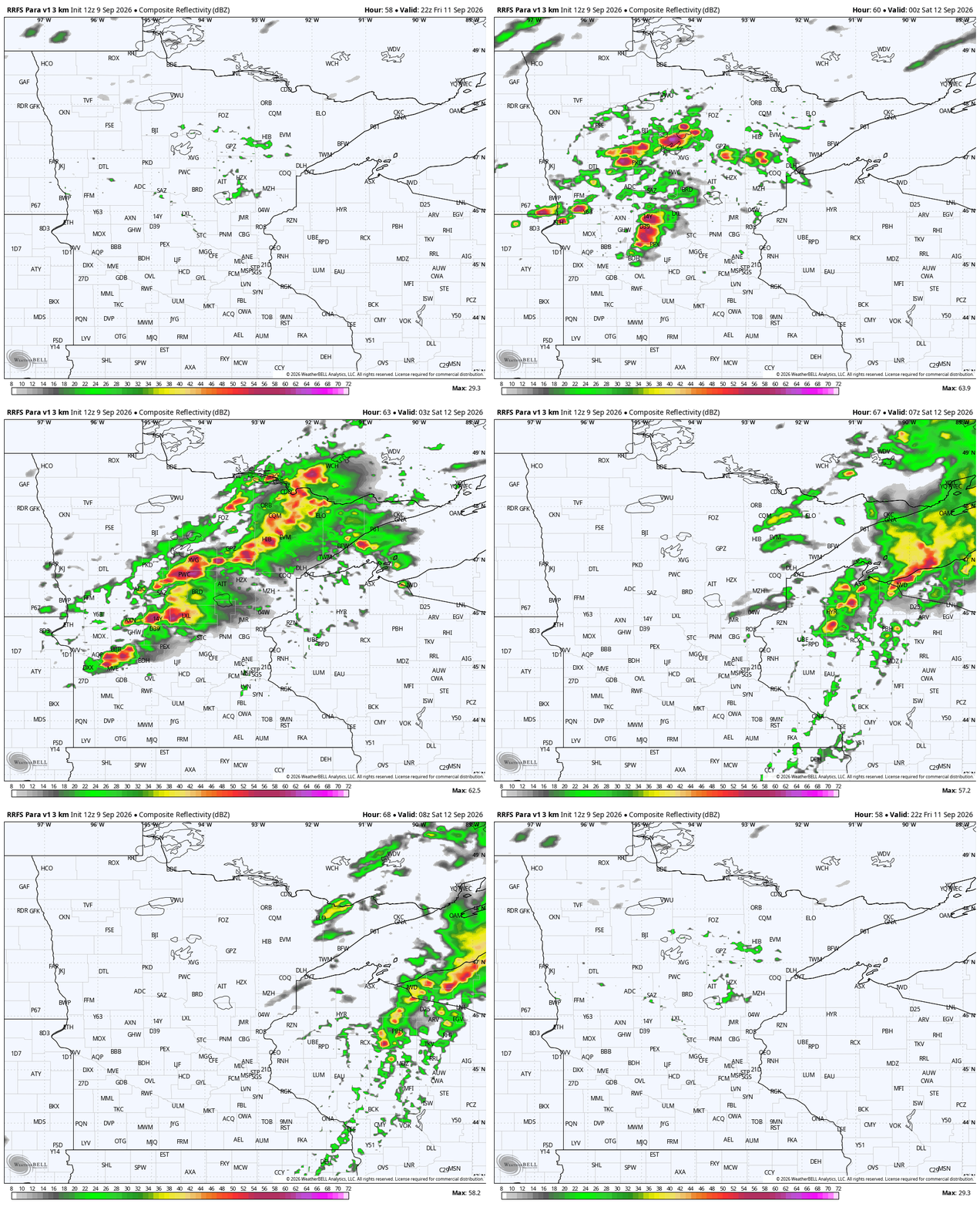
While this is not the peak season for severe weather, and it’s at a fairly odd time of day, the Storm Prediction Center has been highlighting this threat area over Minnesota for days now.
By Saturday’s daylight hours, we may have some brief fog. It’s a cooler day, for sure, but should be dry. Sunday is a tough forecast, for sure! The last few editions of the European deterministic model have a super-soggy day across central and southern Minnesota, and look much cooler.
The American (at least one map, the GFS) map has us dry, and thus, quite a bit warmer. Both maps do have some good soaking rains on Monday across a large footprint of Minnesota. Many might never even hit 60 degrees next Monday! While most of next week has below average temperatures, we will warm up a little bit from Monday’s bottoming-out point.


