
Warming back up Thursday and Friday with storms possible Friday night
Cooler, fall-like air moves in early next week
Go Deeper.
Create an account or log in to save stories.
Like this?
Thanks for liking this story! We have added it to a list of your favorite stories.


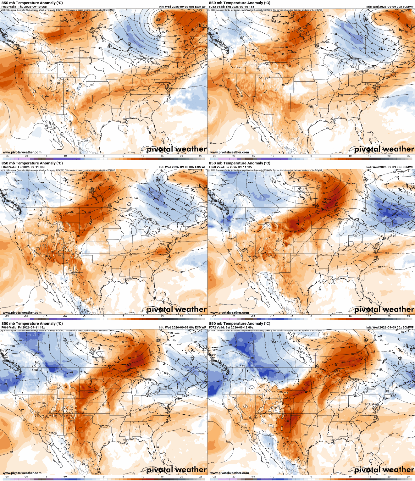
After a cool start, warmer air is already moving back in for Thursday and Friday. The next cool front will touch off some storms Friday night, followed by cooler temperatures again.
Warming Thursday and Friday; storms possible Friday night
It’s a cool start — especially up north — early Thursday morning but we’ll be warming back up Thursday and especially Friday. Look for lots of sun Thursday with highs back near 80 degrees in the Twin Cities with low to mid-80s west and 70s north.

Friday will be even warmer and muggier dew points also return. Highs Friday will be well into the 80s for most of central, southern and western Minnesota along with dew points increasing into the 60s.

The next cool front is slated to move through Friday night. It will touch off at least some scattered showers and thunderstorms, especially for central and northern Minnesota.
Turn Up Your Support
MPR News helps you turn down the noise and build shared understanding. Turn up your support for this public resource and keep trusted journalism accessible to all.
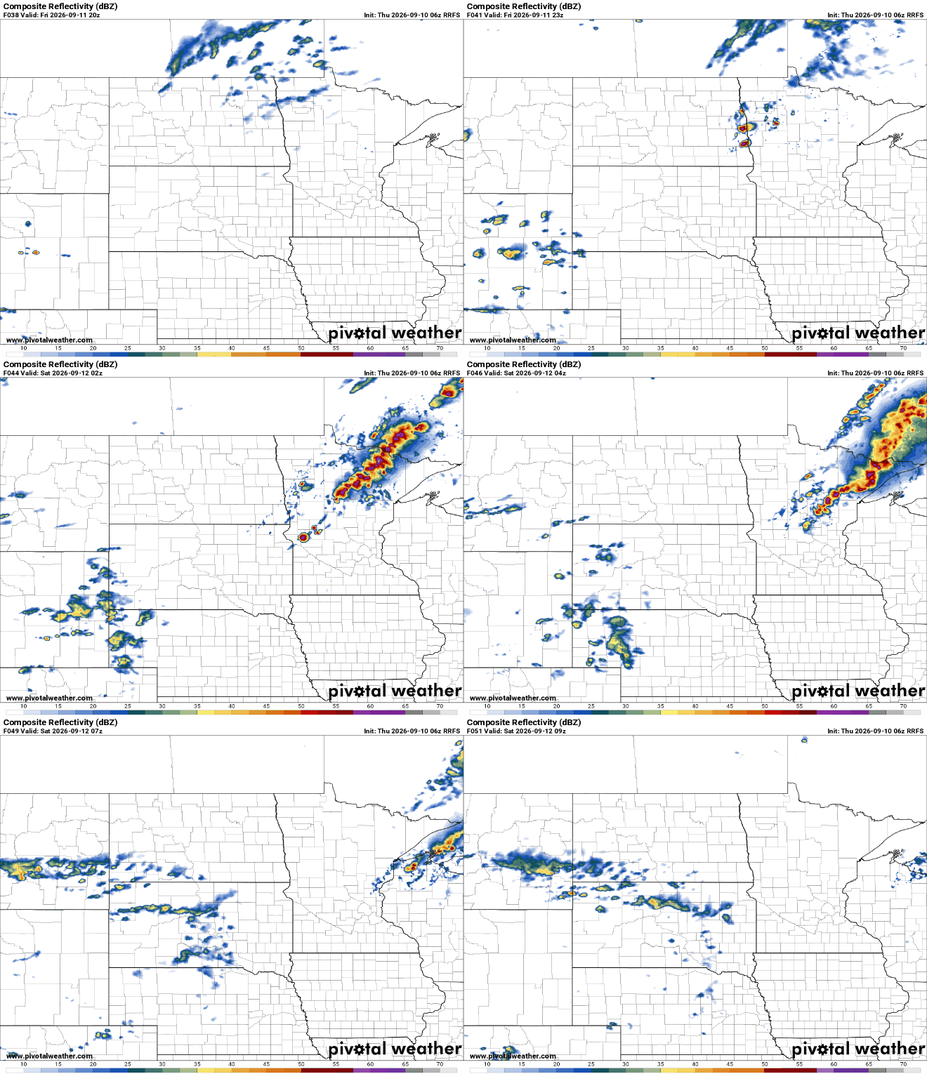
Some storms could be strong to severe Friday night. There’s a slight risk (level 2 of 5) forecast for a large swath of Minnesota.

Behind the front, temperatures will cool off again into the 60s and 70s for Sunday and Monday.
We’re also watching a hopeful system that could deliver significant rainfall to a large portion of Minnesota. Rain showers could develop late Sunday into Monday and Monday night.
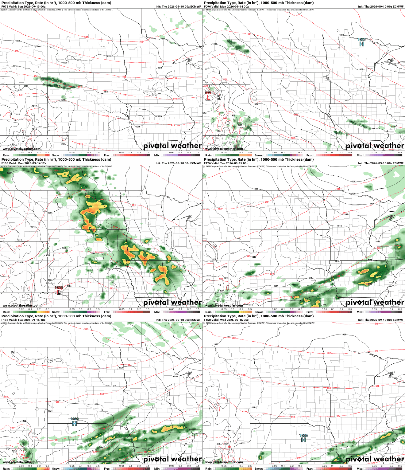
Some forecast models paint Minnesota with anywhere from 1 to 4 inches of rainfall. Forecast models have trended south from Wednesday, however.
The maps below show three forecast model scenarios for total rainfall expected Monday. The maps on top are model runs made today. The maps on the bottom are from Wednesday’s model runs.
Each model has moved about 100 miles (or more) south from Wednesday’s forecasts.


