
Fall-like feel arrives with cooler temperatures and low humidity
A wet start to the work week is on the way

Go Deeper.
Create an account or log in to save stories.
Like this?
Thanks for liking this story! We have added it to a list of your favorite stories.


A cooler weather pattern is taking hold across Minnesota, with temperatures running slightly below average Sunday. Widespread rainfall moves in Monday, bringing a wet start to the work week.
Light showers early south, then clearing
Sunday will start with plenty of clouds across southern Minnesota, along with a chance for a few light rain showers. A weak disturbance moving southeast through the region will help generate the showers, but high pressure nearby should keep rainfall amounts light.
Skies will gradually clear from west to east Sunday afternoon. Temperatures will remain on the cool side, with highs slightly below the seasonal average.
For our friends in the Northland, temperatures will drop into the low to mid-30s Sunday night, prompting a frost advisory through Monday morning.
Turn Up Your Support
MPR News helps you turn down the noise and build shared understanding. Turn up your support for this public resource and keep trusted journalism accessible to all.

Widespread rainfall Monday
Widespread rainfall moves in Monday as our weather pattern becomes much more active. A stronger storm system will move into the Northern Plains and Upper Midwest, bringing plenty of moisture northward as high pressure departs the region.
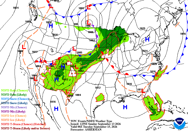
Rainfall will be relatively short-lived as the system moves through quickly, but much of Minnesota could pick up a quarter to three quarters of an inch of rain. Communities closer to the front could see higher amounts, with 1 to 2 inches possible.
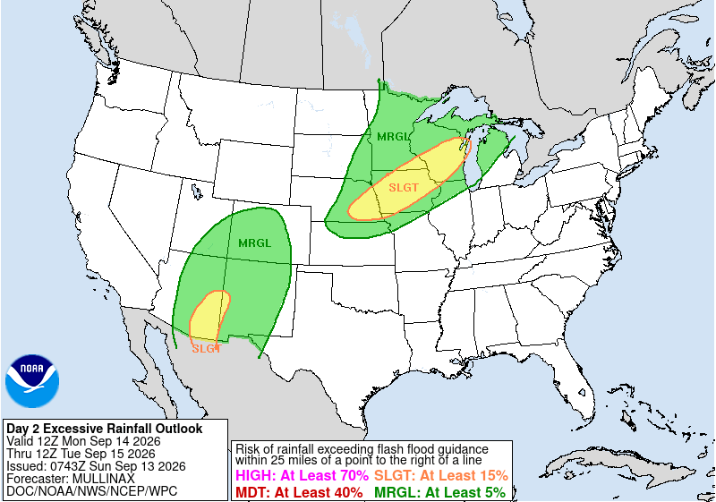
The Weather Prediction Center has placed southeastern Minnesota, central Wisconsin and much of Iowa under a slight risk for excessive rainfall.
After Monday's rain, the overall weather pattern will remain relatively cool. High pressure and a persistent ridge over the southeastern United States will help keep the main storm track and frontal boundary further to our south for at least part of the week. That should keep shower and thunderstorm activity away from the region, until later in the week.
For now, don't expect a major warm-up. Seasonably cool air looks likely to remain in place, with afternoon temperatures generally in the 60s and low 70s and overnight temperatures in the 30s, 40s and 50s.

