
Another cool, cloudy day to start the week
Light rain in southern Minnesota Monday; next chance on Thursday
Go Deeper.
Create an account or log in to save stories.
Like this?
Thanks for liking this story! We have added it to a list of your favorite stories.


Another mostly cloudy and chilly day is on tap across Minnesota to start the week, with temperatures struggling to reach 60 degrees for much of the region.
Chilly, cloudy start to the week
Our last day of summer is ending on a more fall-like note, with cloudy skies and below-average temperatures settling in across Minnesota.
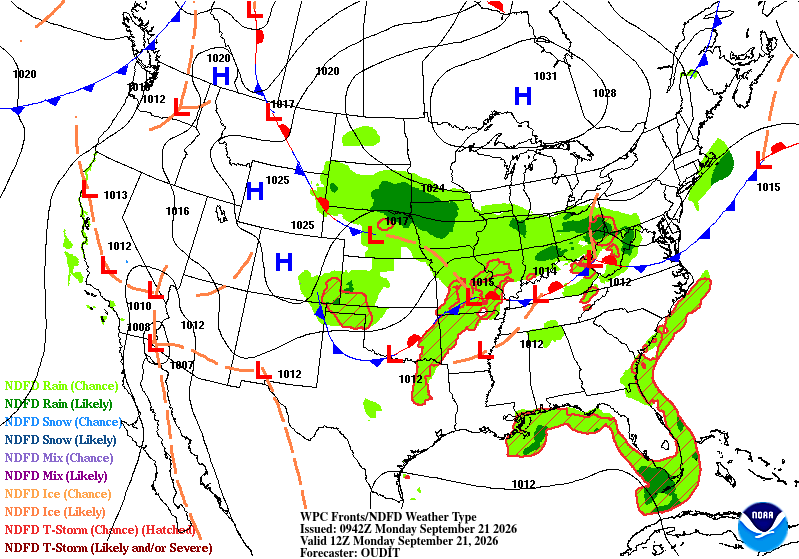
Light rain showers continue across southern Minnesota early Monday, but the precipitation is struggling to push north and east. Dry air being funneled into the region by high pressure positioned north of the Great Lakes is causing the rain to weaken as it moves farther north.
For most of the state, the main story today will be the clouds and chilly temperatures, with highs running well below average for this time of year.
Turn Up Your Support
MPR News helps you turn down the noise and build shared understanding. Turn up your support for this public resource and keep trusted journalism accessible to all.
Temperatures will be warmer in northern Minnesota, generally topping out in the low to mid-60s, while areas farther south remain stuck in the rain-cooled 50s.

Chilly nights bring frost concerns
The bigger weather story may come Monday night and again Tuesday night as clouds finally begin to break apart. With lighter winds and clearing skies, temperatures will be able to drop quickly.
Many locations will fall into the 40s Monday night, with the Northland dropping into the 30s, with potential frost and freeze headlines. Another chilly night follows Tuesday, with lows generally in the upper 30s and lower 40s.

Our temperatures should rebound nicely by Wednesday as winds turn more southerly and the surface high pressure system moves east of the Great Lakes. That southerly flow will begin bringing warmer air and increasing moisture back into Minnesota with dew points returning to the 50s.
A trough moving across the Dakotas will also approach the region, bringing our next opportunity for rain Wednesday night into Thursday. Western Minnesota appears to have the best chance of seeing showers at this time.

