
Minnesota weather: Fall-ing temperatures and rains as we 'leaf' summer behind
Sunshine and mild weather are here for Wednesday but then rain is back early Thursday with on-off showers this weekend.
Go Deeper.
Create an account or log in to save stories.
Like this?
Thanks for liking this story! We have added it to a list of your favorite stories.


It’s fall, y’all! Autumn officially begins at 7:05 p.m. Tuesday. Temperatures will be cool but not cold. Rain returns early Thursday and then again in a couple of wet waves this coming weekend. We may even get some eventual tropical moisture curling around the Pacific Ocean via the Desert Southwest.

A taste of autumn
At 7:05 p.m. Tuesday, the center point of the sun passes over the Earth’s equator. This is the autumnal equinox for the Northern Hemisphere. You don’t have to speak Latin to guess that equinox means “equal night,” as lower latitudes have almost exactly 12 hours of day and 12 hours of night. But in most of Minnesota, the 12-hour split actually comes Friday, Sept. 25! Yes, you can balance a chicken egg on the Equinox! Thing is, you can do this any day, if you’re willing to spend enough time getting the yolk to settle. This does not have to happen on an Equinox.

After our coolest morning since late May, we’re due for another chilly morning. This is great windows-open sleeping weather for the brave. Or, at least a brief reprieve from the air conditioner. Here’s to hoping your electric bills will be low next month.

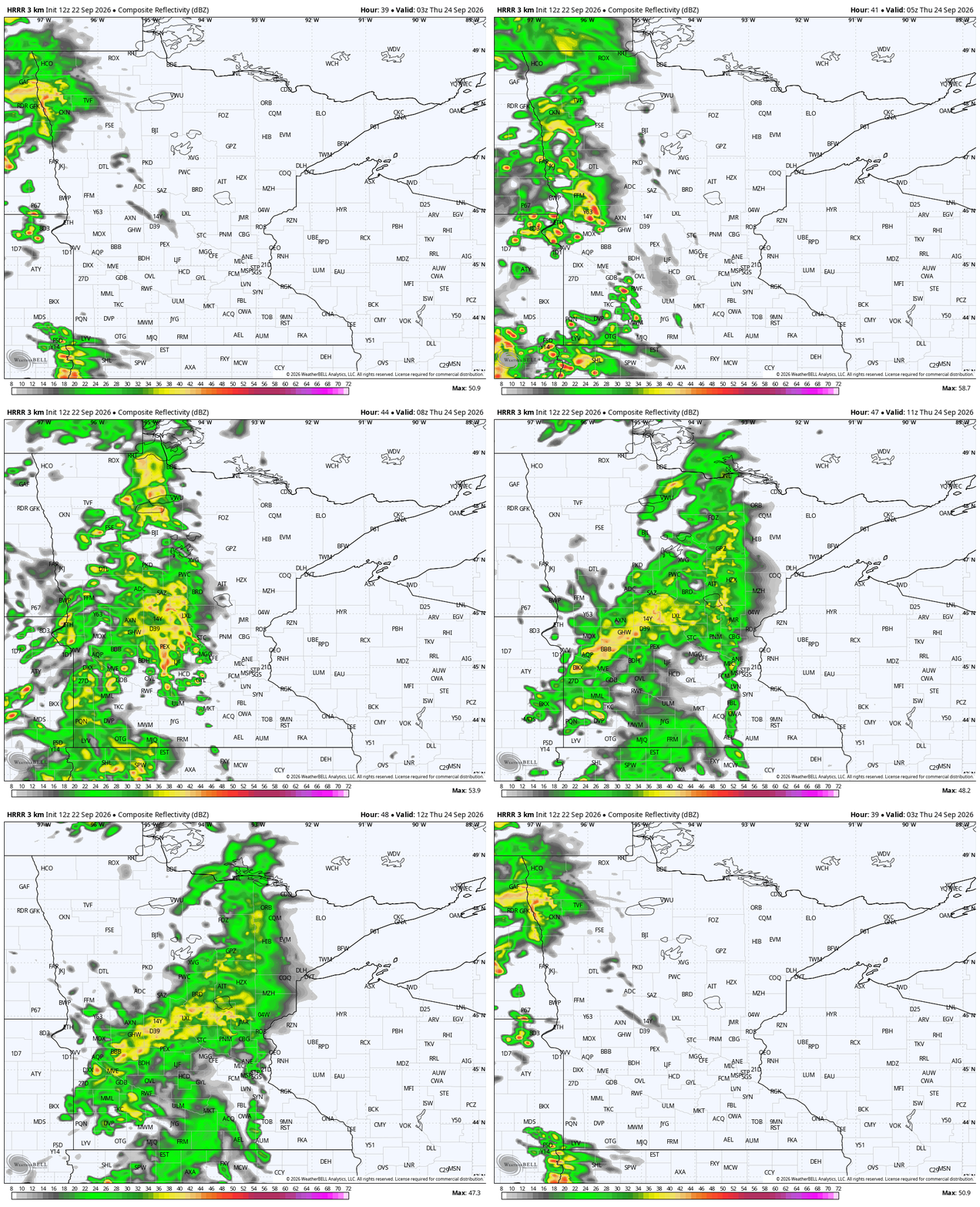
Wednesday should be a tiny bit cooler than average, with ample sunshine in the first two thirds of the day. Clouds roll in along the Red River Valley, and along the Minnesota and South Dakota border by late Wednesday afternoon. This leads to the first rain of fall through mid-morning on Thursday. Because this band is slow moving and is not a thunderstorm risk, that’s great news to help slowly alleviate our drought.
Rain chances start to pile up
The rain Thursday starts from west to east but ends up pushing in some streamers of light rain and sprinkles later in the day Thursday and lingering into Friday. All the way from Wednesday through Friday, we will be a little below average across all parts of Minnesota. Wednesday and Thursday will look much different, but at the warmest, we will only top out in the middle 60s. Friday is likely to be mostly cloudy but a little drier, and perhaps marginally warmer.
While there is no agreement between the Euro (European Center for Medium-Range Weather Forecasting), Americans (a lot of different maps) and Canadian weather maps, they all have a fairly soggy weekend lasting through about Tuesday. Now this would be a really good drought helper! Much of the state now needs 8-12 inches of additional rain and precipitation to eliminate drought over the next few months. This could be a great second wave to get us started!
From now until next Wednesday, the weather maps do actually agree on one thing, even if it is not the timing nor coverage of each rain event. Most of Minnesota is in line for 2-3 inches of rain added up over that time frame. Effectively, it would all balance out for the North Star State through about Day 8.
Turn Up Your Support
MPR News helps you turn down the noise and build shared understanding. Turn up your support for this public resource and keep trusted journalism accessible to all.

