
Big west to east contrast in rainfall Thursday
Another chance of rain on Saturday

Go Deeper.
Create an account or log in to save stories.
Like this?
Thanks for liking this story! We have added it to a list of your favorite stories.


We’ll have scattered showers Thursday but the bulk of significant rainfall will remain west. More showers are possible Saturday along with some warmer temperatures ahead.
Big west to east contrast in rainfall Thursday
Rain showers in western Minnesota will slowly try to expand and push east through the morning Thursday. We’ll likely see some light rain showers this afternoon and evening in the Twin Cities and eastern Minnesota but not nearly as much as northwest parts of the state.
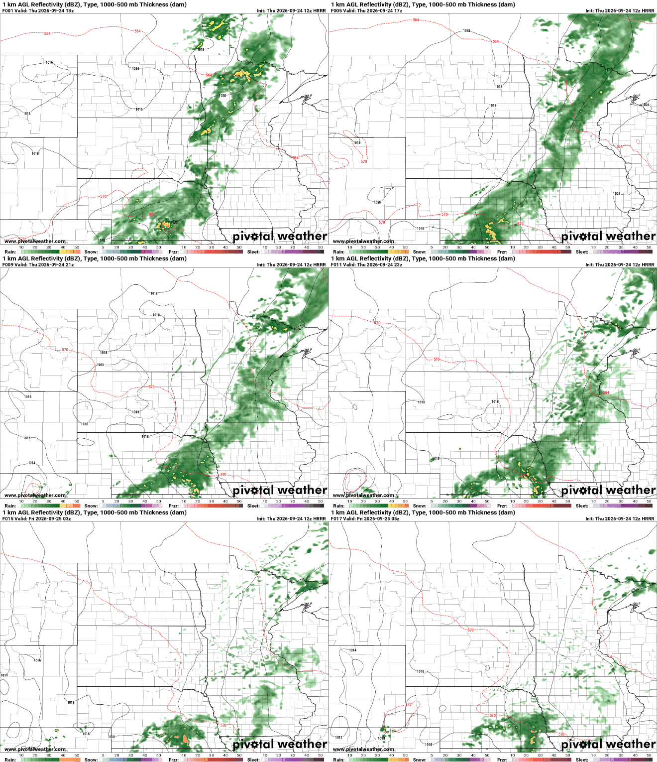
Rainfall will be considerably more significant in western and northwest Minnesota compared to eastern Minnesota and especially western Wisconsin where rainfall totals will be well under a quarter inch.
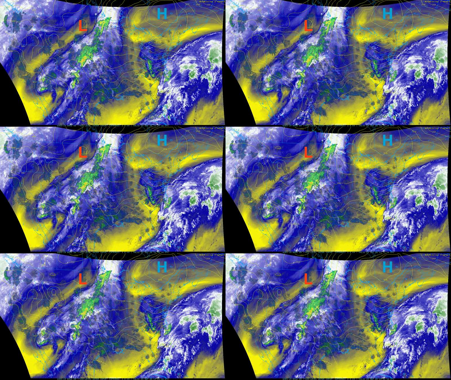
The reason for the big contrast in rainfall totals is due to a large are of high pressure with quite dry air to our east. As air flows clock-wise around high pressure areas, our east/southeast winds today are blowing that dry air into the rain bands to our west.
Turn Up Your Support
MPR News helps you turn down the noise and build shared understanding. Turn up your support for this public resource and keep trusted journalism accessible to all.
Temperatures will remain in the 60s due to the clouds and showers Thursday but Friday will be warmer, even under some cloud cover. Afternoon highs Friday will be in the low 70s for much of central and northwest Minnesota.

Another system will attempt to bring rain Saturday but rainfall amounts have been decreasing over time in our forecast models. Showers will be developing from the southwest but once again, will run into dry air from the east as our upper level pattern remains pretty stagnant.
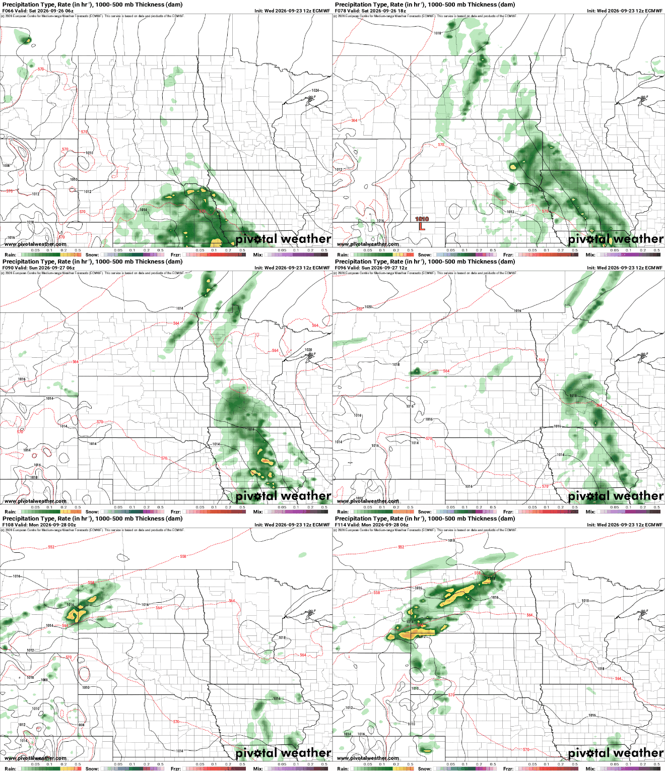
At this point, the bulk of Saturday’s rainfall again, looks to be confined to western and far southern Minnesota. The Twin Cities and eastern portions of the state into Wisconsin will likely see lighter amounts.

There may be a more significant system for next week but it’s still several days out.

