
Rain lingers Saturday, more still on track for Tuesday and Thursday
We may get a little bit heavier rain near the Twin Cities on Saturday, but Sunday and Monday are still stunning.

Go Deeper.
Create an account or log in to save stories.
Like this?
Thanks for liking this story! We have added it to a list of your favorite stories.


We are still holding for nice weather most of Sunday and Monday (except for northwestern Minnesota on Monday evening). A soaking rain is rolling in for most of the state on Tuesday. Then some moisture tied to the Pacific Ocean hurricane called Polo could impact our southern counties on Thursday.
Run the Saturday errands early
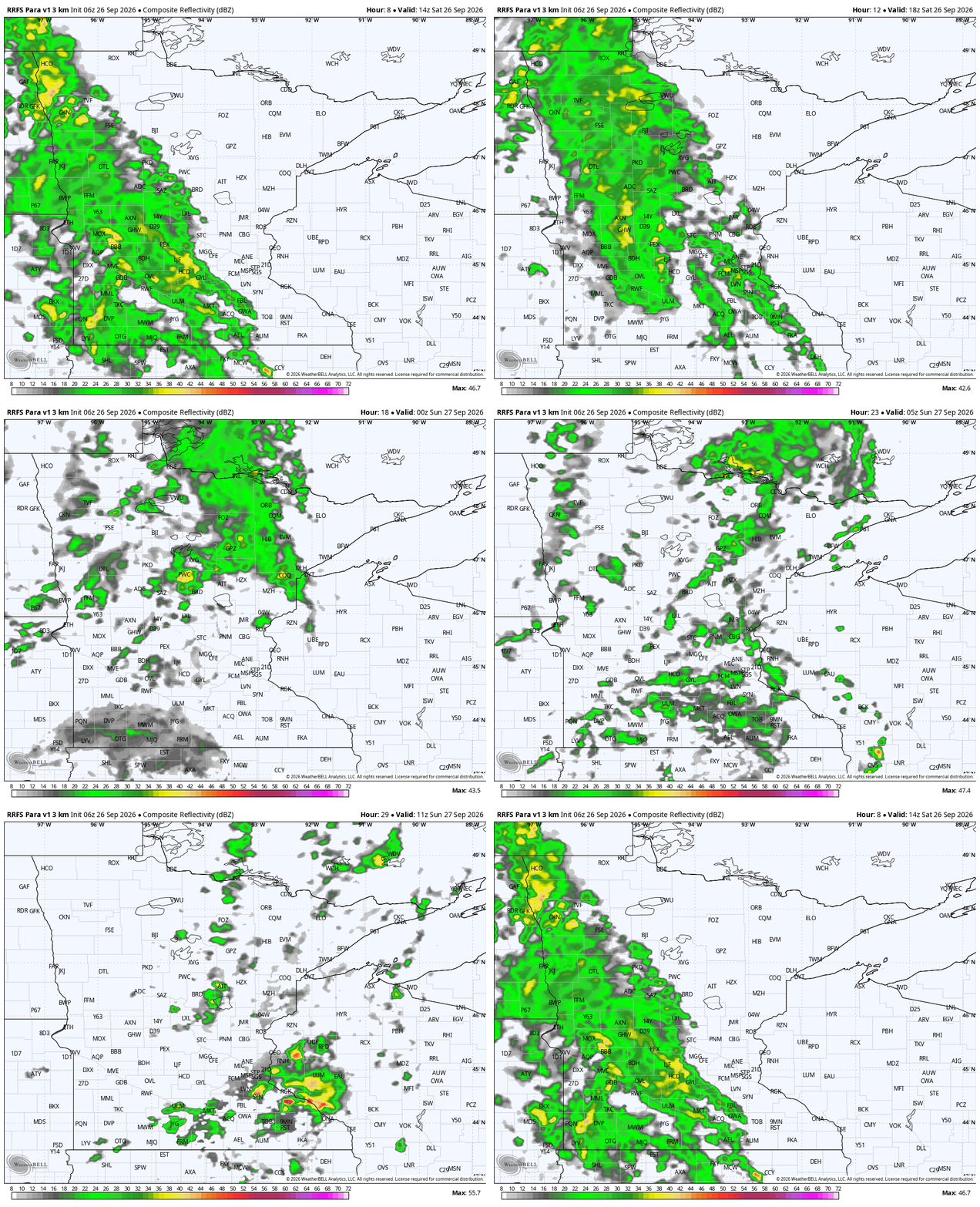
Showers have already started in Alexandria, Worthington and Pipestone, along with many other towns in southwest Minnesota and into eastern South Dakota. To paraphrase former Minnesota Vikings head coach Dennis Green (when he was coaching the Arizona Cardinals) : “the (rains) are who we thought they were! They are who we thought they were!”
That means we’ll see rain spreading towards the southern suburbs of the Twin Cities closer to noon. The tweak to the forecast is that rain will hold steady for much of the afternoon for the southern half of Minnesota, instead of just shooting farther north and fizzling.

Temperatures are not expected to skyrocket Saturday, because of the all the cool clouds and rain. The humongous nor’easter off the East Coast has a big influence on the nation’s weather pattern again Saturday. That is stacking rain fully south to north along with clouds. So it will end up being a cool and rainy, drizzly Saturday.
Turn Up Your Support
MPR News helps you turn down the noise and build shared understanding. Turn up your support for this public resource and keep trusted journalism accessible to all.

The only other wrench in the forecast — though it is less impactful for most folks — is that a few small thunderstorms are going to form in the north end of Iowa very early Sunday morning. We could get some predawn rumbles closer to Northfield and Red Wing Sunday, but then the rest of the day should be tranquil and warmer across Minnesota.
Solid 2-day break in weather
Sunday still has those stubborn clouds wedged up against the back of the nor’easter. We are getting this “accordion” effect happening, because incoming systems are just getting stuck over Minnesota, for lack of a better term. The nor’easter is disrupting the atmospheric flow so strongly that we just get the clouds. Sunday should be really nice apart from grey skies. The southern end of the state should range from the middle 60s to lower 70s. Up north, we’re going to be cooler.
For most, Monday is a pick day. Lots of sunshine, lower-to-middle 70s, a really a nice day! For northwestern Minnesota, however, rain will return before dusk. This system, dropping out of Alberta and Saskatchewan, will bring the rest of the state rains throughout Tuesday.
Tuesday and Thursday rains
Does it feel like we’ve been touting the Tuesday rain forever to anyone else? Just us? We are still looking at a half-inch to 1.25 inches of rain from this band. Full disclosure: Totals have slowly been falling for southeastern Minnesota the last few days, but rain is still quite likely.

Wednesday is much drier and actually a little bit above average! We should glimpse the sunshine (and we haven’t said that too much in a long while).
Thursday is an interesting case study, because this is not something we see very frequently. Since about 10 days ago, we’ve been monitoring the southwestern end of Mexico, because it’s been so active for tropical weather. A storm called Polo was really intense, even undergoing an eyewall replacement cycle. That’s where a really strong hurricane regrows its own eyewall because things are so big. By early next week, Polo will works its way on shore, farther north up the coast. We could get some rains in our far southern counties on Thursday. Those would be what meteorologists call a remnant low. More to come this afternoon in a tropical bulletin of Updraft!


