
Tackling the drought early this week
Go Deeper.
Create an account or log in to save stories.
Like this?
Thanks for liking this story! We have added it to a list of your favorite stories.


Say goodbye to day after day of clouds and fog. The unusual September pattern has been “stuck” since last Thursday.
The next front changes all of that for a brief few hours. We should get some quick sunshine in southern Minnesota amidst a few puffy clouds later Monday.
That front is already bringing rain to far northwestern Minnesota, where it will stall out. This Monday afternoon and evening rain should largely knock out the lingering drought in that part of the state.
Mysterious object in the sky
We’ve heard our grandparents talking about this glowing orb in the sky, but it always seemed like some ancient lore. On Monday afternoon, some Minnesotans finally found out what it was: what the ancestors called “the sun!”
Turn Up Your Support
MPR News helps you turn down the noise and build shared understanding. Turn up your support for this public resource and keep trusted journalism accessible to all.
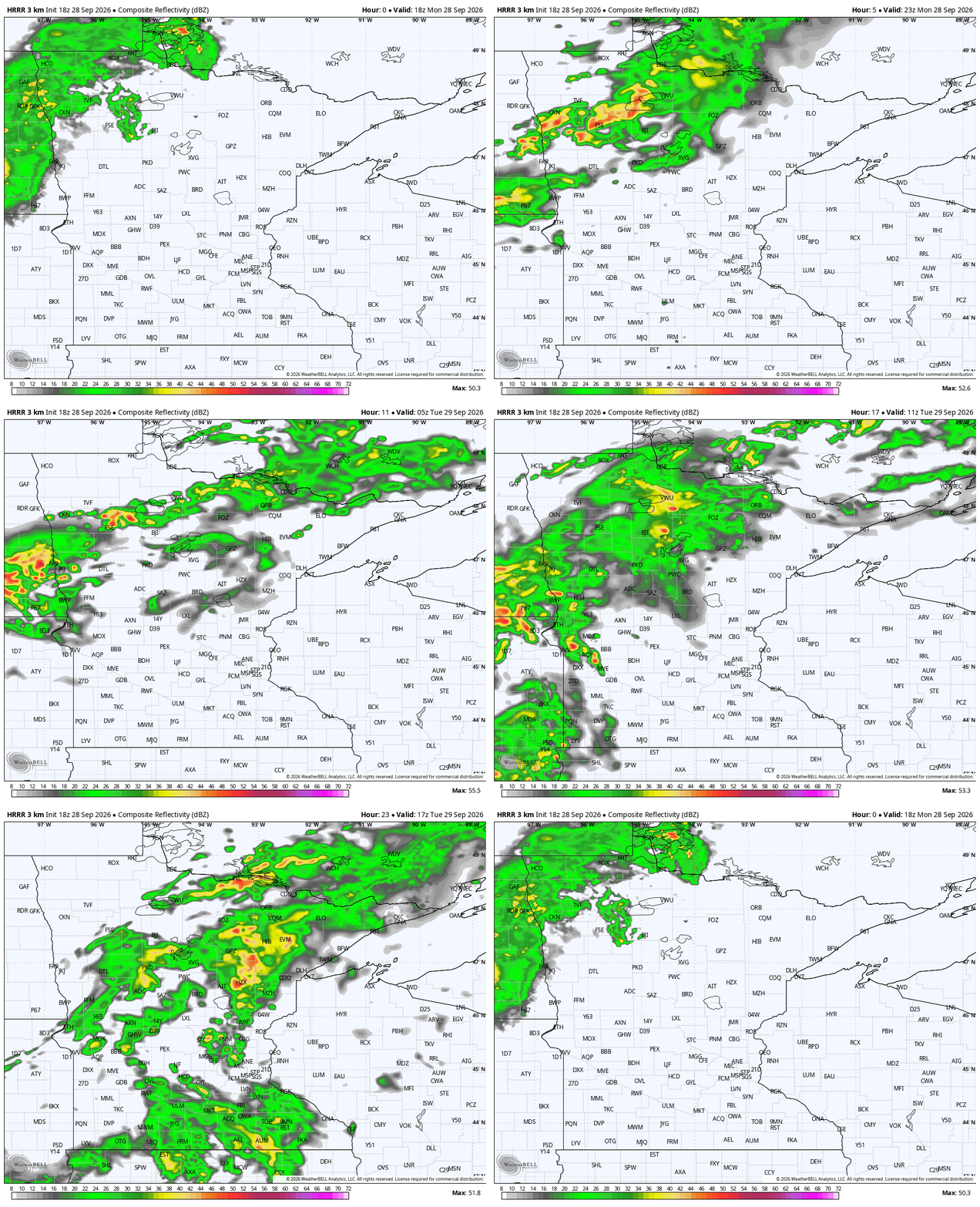
Sure, I’m being a little dramatic, but it seems like forever ago when we had some sunshine. That allowed our temperatures to quickly climb around the Twin Cities before even more clouds returned. Rain is already in northwestern Minnesota, where it’s sat for hours. That actually will not move much overnight before finally descending south on Tuesday morning.
We expect the rain to hit St. Cloud around 10 a.m. and the Twin Cities around 1 p.m. Highs will be a little warmer, and it’ll be really muggy on Tuesday. The rains northwest will quite possibly get close to ending drought in that region as well.
Later week rain chances
Some of the rain showers left over from Tuesday night will turn into a few rumbles of thunder on Wednesday morning, but mostly for the southeastern quadrant of Minnesota. One or two severe storms are possible, but this would largely be isolated downpours.
Later Wednesday night into early Thursday is my biggest question of the week, something I’ve been looking at for nearly two weeks: Could some of the tangential moisture from the “remnant low” of Polo materialize all the way in Minnesota? One way or another, it will be a really close call.
Often, when a Gulf tropical low impacts Minnesota (it’s hardly ever from the Pacific), the jet stream highway cuts the rain hard to the east near our latitude.

That leaves the biggest rains for Iowa and Wisconsin, with our state just getting a few crumbs. In the case of this week, Polo makes it all this way just to dive south near La Crosse, Rochester and Caledonia late Wednesday. The rest of us will miss out again.
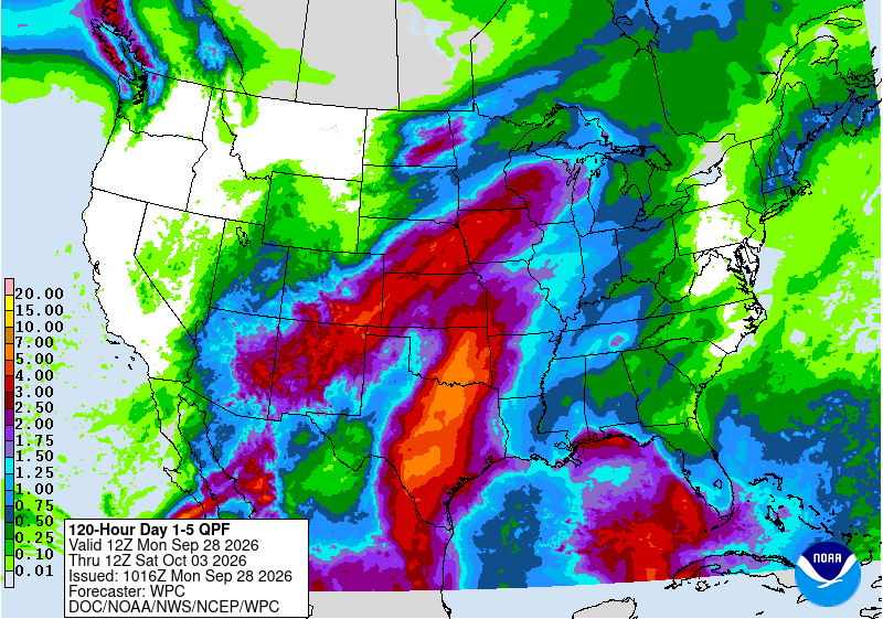
There are not many other chances of rain for the work week. We may see a little more rain in central Minnesota midday on Saturday, but many areas will continue to stay pretty dry. Temps will go well below average by this coming weekend.


