
Rain expands east Tuesday into Wednesday
Sunshine finally breaks out Thursday into Friday

Go Deeper.
Create an account or log in to save stories.
Like this?
Thanks for liking this story! We have added it to a list of your favorite stories.


Rain will continue to expand and develop east Tuesday morning. We’ll see showers Tuesday afternoon into the night with more rain Wednesday for southern and southeastern Minnesota.
Rain expands east Tuesday into Wednesday
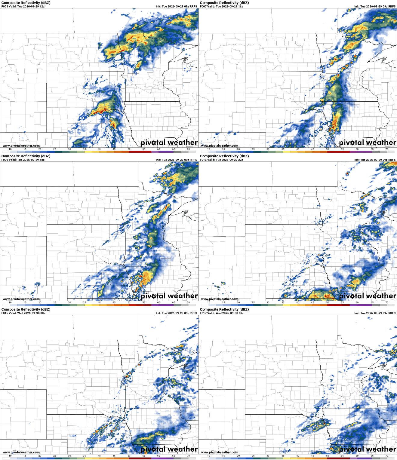
The latest system is producing rain across western and northern Minnesota Tuesday morning. Those showers will expand east through the morning. Eastern Minnesota and the Twin Cities can anticipate scattered afternoon showers into the overnight.
A second surge of moisture Wednesday looks to remain mostly in Iowa but could clip far southeastern Minnesota.
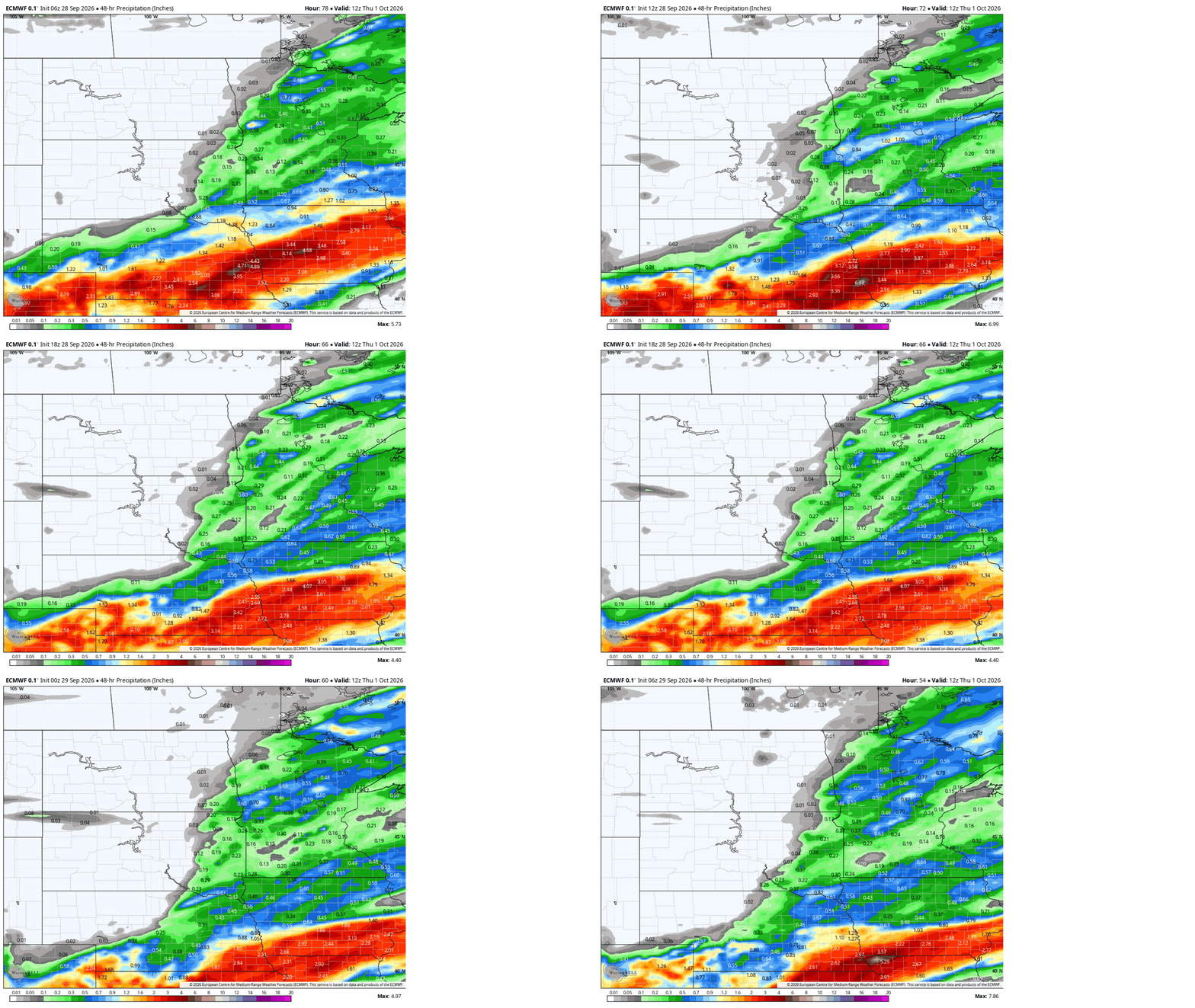
Rainfall amounts look lighter than Monday. Amounts of one-half inch to 1 inch are possible in northwestern and southeastern Minnesota with just one-tenth to three-tenths of an inch in central Minnesota, including the Twin Cities.
Turn Up Your Support
MPR News helps you turn down the noise and build shared understanding. Turn up your support for this public resource and keep trusted journalism accessible to all.
You can see the shift from Monday morning through Tuesday morning in forecast total rainfall. All forecast models have shifted the heaviest rainfall totals a bit more south into Iowa as the second surge of moisture Wednesday shifts.
Temperatures and dew points will be above normal. Highs Tuesday will be in the 60s, but many in central Minnesota will see highs in the 70s where we get a break from the rain Wednesday.
Cooler, sunnier Thursday and Friday
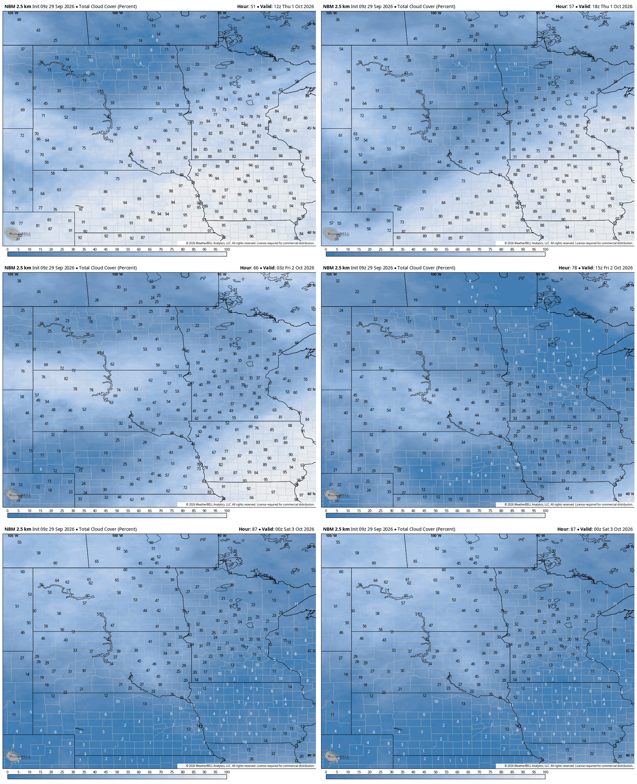
High pressure builds in for Thursday and Friday. That means clouds will decrease Thursday, making for a bright afternoon and lots of sun on Friday.
It’ll also be a bit cooler behind the system for Thursday and Friday. Highs will be in the low to mid-60s south with 50s north.

This means we may finally see our first officially recorded overnight low below 50 degrees in the Twin Cities on Thursday night. That’s about a month later than normal. We average nine lows in the 40s in September.


